
Day 10
Altitude: 322 ft. Stoke level: 8 Temperature: 98-70 degrees Conditions: sunny, light wind
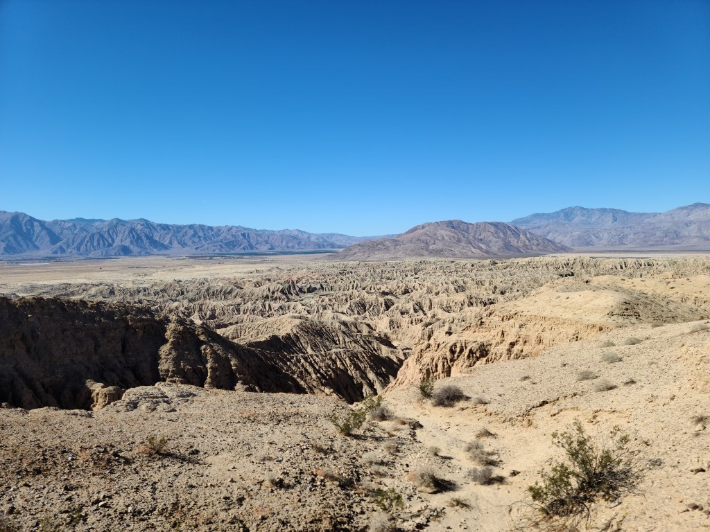
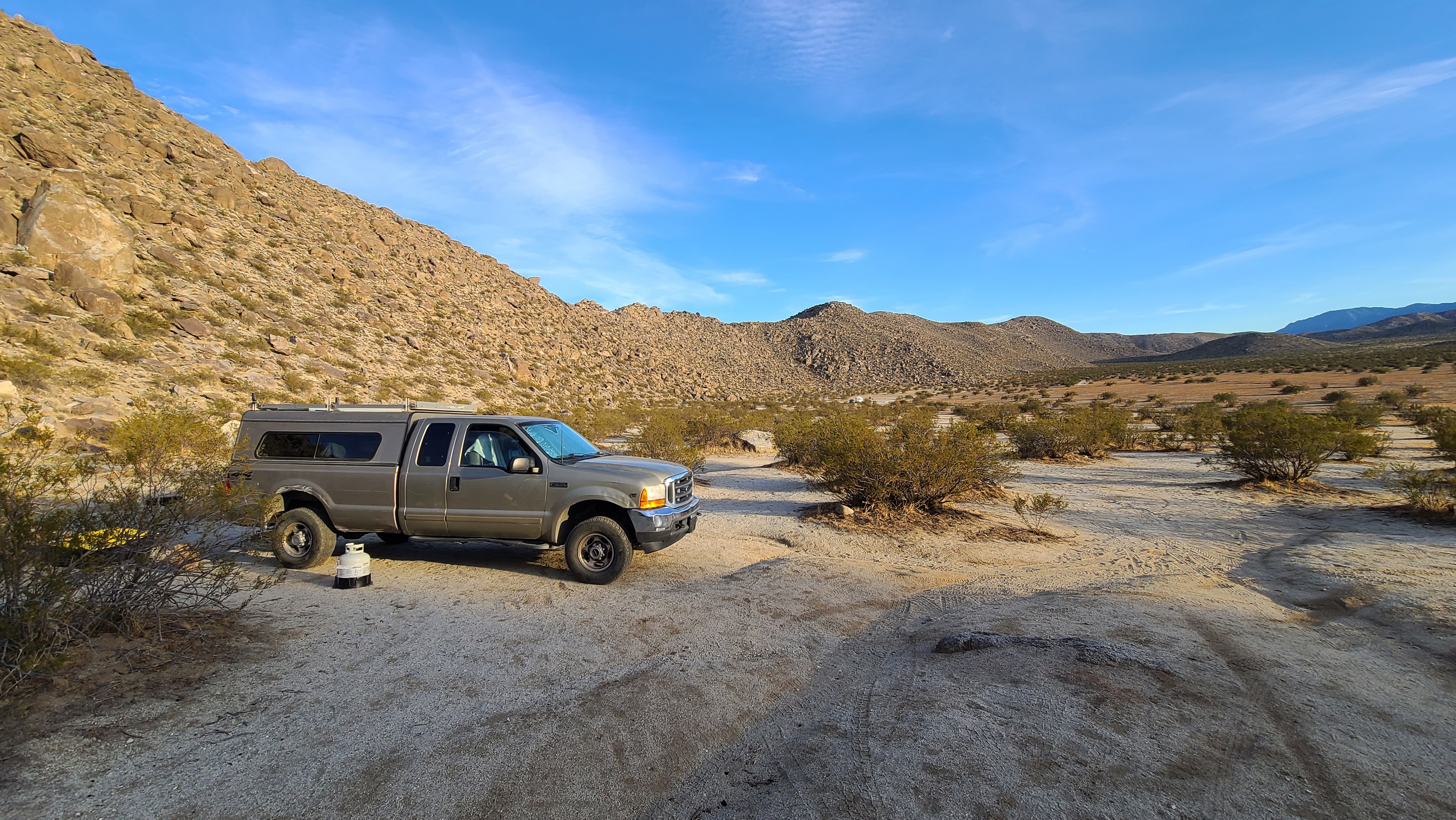
I finally managed to pry myself away from my campsite in Arroyo Salado. I needed to go into town to reload on supplies and upload my blog, but first I wanted to check out this BLM campsite about five miles down the road in the direction of Salton City. I knew that this campsite would have a nice view of the Salton Sea, and I wanted to see that sea for the first time. I drove down the road and located the spot without a problem. Like most BLM land, it was wide open and there was quite a vast area there with many places to camp.
Sure enough, the site had a great view of the Salton Sea! I had always thought of it as this dying, shrinking inland sea (and it is) but it still stretches from horizon to horizon. I was still 10-15 miles away and I could smell the faint odor of rotten fish on the breeze however. The water has retreated so fast in such a short amount of time. I’ve seen documentaries and pictures of all the dead fish everywhere as a result. The Salton Sea is not a natural feature, it was created artifically. Back in the 50’s developers planned a ‘California Riviera’ type community around the lake, and for a while it went pretty well. Lots of people bought homes and businesses there.
Unfortunately, over the years it has dried up and created a blighted community. The legendary ‘Slab City’ is located at the southeast end of the sea next to a military gunnery range. It’s a lawless, Mad-Max style tweaker community that I hear actually has a little art and music scene going on there. I’d like to check it out, but if something went wrong with The Beast and I broke down there I’m sure those bastards would strip my truck. Dealing with suspicious tweakers is not on my desert agenda at all. I’ll probably at least go check out Salton City and Bombay Beach though. There’s supposedly a banana museum over there, that sounds pretty interesting. I’ll have to get around to that next week sometime.

Amazingly, at this spot I got almost full bars of 5G data! I was able to upload my blog and my UFO & fox videos to YouTube without a problem. That saved me a trip into town. Of course, I still needed fuel and supplies, but that could wait another day. The BLM spot was pretty wide-open, but the highway ran only about a quarter mile away so it definitely wasn’t quiet. Also, there were a lot of OHV trails in the area so there were dune buggies and motorcycles constantly zipping back and forth. Still, it was reasonably private and I had good signal, so I would stick with it for the night.
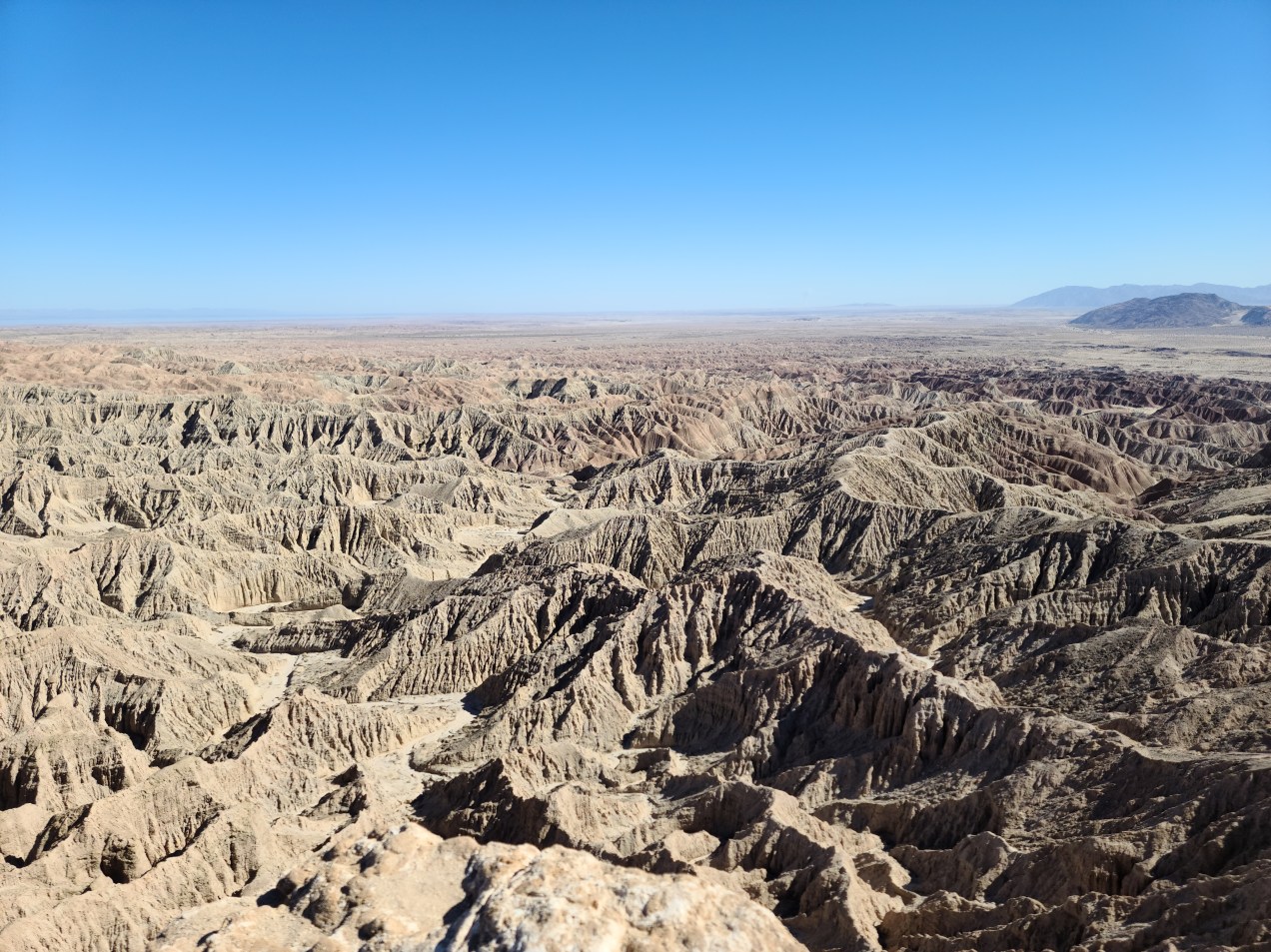
I had been meaning to get to Font’s Point all week, so since I was only about a 15 minute drive from the trailhead I headed that way. I found the trail to be in a wash with deep sand, definitely only accessible by 4 wheel drive. I deflated my tires and locked my hubs for the 4 mile trip to the location. It’s always amazing how good The Beast can handle bad trail conditions with my all-terrain tires. A couple of times it threatened to bog me down, but I just kept steady throttle and managed to get through the deep desert sand.

I arrived at Font’s Point to find that I was the only one there! It’s the most popular view in the whole park and I was to have it all to myself. What a stroke of luck! I got out and walked up to the vista point, and I was completely blown away. I had heard the place was called ‘California’s Grand Canyon’ and I can see why. I’ve seen a lot of cool formations out in the desert, but nothing like this. This is a proper canyon for sure! I mean, it’s no Grand Canyon, but it has a similar feel of space and awe.
It’s a photographer’s dream, and I hear sunset and sunrise are the best times to take photos. There’s just so much texture in the landscape, as well as color. I had learned from the Visitor Center what each level of the canyon corresponded to in geologic time. Since at one point this all used to be a sea (and then the Colorado River came through and carved it out, same as the Grand Canyon) you can tell by the sediment colors whether they were from land or ocean strata.


I was very impressed with Font’s Point. I was glad I had made the trek out there. I’m a sucker for any kind of novel geologic formation! It was incredible to have experienced it without anyone else around as well. Font’s Point, like the Grand Canyon, doesn’t translate as well to film as it does to the naked eye. Pictures don’t do places like this justice. Just being there, looking out into this huge void makes one feel insignificant. I’ll be forever amazed by what nature can accomplish!
I made my way back to the BLM land around 3 o’clock. Some group of RV’s had claimed my spot, but there was plenty open land with good views of the Salton Sea. There was also a nice canyon behind my campspot, I could just pull up right to the edge. It was a sort of mini-Font’s Point in itself! I set up camp and enjoyed the view.

When night fell, it was very lit up and lively! It was totally unlike my previous spot on the other side of the ridge. For starters, the lights of Salton City filled the horizon to the east. From the northeast to the south I saw the lights of cities, from Palm Springs, to Indio & the Coachella Valley, to Joshua Tree, on down to Calexico and Mexicali. I love being out here in the desert, you can see for miles! There were all kinds of lights everywhere, it’s neat to look at but I hate the light pollution overall.
In addition to this, the lights and noise from the highway took off some love I had for the place. There were also a lot of people out on their buggies and dirtbikes at all hours of the night. I definitely don’t need to camp near an SVRA any more! (SVRA is State Vehicle Recreation Area by the way. These are places where it’s legal to take your off-highway vehicle to tear up dirt to your heart’s content.)
I’m still having issues with my 12 volt cooler. It uses just a bit more power than my 100 watt panel can provide for a day. The voltage has been getting lower and lower every night. Last night it was at 12.0 which is very bad. I can’t risk ruining my battery over a few cheap foodstuffs, so what I think I’m going to have to do is go to town tomorrow and find a cheap cooler of some type and some ice. I hate to do it, but if I don’t give the battery time to recharge, I could mess it up. The way it looks is that I’m going to have to ice my perishables down one day out of every 4-5. I’m still saving money, but it is a huge hassle.
Unless I’m on the move, the cooler will have to stay off. That sucks because I mostly use it to keep beer, Powerade, green tea and water cold. It’s been sweltering out here the last couple of days so cold drinks are almost a necessity. I’m definitely going to order another solar panel, one with tilting brackets so I can change the angle of it with the sun. I’ve still got room space to expand, so I think that will be the easiest, cheapest way out of my solar predicament.
Day 11
Altitude: 1449 ft. Stoke level: 8.5 Temperature: 91-61 degrees Conditions: sunny, light clouds, light to moderate wind
When I got up this morning, my battery was at 11.8. This simply will not do. As much as I hate to do it, I need to go get myself a cooler and some ice. I can’t let my battery be damaged trying to keep ten dollars worth of food cold. I got back on the road and headed to Borrego Springs. I went to the market and got a few items, most importantly a small styrofoam cooler and a 7 lb. bag of ice. I did the usual gas/garbage dump pit stop and planned out my day.
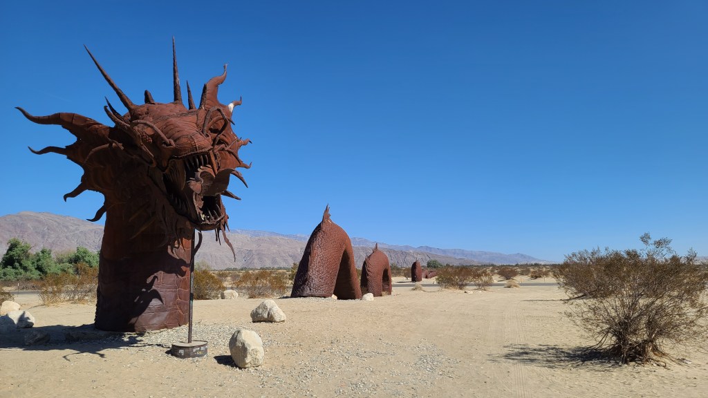
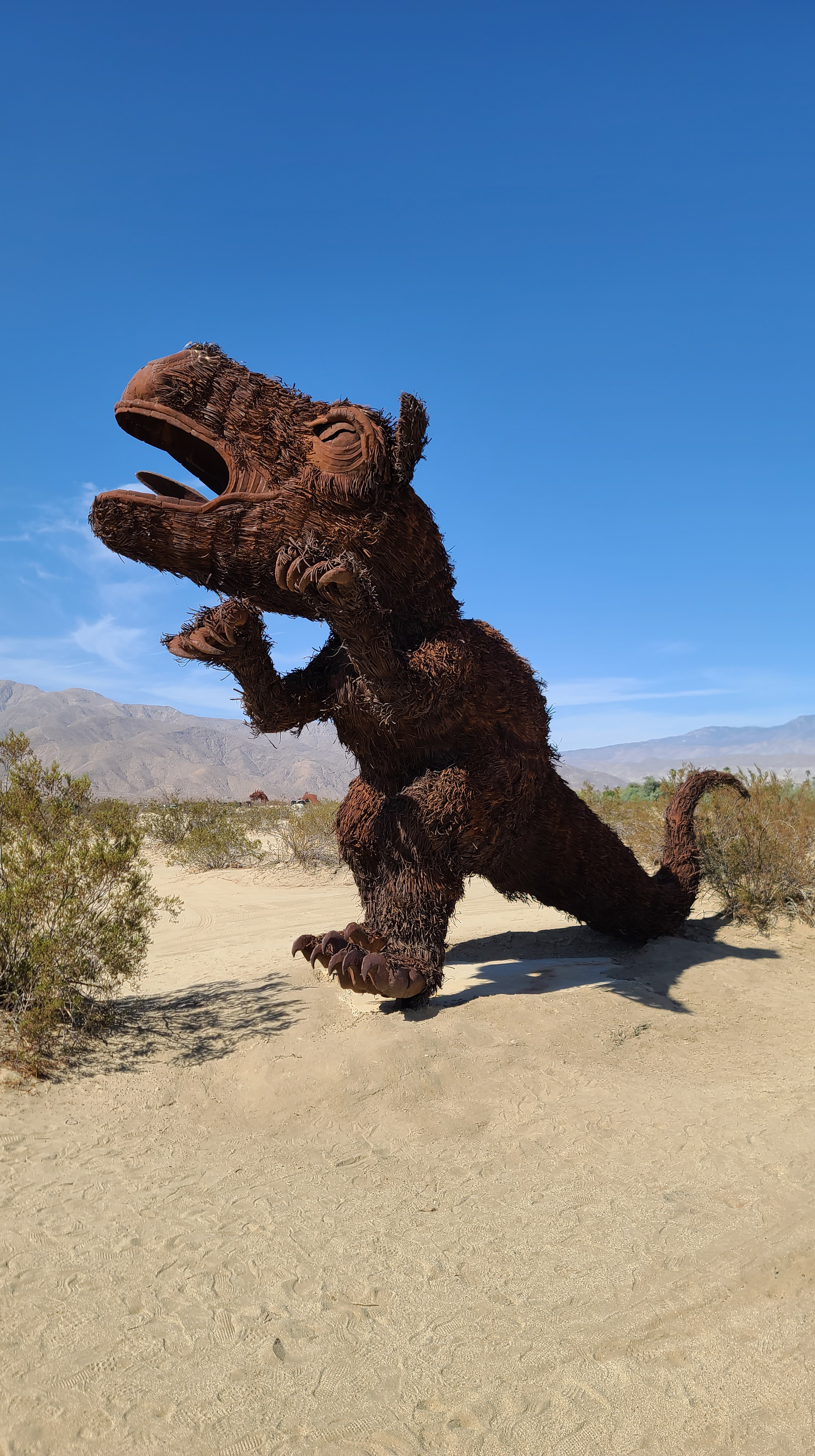
Borrego Springs is known for all the metal sculptures in and around town. I looked up on Google Maps where the biggest concentration was at and headed that way. The one I was looking most forward to was this dragon sculpture that appears to undulate under the sand on either side of the highway. I drove over to see that one first. I drove up to it and it didn’t disappoint! It’s pretty famous around town, you’ll see representations of the dragon all around Borrego Springs. There were a few people around, so I waited until there was a gap in the crowds for a few moments and took some pictures.

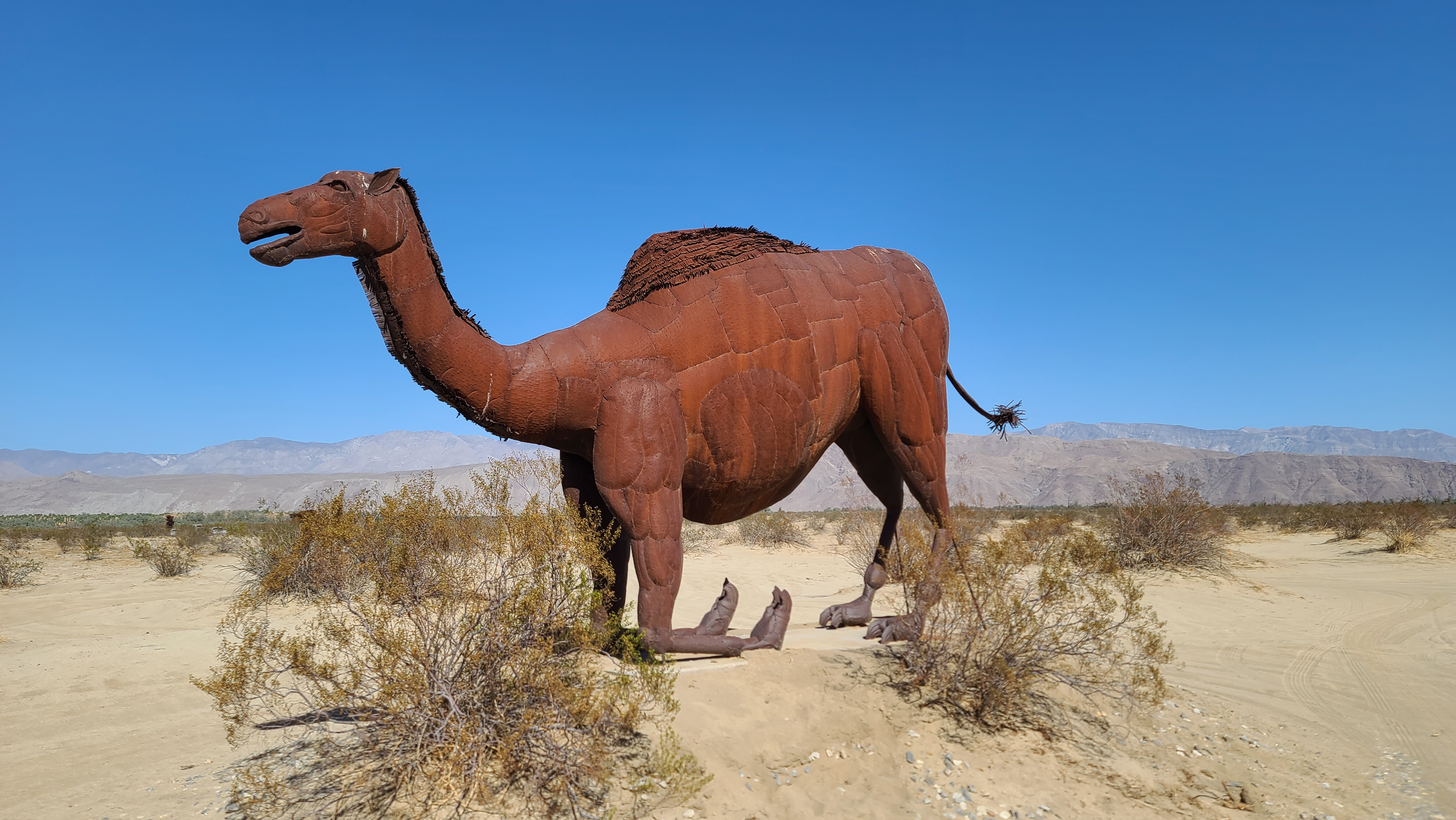
On the other side of the road about a half mile down from the dragon were a whole bunch more animal sculptures. I drove over there to go check them out. It is really bizarre seeing life-sized amimals standing still and not moving around! I guess this is the appeal of such sculptures.


After I looked at all the sculptures, I decided to go south out of town and check out that part of the park. So far I have checked out the northwest and northeast parts of the top 1/3rd of the park. Now I wanted to go check out the southeast and south parts of the north 1/3. This place is so vast, I’ve been here a bit more than a week and I’ve seen less than a third of the park!
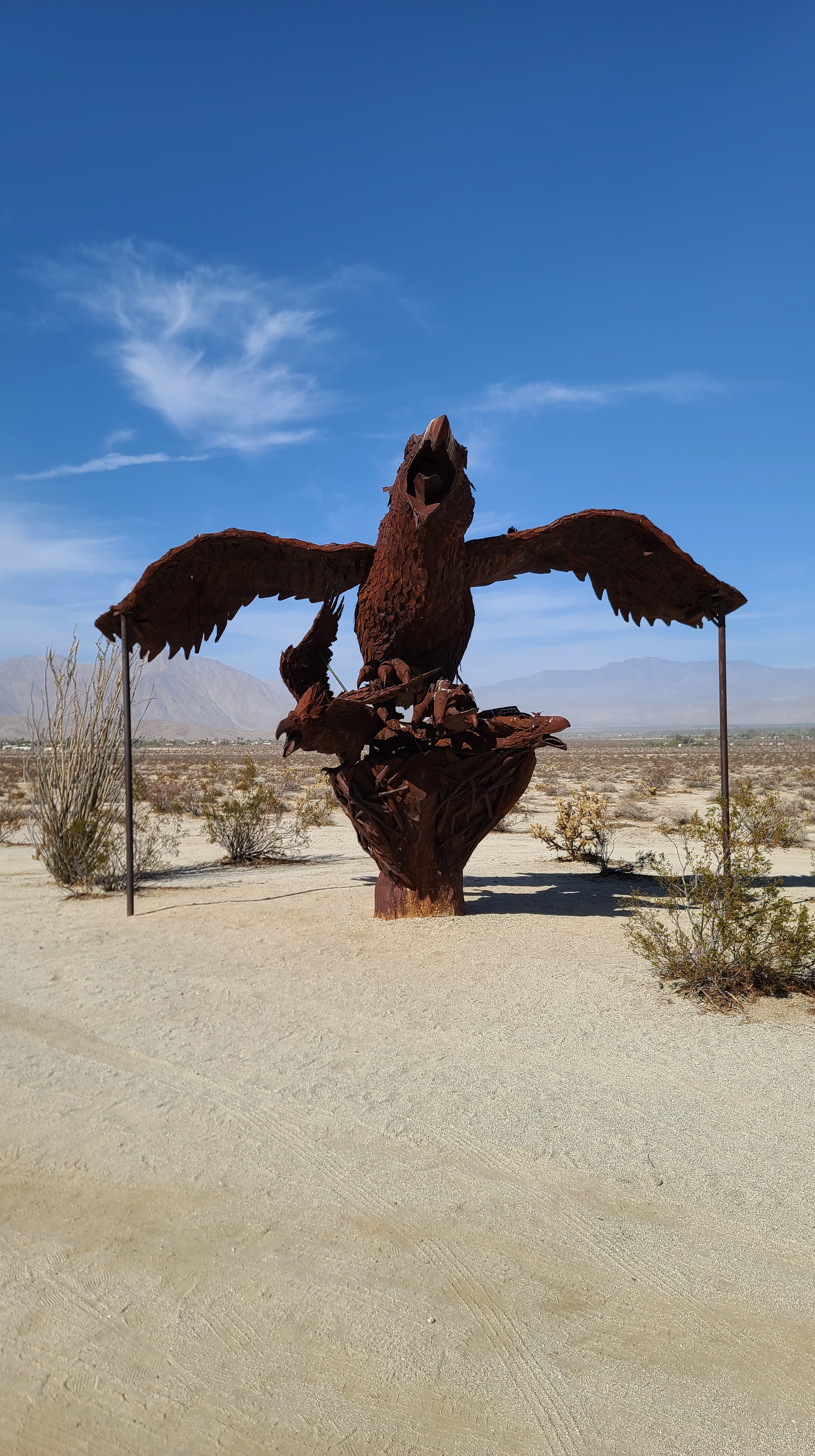
My destination for the day was a dispersed campground called Yaqui Wells. As I headed out of town on the highway south, I saw another area filled with metal sculpture! I had to stop and check it out. First there was an eagle sitting by itself, then across the road were a lot of saber-toothed cats attacking wild horses. Such great art, you could imagine these very same animals out here living their lives so long ago.


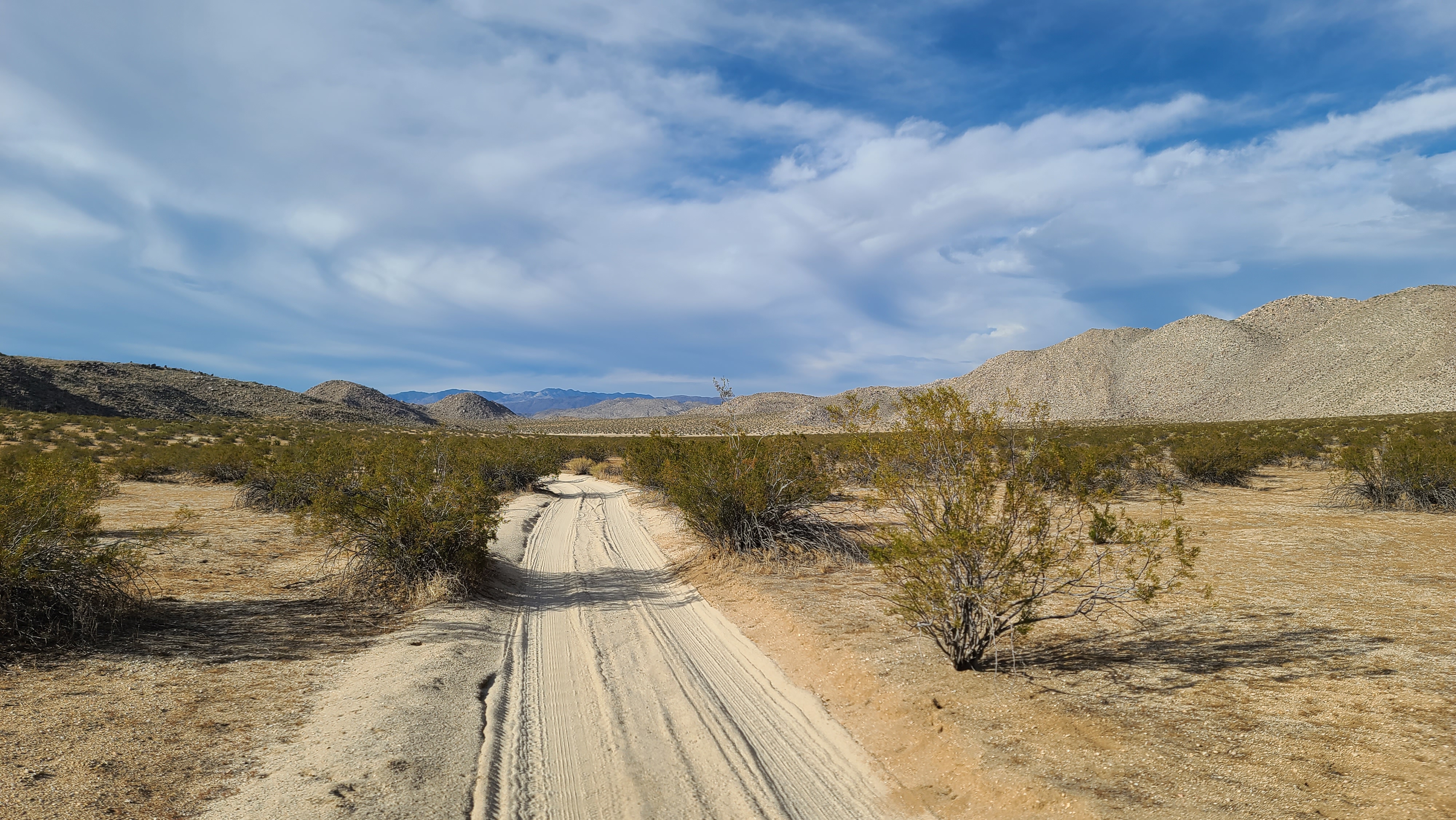
I made my down to the campground up in a place in the mountains called Lizard Canyon. The turn-off was easy to miss, so I passed it and had to double back a couple of times to find it. I was pleasantly surprised to find the place deserted other than a handful of other people. I was nervous about trying to find a new camp on a Saturday, but it really worked out. It’s designed where no one has to camp within a couple hundred yards of one another, which I really like. Like every camping spot I’ve been to here though, it’s close by a road and the noise is continual. I can’t wait until I get up to the Mojave and be truly out in the remote desert. No noise or traffic, and a lot less people await me.
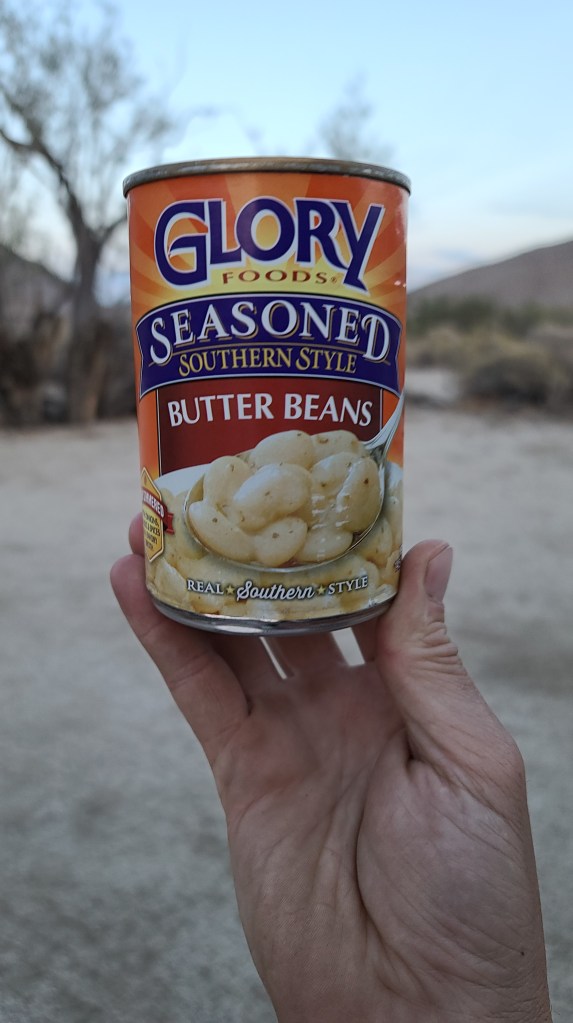
I had a really great dinner. I made some dirty rice along with Glory Southern-Style Butter Beans. I was impressed by the southern food selection of the small market in Borrego Springs. They had all kinds of Louisiana brand fish fry and a few canned vegetables like the Glory Brand. I can get the Glory Brand mustard & turnip greens in the Santa Cruz area, but not the butterbeans. It was a real score! I’ll have to stock up before I leave town.

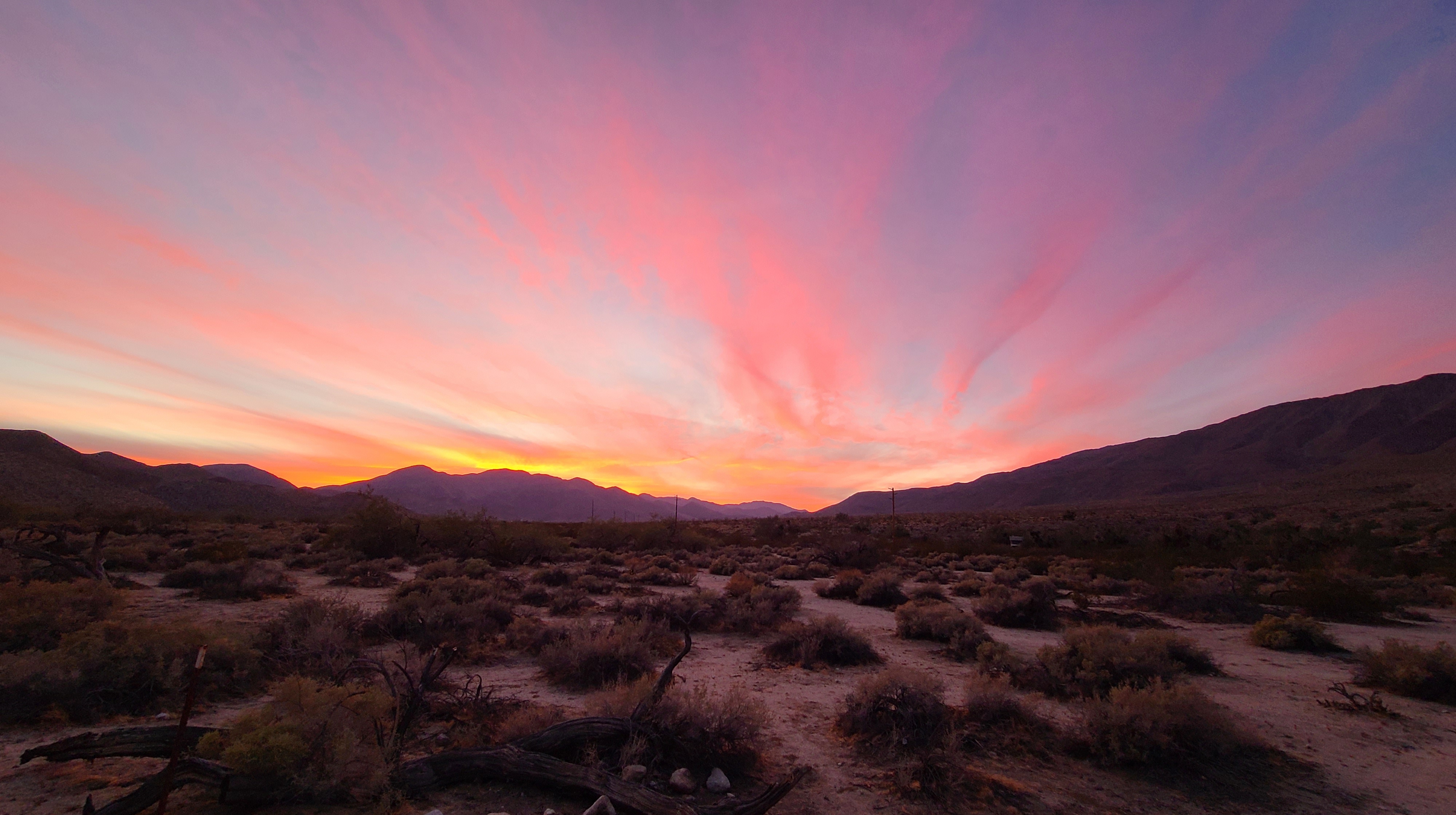
As I was cooking dinner, the sun began to go behind the mountains. There were enough clouds in the sky to promise a great sunset, and I was not let down.

Today was a pretty good day, all things considered. Other than the issues I’m having with my battery and the 12-volt cooler, everything went pretty well. I’ve made all the arrangements I need to fly back to Louisiana on the 18th of November, so the expedition has a deadline now. I’ve been doing a lot of thinking about what exactly I want to do in the short and long term on this expedition. Tomorrow I’ll either go to this cool slot canyon or this place called Blair Valley. After I see these places I want to go see these mud caves that they have here.
When I’m through with these places I’ll be pretty much done with all I want to see here. I’m wanting to go check out the Salton Sea, then drive this trail I’ve never been on in Joshua Tree National Park. After that, I’ll go spend some time up in the Mojave National Preserve. That’ll pretty much fill up the next couple weeks. I’ve still got things to see here in Anza-Borrego before I leave though! I figure I’ll head out around mid-week.
Day 12
Altitude: 2570 ft. Stoke Meter: 9 Temperature: 86 to 61 degrees Conditions: sunny, light clouds, moderate wind
After a night off from having to keep my cooler charged, my voltimeter was at 12.4 this morning. It was a bit less than I had hoped for, but anything is better than the readings I’ve been recording the last few days! It was actually pretty chilly when I woke up, the temps at 7:30 AM were only at 61, but it was around 50% humidity which is really rare for the desert. I guess it’s the effect that Lizard Canyon has on the local micro-climate. It sure made the air a lot more chilly than usual!
I figured I’d take my time on getting into the day so the weekend warriors could filter out a bit. I was going back and forth on whether or not I should go to Blair Valley or The Slot today. After much thought, I decided that the slot canyon would be much better experienced away from the weekend crowds, so I decided to put that off until the upcoming week. Blair Valley would be my destination for the day!
I wanted to be in a cool spot for Halloween. Blair Valley made me think about The Blair Witch Project and Linda Blair from The Exorcist, so that sounded like a good place for me to wind up for the evening. Since I had no signal for Google Maps to work with, I left the campsite in the general direction of where I wanted to go. Unfortunately, after almost an hour of driving, I realized I was heading in completely the wrong direction. After a string of cussing, I managed to catch myself and get back on track.
I still did really good though, and managed to find the entrance to Blair Valley 3 hours before the sun went down. I charged down a really nice stretch of off-road towards some land that was marked on my map as being a dispersed camping area. After trying out a couple of potential spots, I finally found my camp for the night. The cove in the mountain only had one other camper within a quarter mile vicinity, so I felt that it was ok. Incredibly, somehow I had almost full 5G connection here as well! This camp was going to be a good one! I got set up for the night, and put my phone to work downloading and uploading the many files needed to keep this expedition on the rails.

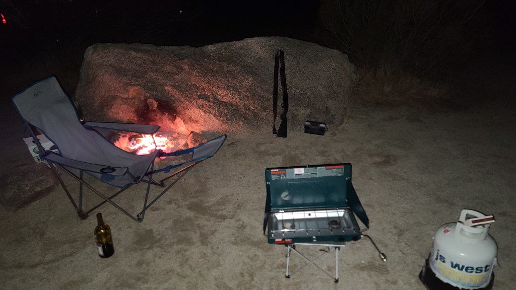
This place is just gorgeous. I had a nice little fire-pit spot about twenty yards away from where the land was flat enough for me to park, so I got my campfire kit out in preparation for my upcoming Halloween bonfire. While I was doing this, I had to take time out to take pictures of the sunset. While the mountains in front of me blocked out a lot of the lightshow, there still was enough sunset to light the sky up real pretty.

It was around this time when things started to get a little weird. I heard a single gunshot from my next-door neighbors. Normally I wouldn’t trip out about it too much, as people out here in the middle of nowhere sometimes like to shoot rounds off for shits and giggles. I’ve been known to do this occasionally! Nevertheless, it stuck me as weird that there was only one round fired from what sounded like a big caliber handgun and nothing else after that. I started to get a bit nervous, so for the first time on this trip I got my shotgun out and loaded up a few shells. Better safe than sorry!
I actually just made a nice upgrade to my stock Mossberg 88 12 gauge shotgun. I got a magazine mounting bracket for a light to put on the thing. For the light, I shelled out 120 bucks for a Streamlight high-intensity tactical flashlight that is designed for firearms. It was the most expensive light I’ve ever bought, but man oh man, is that thing bright! The way I think about it, the light is just as much of a defensive weapon as the shotgun. It can burn your eyes out at night if you’re looking at it from the wrong end. In addition to this new light, I added a clip-on fiber optic bead to my barrel which is a huge improvement to my aim.

By my fire, I had set up my new Kaito survival radio so I could listen to Coast to Coast live on the air. I’ve stopped subscribing to the show since I’ve don’t like the direction that it is going in these days, but on Halloween I’ve got to tune in for old time’s sake! The reception here is pretty crappy, but after winding my 25 foot antenna in the top of a nearby creosote bush I got a decent signal from AM 600 out of San Diego. It wasn’t the best show, but I felt good that I followed tradition and listened in along with the C2C nationwide audience.
All things considered, it was a good place to spend Halloween. I’m going to make the Blair Valley & Little Blair Valley loop tomorrow, looking forward to seeing more of this spectacular place!
Day 13
Altitude: 2560 ft. Stoke meter: 7 Temperature: 82-60 degrees Conditions: partly cloudy, light wind
I was up until dawn writing, and only got about 3 hours sleep. I was feeling pretty haggard and hung over. I’m at the point in the expedition where I can’t waste days any more, so I got myself together and prepared to break camp.

I actually was feeling pretty proud of myself. Since I had such a good signal last night, I got online and managed to track down the parts I need to expand my solar capacity. I ordered my wiring and mounting brackets on Amazon and had them shipped to a Amazon box up in Yucca Valley, which is up by Joshua Tree. They couldn’t send the actual 100 watt solar panel there due to the size, so I did an in-store pickup order at Home Depot also in Yucca Valley. I searched and searched all over for a place I could go pick this stuff up, I was even willing to drive the hour to San Diego. This is the only way to go about it unfortunately. I’ll be up there around Joshua Tree in a few days so I that’s why I ordered ahead. The parts will be in on Thursday but the panel will come in sometime next week. My expedition will almost be over by then! Oh well, I’ve been long needing an upgrade for my setup, I’ll think of it as a birthday present for myself!
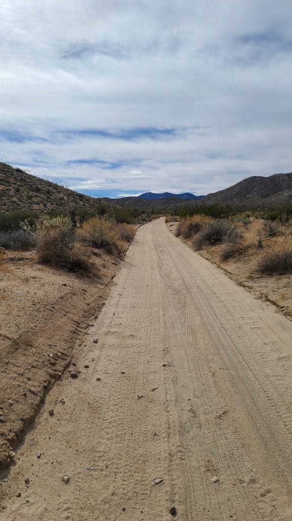
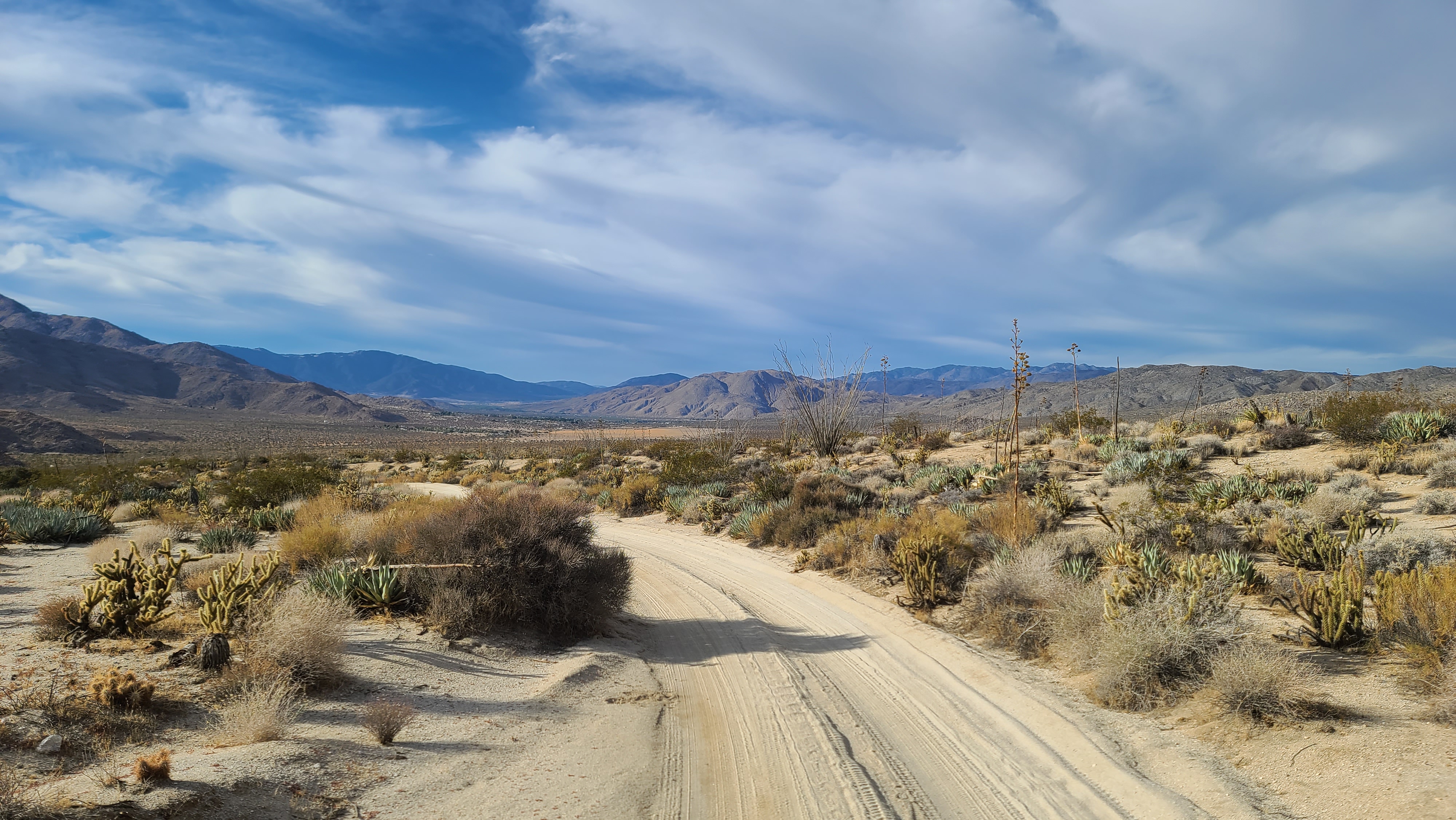
I hit the road around 11 and started making my way around the loop. The Blair Valley trail makes its way through Blair Valley and loops around the other side of the mountain through what is called Little Blair Valley. The road is in good condition, and this being Monday, there was no traffic at all. I was glad for this, as the road was only one lane and it would have been an aggravation having to find a place to pull over to let people by.
After a short distance, I came up on a kiosk that told me about the interesting hikes that were located right off the trail. I remember reading about them beforehand but I had completely spaced it. I was barely in good enough shape to drive, not to mention hiking in the desert sun! If I would have remembered, I might would have taken the extra day to recover. I didn’t want to miss these trails however.
There were three trails to consider. One was to an old homestead where this anthropologist lived at in the early 1900’s, and the other two were of native people’s pictographs and villages. I decided to skip the homestead trail for another day and just focus on the native people’s trails. I was tired and kind of shaky, but sometimes you’ve just got to force yourself to do things…especially if you know you’ll regret not doing it later.
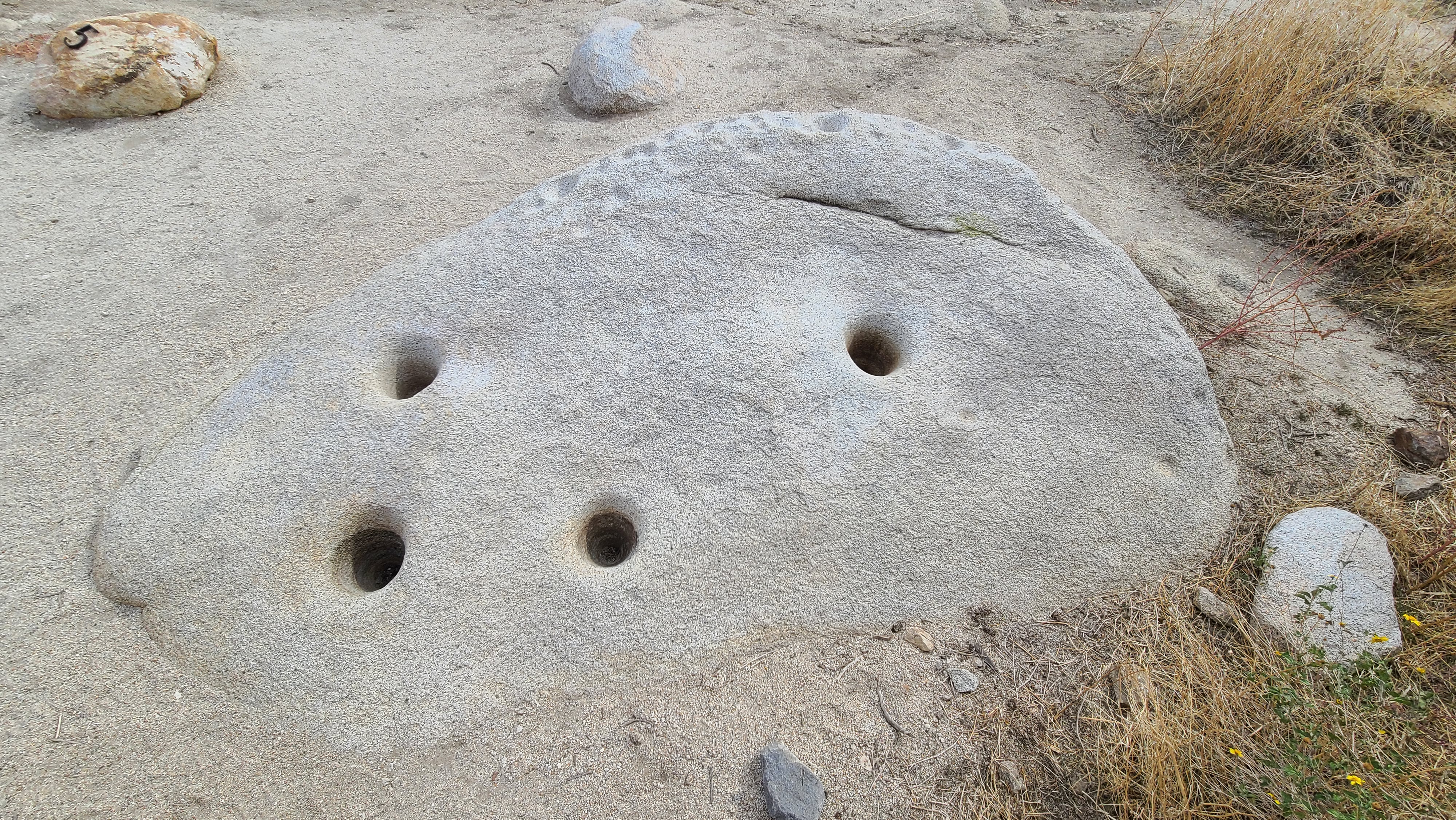
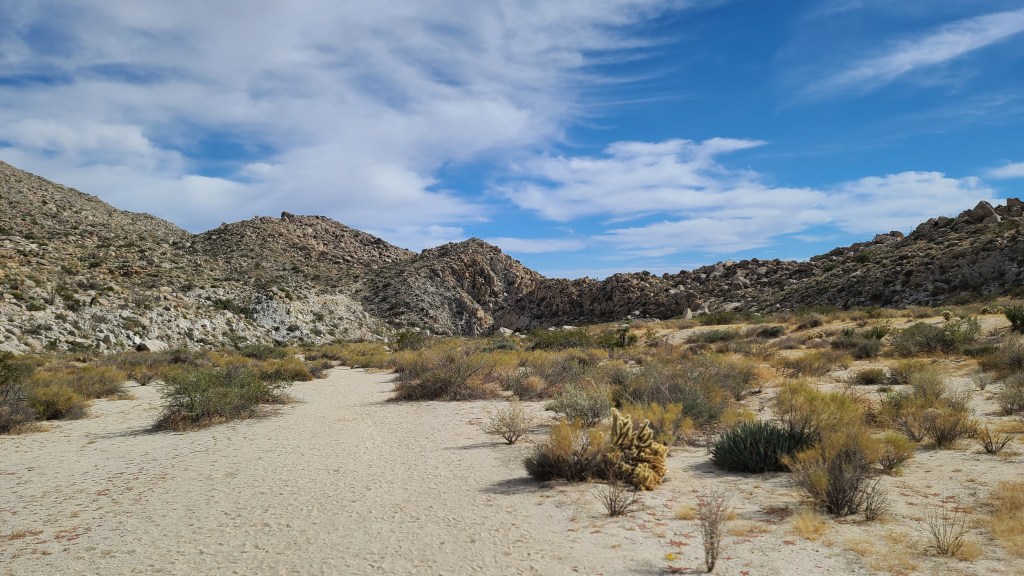
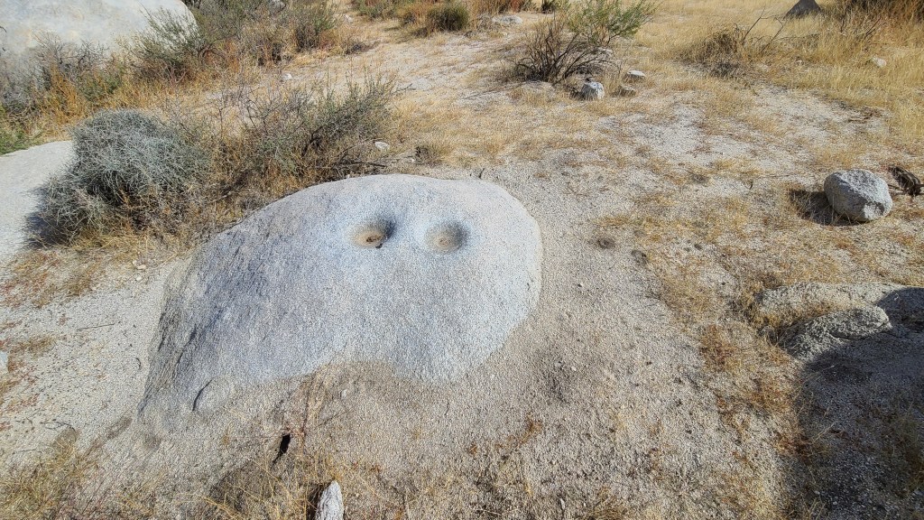
I soon came across the trailhead for the first spot called the ‘Ehmuu-Morteros trail. ‘Ehmuu means “bedrock hole” in Kumeyaay, the local tribe that lived in these parts. Morteros means “mortar” in Spanish. The Kumeyaay had a village down here, and there are mortar holes in the rocks where they used to pound grain, hence the name. As I set out on the trail, I began to feel the magic of the place. I can totally see why they settled here, the place is just incredibly beautiful. The terrain is really interesting as well with big boulders everywhere. My hangover soon disappeared from the excitement I felt from being in such an interesting spot. There was a healing energy about the place.
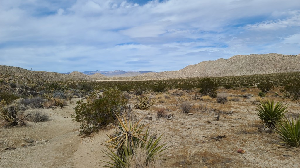
There was a handy pamphlet at the trailhead that gave the history of the place, as well as explained the meaning of the numbered sites along the trail. First thing I noticed was the different species of desert plants up here. There were yuccas, juniper, and agave all over the place. Since I’m at around 3000 ft. elevation, different species grow here than down in Borrego Valley. I also saw some different species of cholla and cactus I hadn’t seen before.


The little map in the pamphlet wasn’t the best, so I had trouble finding the sites. I just kind of blundered into most of them. I really wanted to see the mortar holes and pictographs, so those were what I was keeping an eye out for. While I was taking pictures of big rocks, I just stumbled into the first site. It was pretty neat! The holes were pretty deep and perfectly round. The natives must have pounded on these rocks for a very long time to make holes like this. I spent some time there just wondering what it was like for the native peoples that lived here. Thanks to the park service for preserving the place to be like it was a 1000 years ago. I felt the energy of the place, I almost expected to run into a Kumeyaay ghost at any moment! I love historical places, it’s almost like time travel in a way.


I was overjoyed at finding the morteros, so now it was time to go find the pictograph. I set off down the trail. I walked and walked, and soon my feet began to kill me. I had stupidly worn my off-road Crocs, which are not good at all for rock-hopping and desert work. I finally reached a point where I had enough. Regrettably, I turned around and headed back up the trail.

I was really sad about not finding the pictograph. On my way back however, I noticed a small directional sign I had overlooked. I followed it, and what do you know, I found the pictograph! It was in really good shape, it looked like it had been freshly painted. Who knows how many years it had been there?

After I got my fill of enjoying the pictograph, I turned and headed back up the trail. I was distracted by thinking about the pictograph, and I didn’t pay attention to where my body was in relation to the many prickly things along the trail. Suddenly, I got a poke on my right calf. An agave plant had stabbed me, and left a nice wound. Blood immediately started gushing out. It soon started pooling in my Crocs, so I made the hike back to The Beast with pain in my leg and sticky blood in my shoe. I guess that was the price that the trail demanded for seeing the sites, a blood sacrifice was in order! I somehow got lost on the way out and hit the main road a quarter mile away from my truck. I knew where I was at so I wasn’t truly lost, but it was good to find The Beast where I had left him.
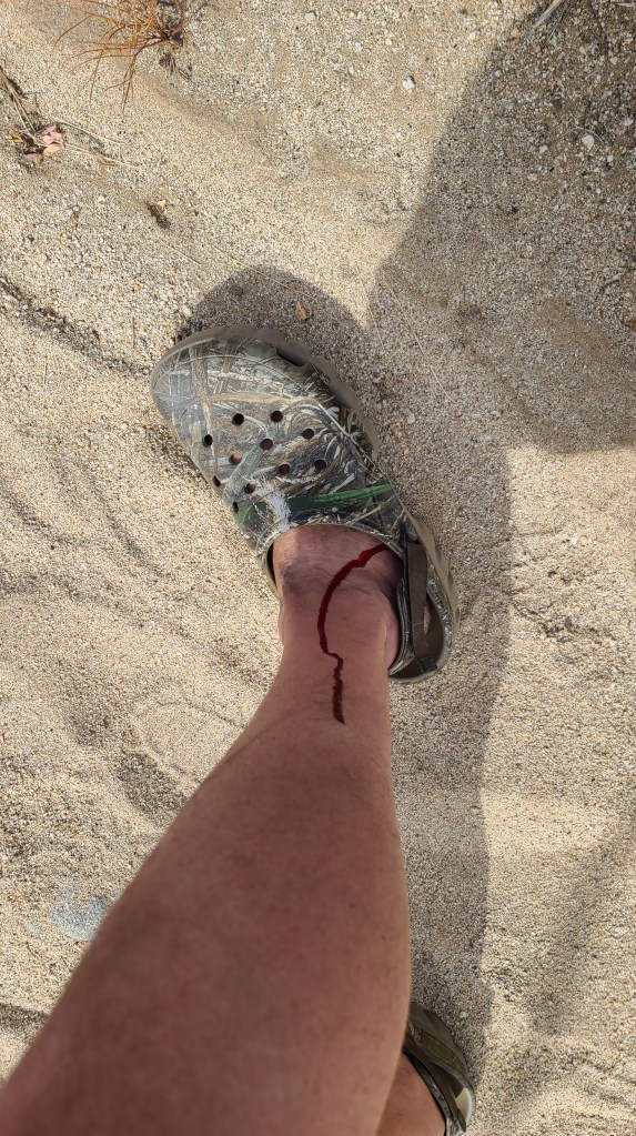
Fortunately, I have first aid gear in my truck so I got cleaned and patched up from my injury. Those agave plants are as sharp as cactus, I’ve got to watch out for them in the future. I was ready to go check out the other trail, so I drove a mile and a half to the next trailhead. This trail called ‘The Pictograph Trail’ promised more pictographs after a mile hike in. My leg hurt a bit from the poke, but not enough to keep me from hiking. This trail was a lot wider and easier to navigate, but it was a lot longer than the other hike. It took around 40 minutes to get to the end.
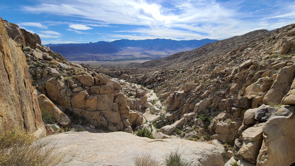
I followed the trail through the end of the box canyon where it abruptly ended in a 40 foot cliff with an incredible view. I looked everywhere for the pictographs but couldn’t find them anywhere. I hoped to stumble across them like I did before, but no luck this time. I did find another mortero site though. I really liked the place however, it was worth the hike even though I didn’t find what I was looking for.
On my way back, I ran into a couple of old guys hiking up the trail. I told them I couldn’t find the pictographs for the life of me, but I wished them luck on their search. I got back to my truck and as it was getting later on in the day, I decided to finish the loop and camp somewhere near where I had camped the night before. I started up the east side of the loop which ran through Little Blair Valley. It was just as beautiful as the other side, most of it consisting of a dry lake bed. It was almost like a savannah instead of a desert.
I returned to the dispersed campground on the other side of the mountain once I finished my loop. I found a site close by where I camped the night before. I was too tired to write, so I made some mac and cheese and watched The Man in the High Castle for a while. What a day it was! Tomorrow is going to be a writing and provisioning day. I’m going to get set up to take on this slot canyon that I’ve been hearing so much about. It’ll probably be Wednesday before I tackle that. I hear there’s a pretty hairy hill to go down, it might be a problem for The Beast. I need to gather info about the best way to tackle it. We’ll see how it goes!
