Camping, Off-Roading

Out and About in the Valley of Death/Expedition’s End

Day 24

Altitude: 3627 ft.  Stoke level: 10 Temperature: 86-74 degrees        Conditions: sunny, light clouds, light wind

Last night it got pretty crowded up here on the mountain. Folks kept coming in until dark. I had a happy family set up about two hundred yards away from me, it sounded like they were having a real good time. I didn’t stress about it like I usually would, as I was in a pretty good mood and had good sleep at the Sidewinder Camp. I got packed up and left around 9 o’clock.

The first order of the day was to go to the Visitor Center in Furnace Creek to get a park pass. When I rolled into town, I could see that there was a lot going on. Not only were there throngs of tourists everywhere, but there were a few booths set up selling goods. I’ve been here in the hottest days of summer and it was a ghost town then, so to see it so busy was quite a trip! I got out and checked out what was going on. It seemed that the whole month of November they have what is called “49er Days”, which I guess celebrates the legacy of the pioneers that gave the valley its name. There were some really nice blankets and jewellery on hand. There’s nothing that I need here, so I got back in The Beast and headed over to the visitor center.

I’m glad the local artisans have a place to ply their wares.

Glad I don’t have to fill up here!

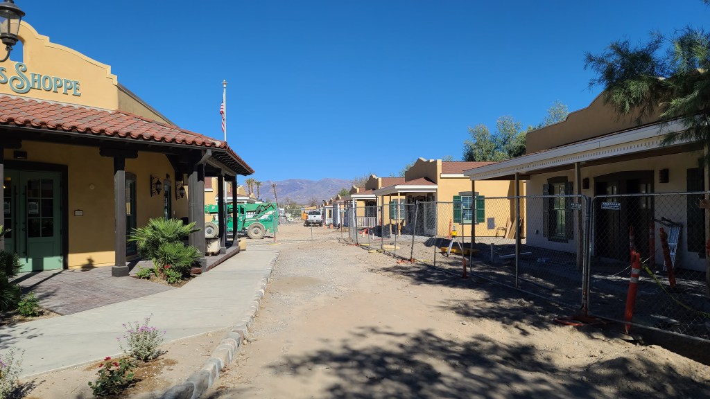
Of course the visitor center was mobbed like I expected it to be. The only other time I’ve seen it like this is when I came up for the first time back in ’15 to see the desert superbloom. I got my pass and bought a postcard for Bethan. I was told that to mail it I’d have to go a quarter mile down the road and post it at this place called ‘The Ranch’. I rolled down the road and the place was easy to find. It’s basically the downtown area of Furnace Creek. I’d been here before to go to the restaurant and bar, and there has been a huge facelift on the place in the meantime. I almost didn’t recognize it! It’s set up to be an adobe desert village, I really like their choice in architecture.

I don’t remember this from last time! What a nice little oasis, it’s been a while since I’ve seen this much greenery.

There was a lot of new construction going on. There’s big money flowing into this place these days. Maybe because of so many tourists due to the pandemic? I don’t know.

I found the little post office there and sent off my postcard. So the plan for the day was to hit a couple of places that I missed on my previous trip, then cut over back to the east side of the park. I was then going to head down to the trail I wanted to go on in the southern part of Death Valley. There’s a lot of cool spots to go to around Furnace Creek like Artist’s Palette, Zabriskie Point and Badwater, but I’ve been to those places before. I was interested in checking out the 20 Mule Canyon and Dante’s Point, as I’d missed these places on my first trip here.

Dante’s Point is the highest point in the park and is where they filmed a scene in the original Star Wars. It is the scene where Luke and Obi-Wan Kenobe are looking down at Mos Eisley and Obi-Wan says his famous “scum and villany” line. Yes, Death Valley is Tatooine! A lot of scenes from that movie were filmed here. I was stoked to see such an iconic view, so I headed off down the highway.

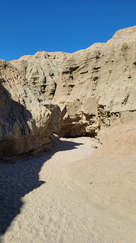
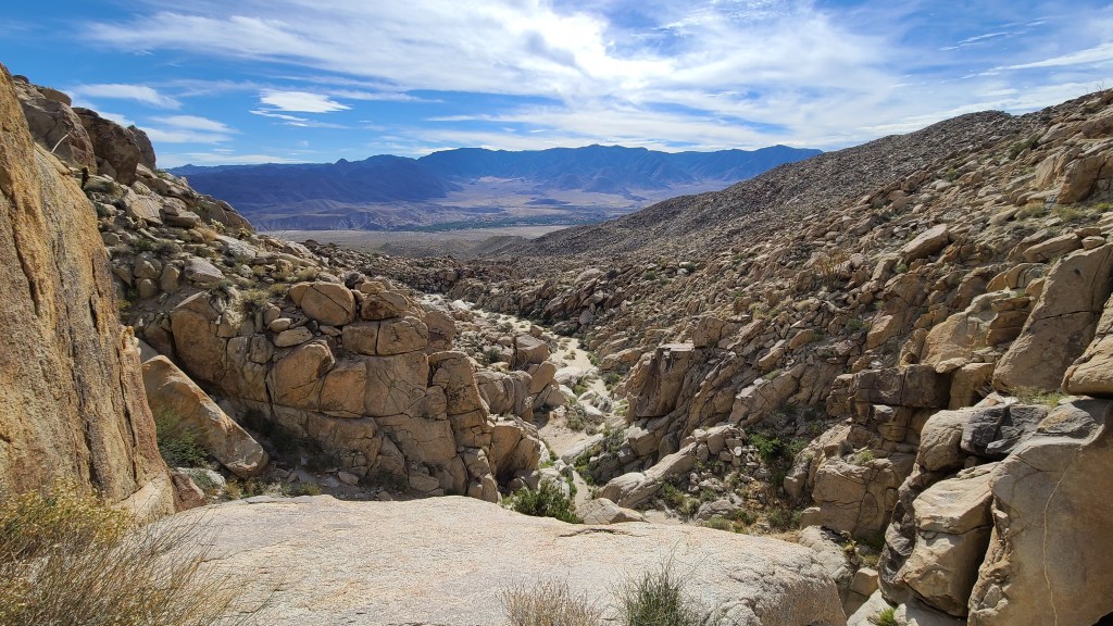
Along the way I arrived at 20 Mule Canyon. It’s a little detour off the main road that runs through a little side canyon. It took maybe 20 minutes to drive through. There were some pretty sharp corners to make in restricted driving space, but I managed all right. There was a lot of cool geology to see (like pretty much everywhere else) and it was worth making the little detour.

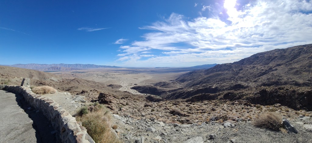
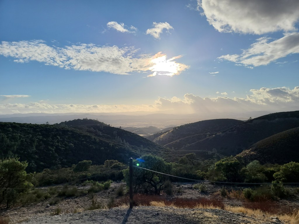
After I had made the loop, I set my sights on Dante’s Peak. It was about 8 miles off the main road. I had heard that it was a really steep ascent, especially in the last quarter mile. It’s paved all the way, not any kind of crazy off-road, so I figured it would be fine. I headed out that way, and the road wasn’t a problem. It did get very steep at the end, that part was true. I shifted down to first gear and The Beast didn’t have any issues with it. I arrived at the top, and the view was just unbelievable! I got a little bit of vertigo looking at it.

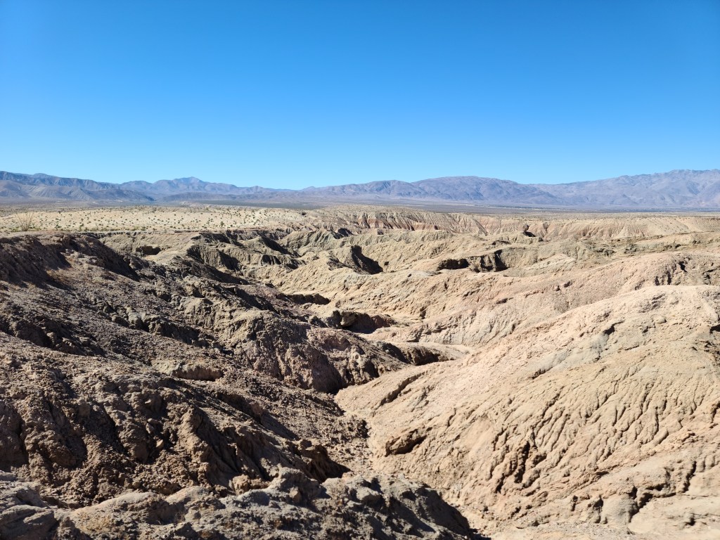
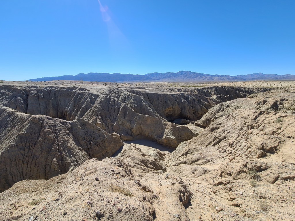
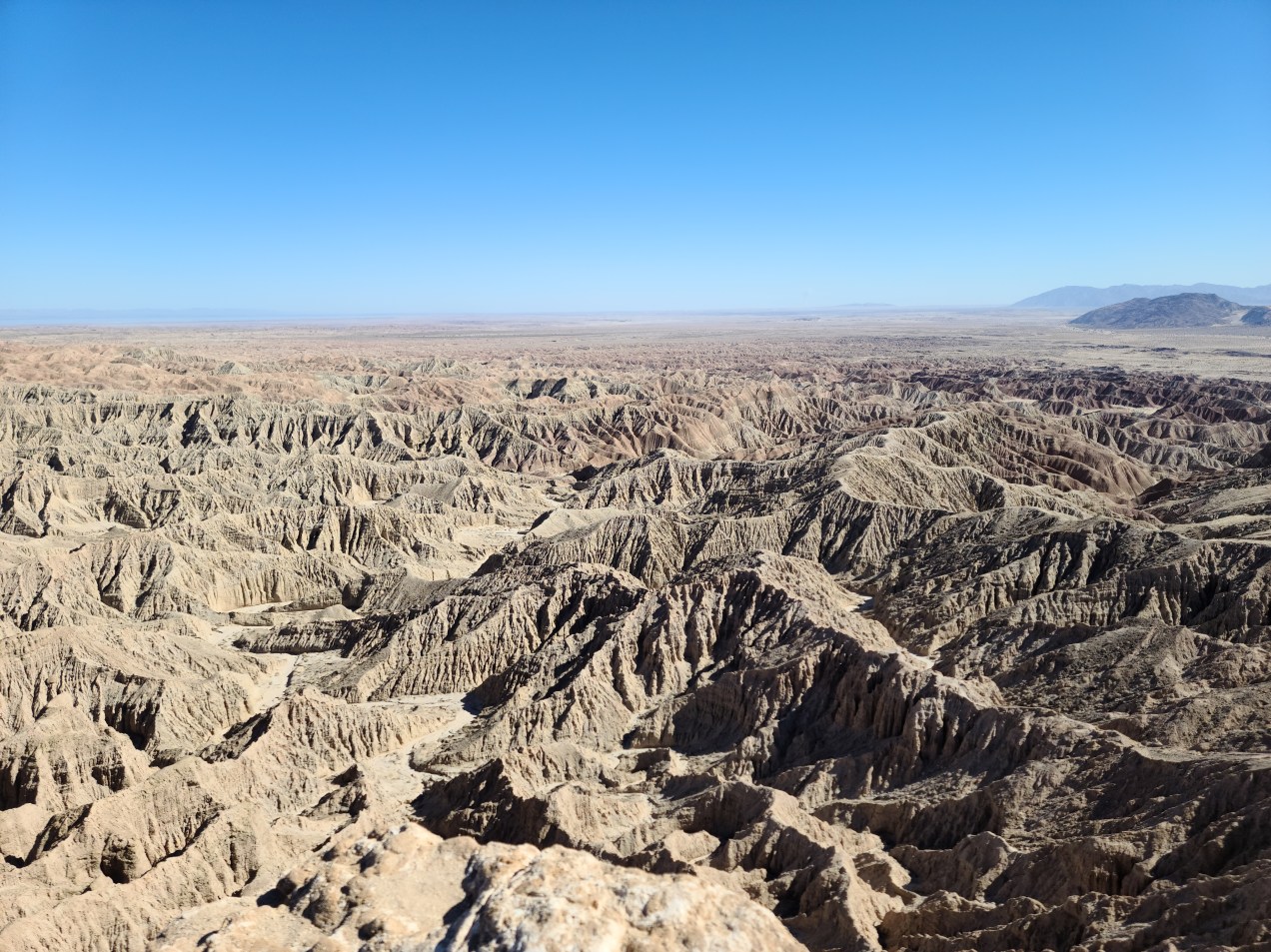
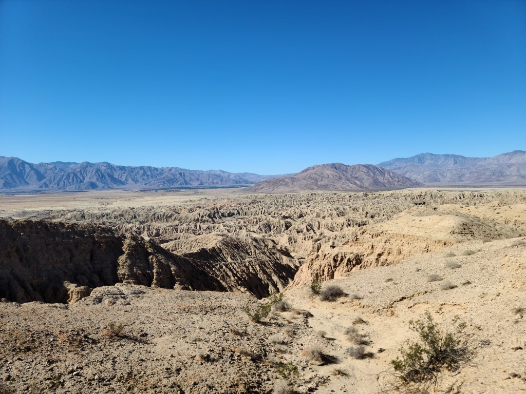
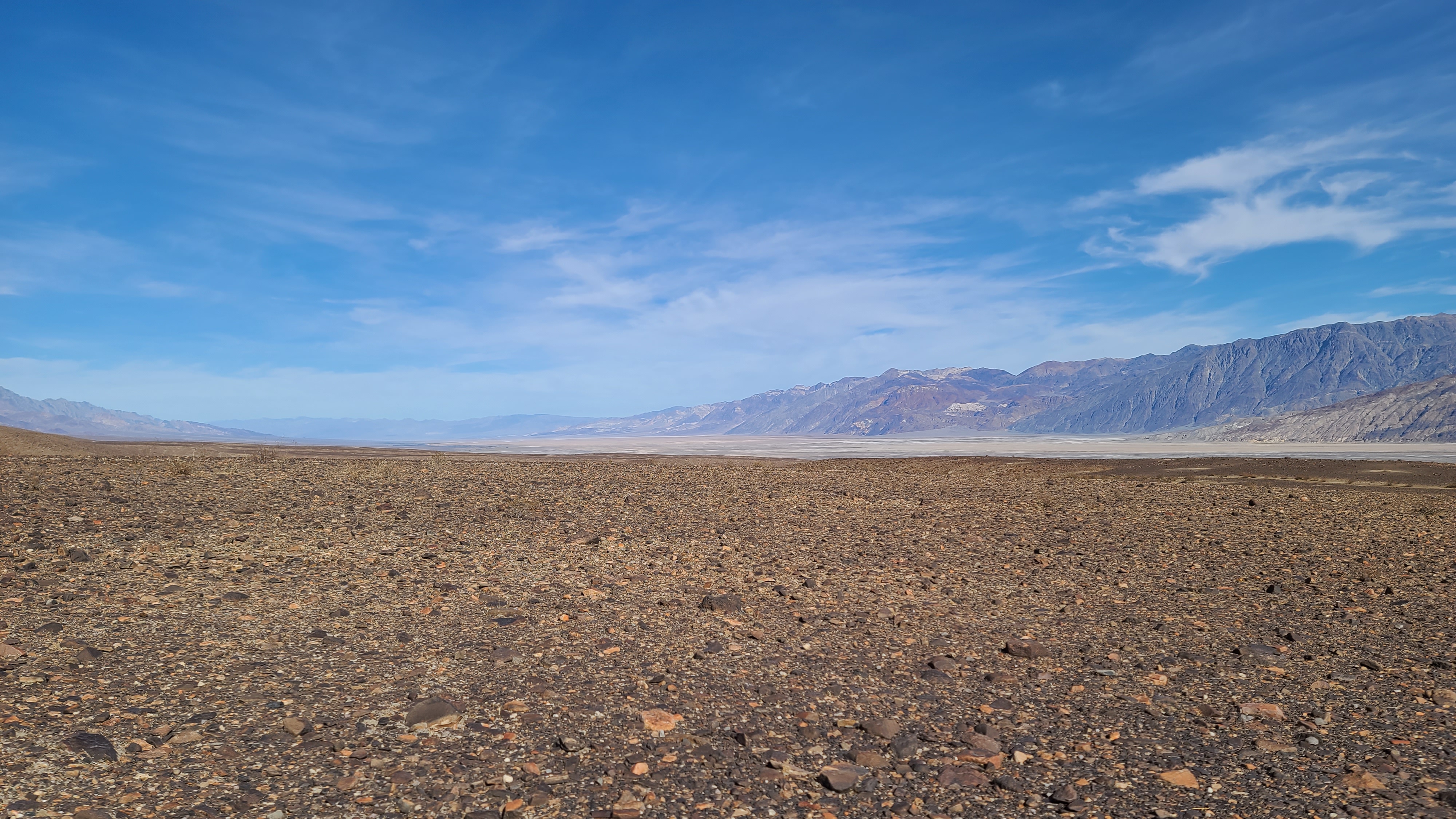
From Dante’s Peak, you can see the whole of Death Valley laid out before you. The sign said that on a clear day, you can see a mountain that is 100 miles away. I can see George Lucas going up here and saying, “Yup, I need a shot of this in my movie!” Wise decision indeed. It was easy to find the exact view when I got up there. Luke and Obi-Wan saw what my featured image was for this blog post. After an Internet query, I saw that Furnace Creek stood in for Mos Eisley. What a thrill it was to be standing at the place of such a key scene in one of my all time favorite movies!

This cheeky little joker entertained the tourists with his antics up on the peak.

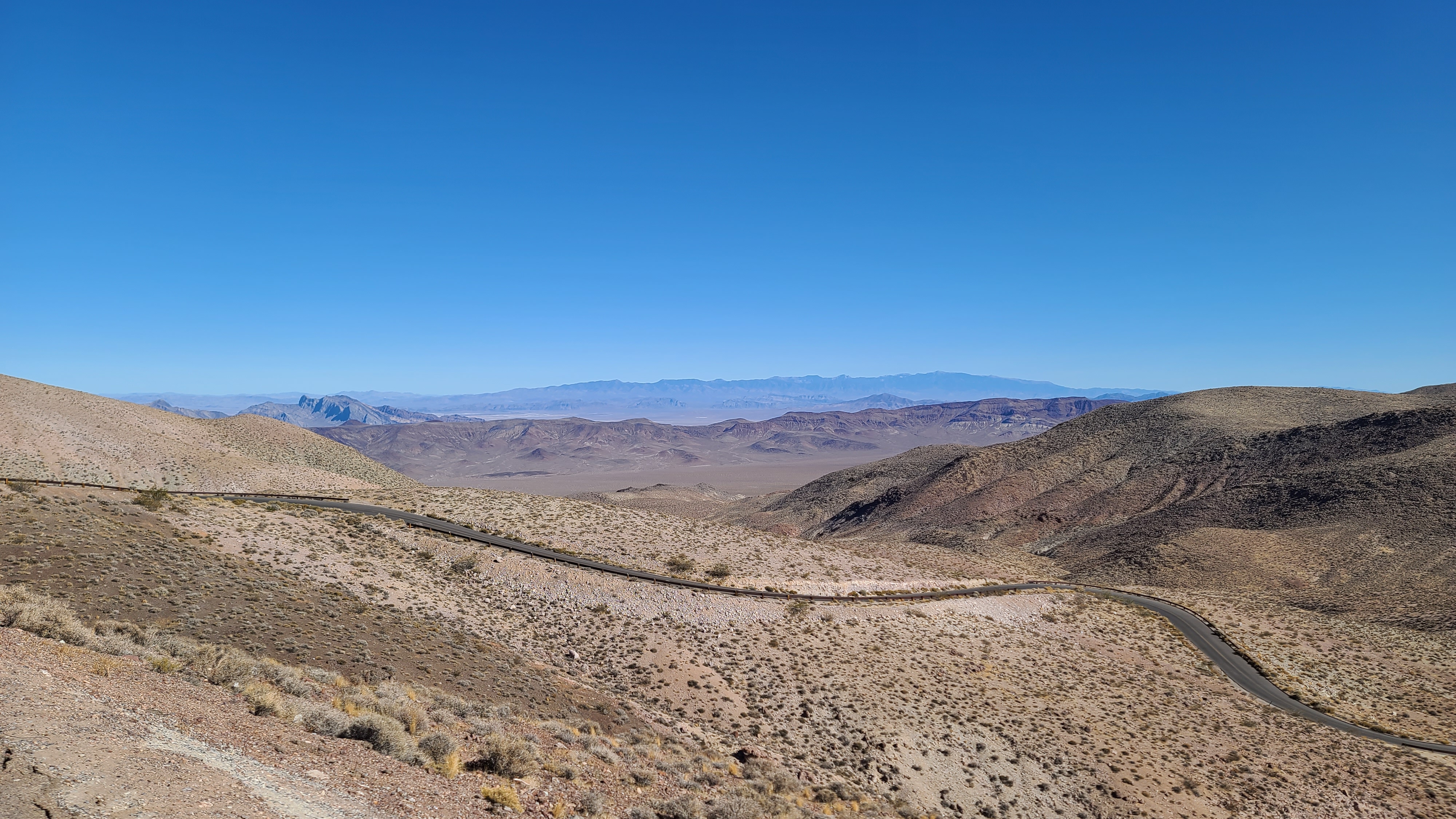
I was completely blown away by the view. I can’t believe I didn’t hit it up the first time I was here! It was around 5000 ft., so it was a bit chilly. It’s probably the first time I’ve been cold in the daytime here. I lingered up there for a while, soaking up the view. When I had my fill, I made my way back down to the bottom of the mountain.

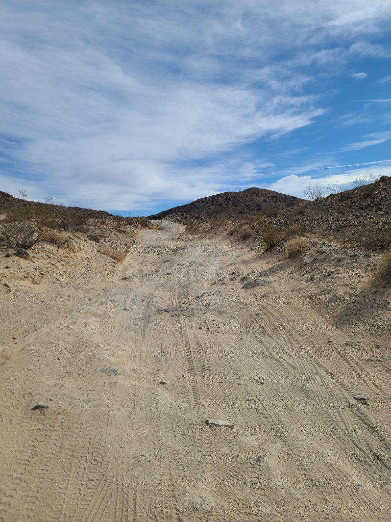
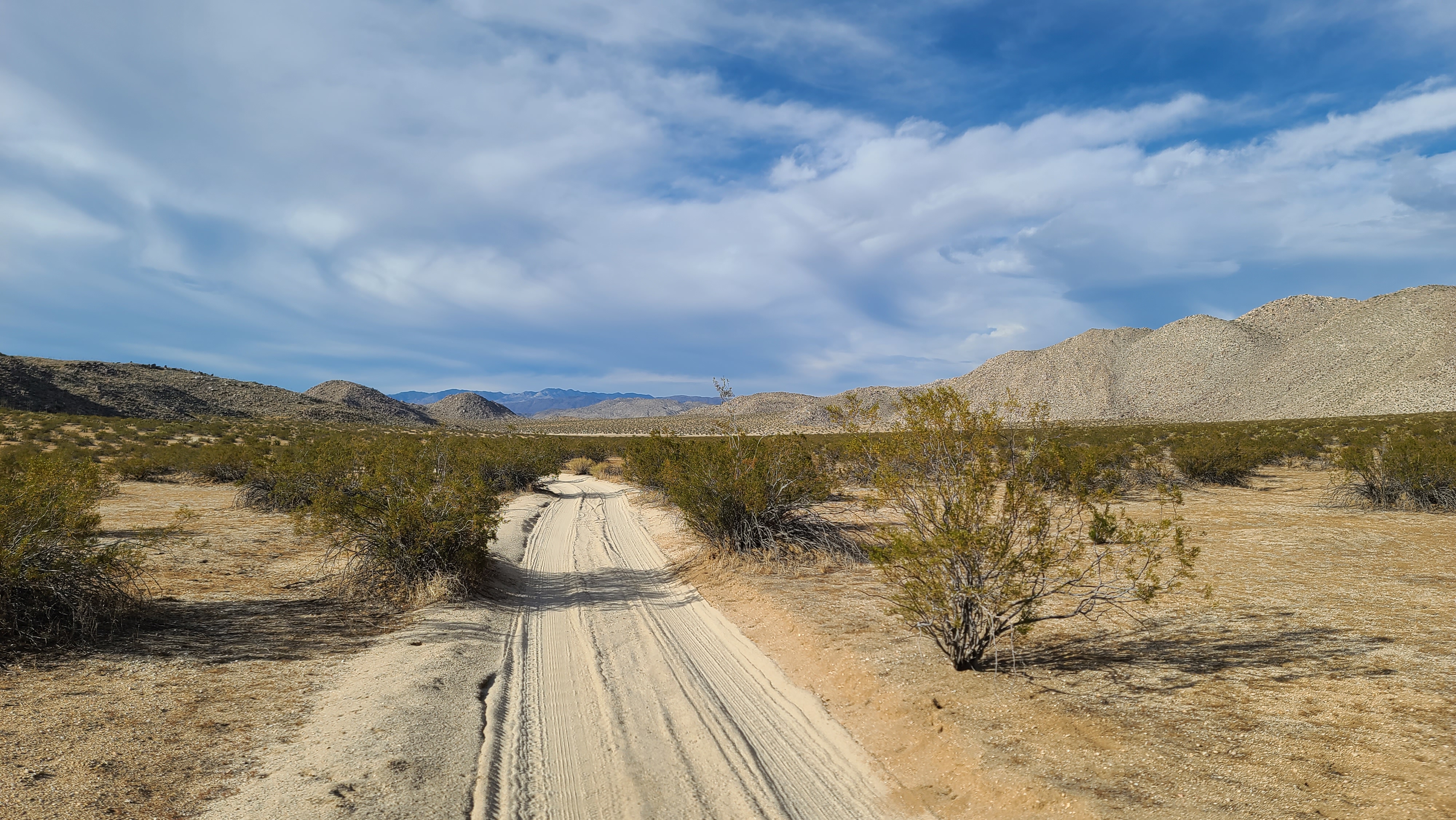
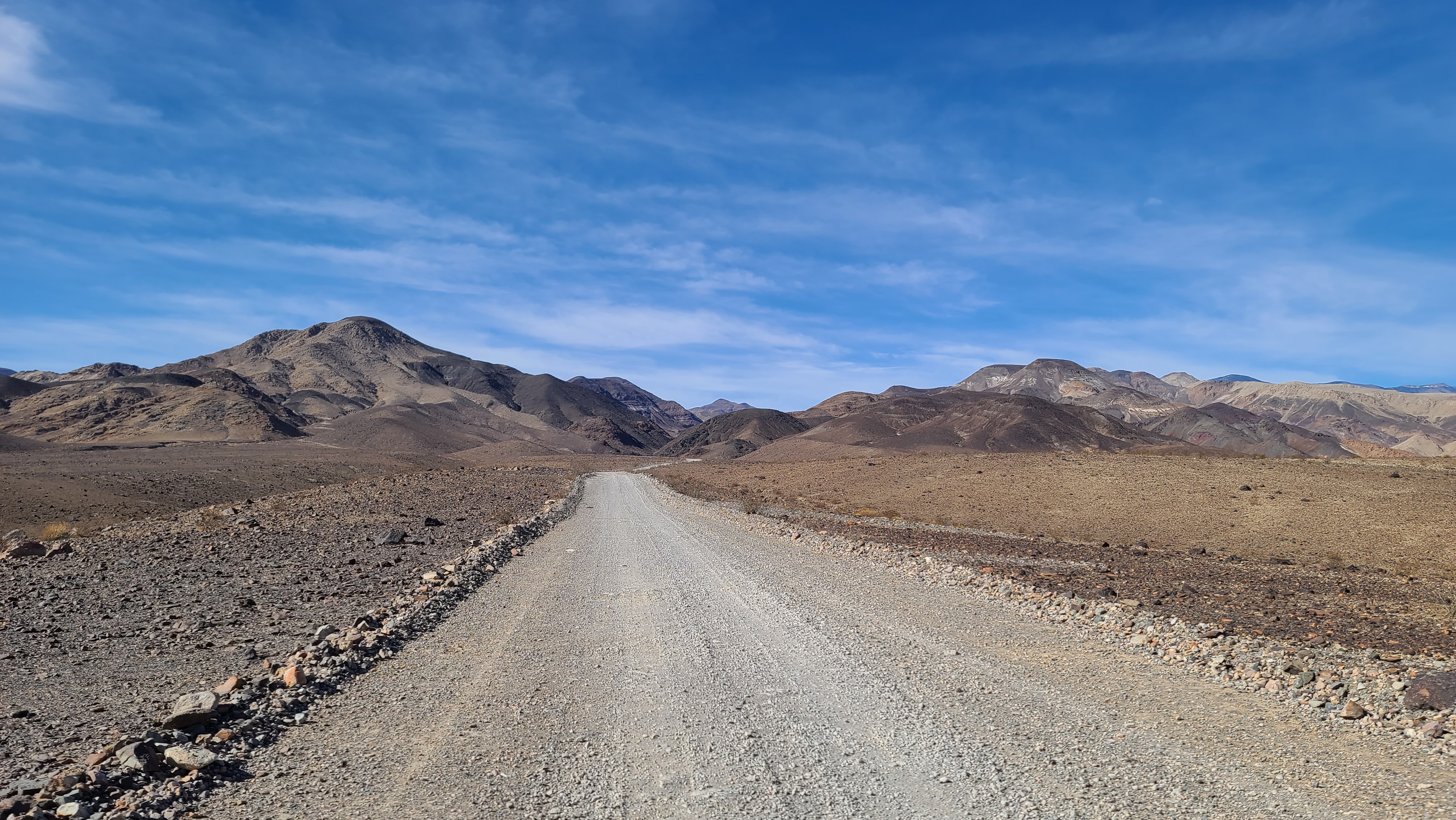
I wanted to head in the direction of Shoshone to get some fuel, then head down to the Exit Road. I saw on my map that there was a couple of ways to get there. One was the way I came in on, and the other was a dirt road that went almost directly there. It was a 26 mile stretch of trail that went down through Greenwater Valley. It looked like way more of an adventure than the sterile highway, so I decided to take the route. It started right at the base of the mountain I was on, so it was really convenient for me. I found the trail and it was in real good shape. I locked the hubs, deflated the tires and set upon it.

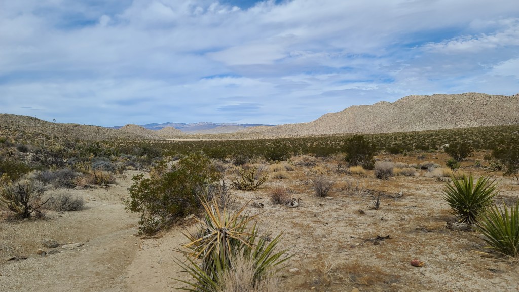
I really enjoyed my journey through Greenwater Valley. The road was great, the views were spectacular, and there was 0 traffic. Everywhere I had been to the park by this point had been chock-a-block with tourists, now there were no people whatsoever. The vast majority of tourists stick to the paved roads, it seems. As soon as you hit the gravel, everyone vanishes. It was pretty cool.

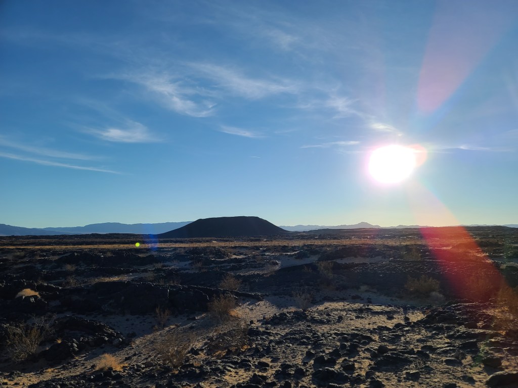
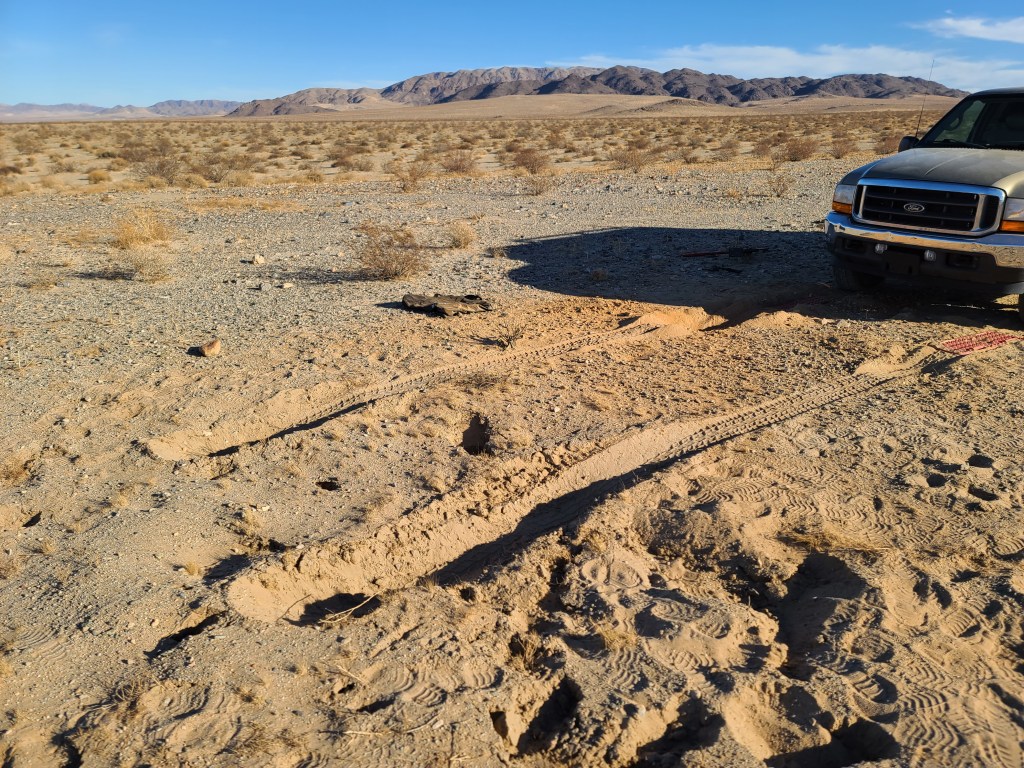
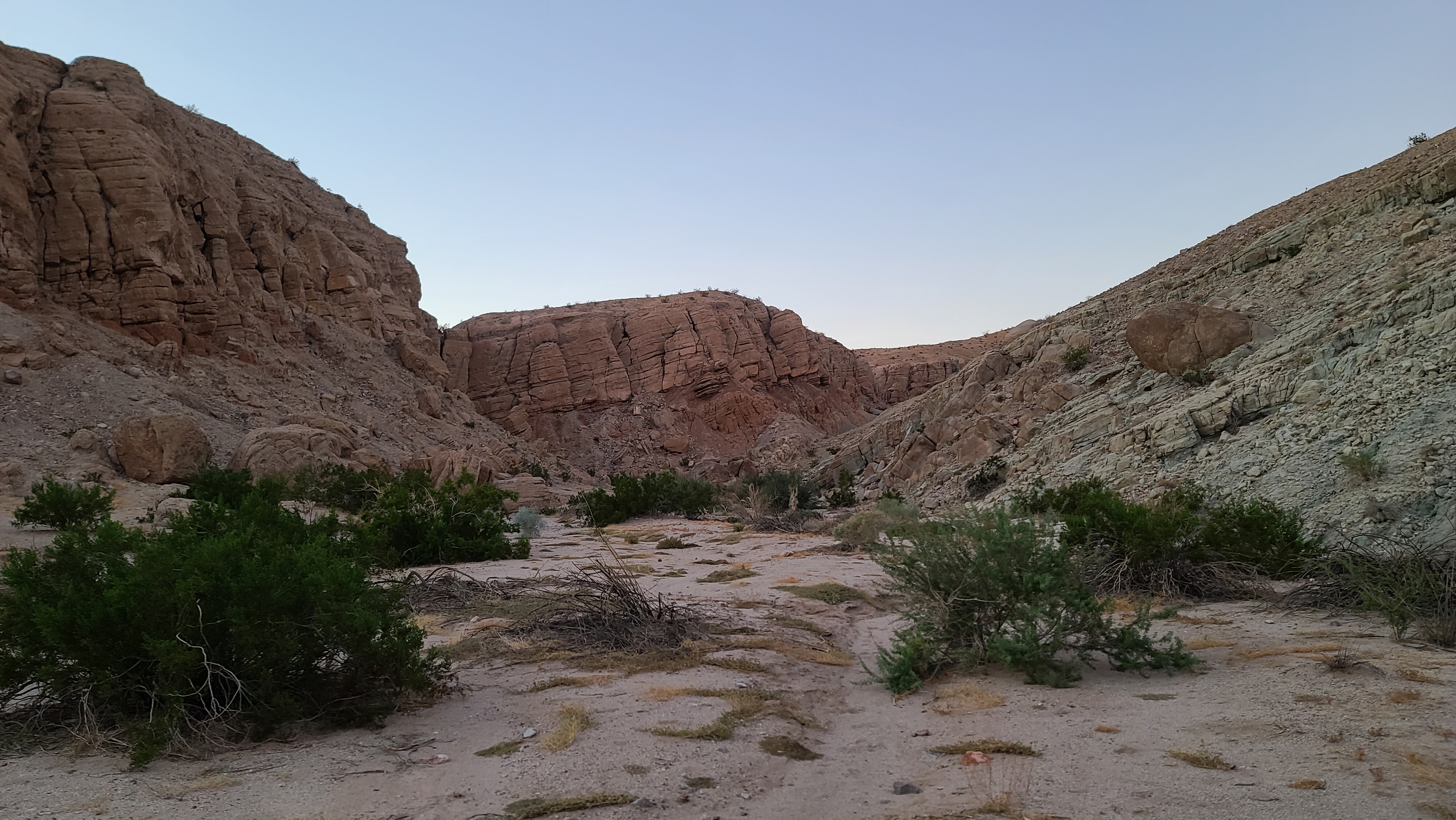
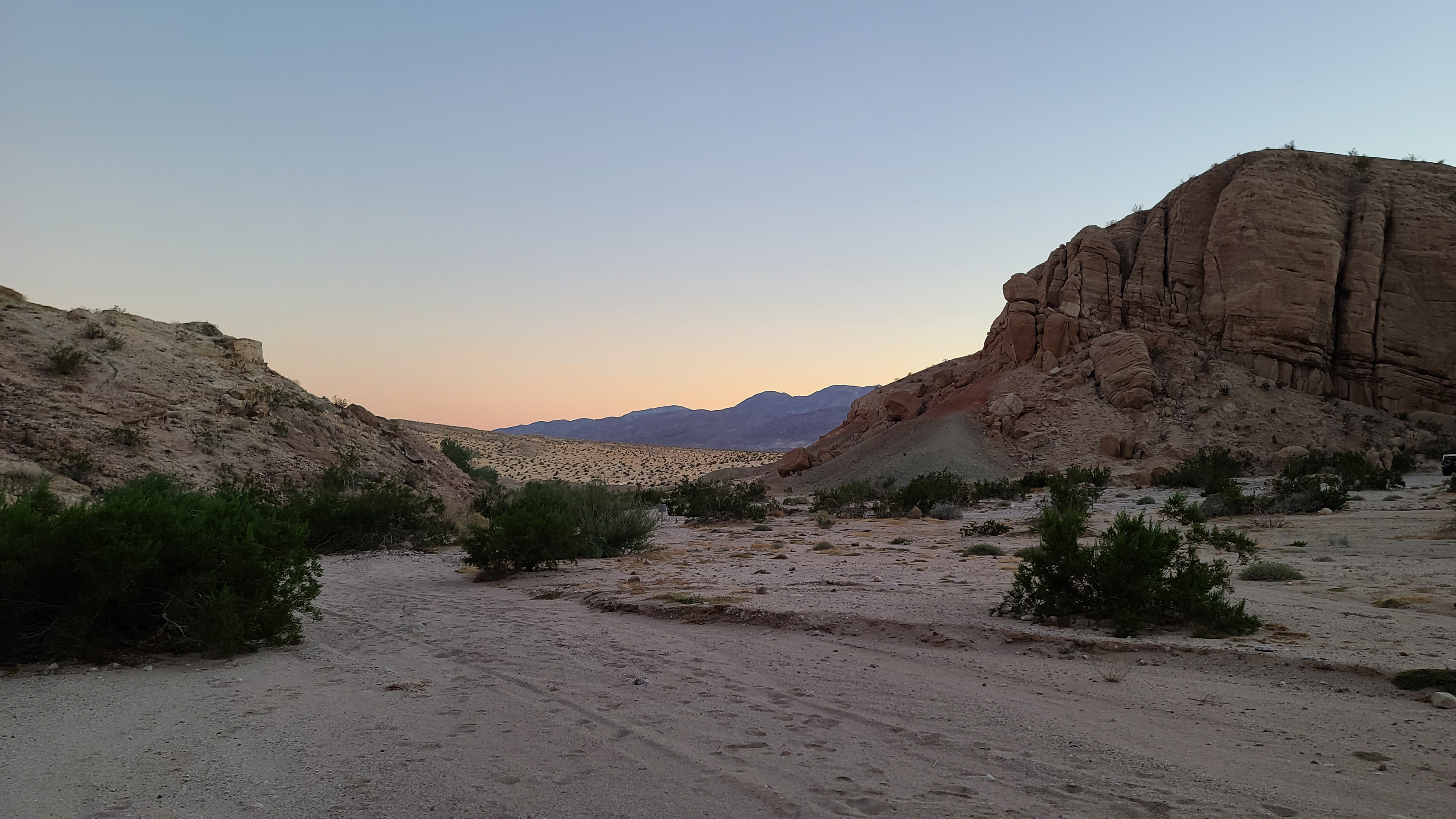
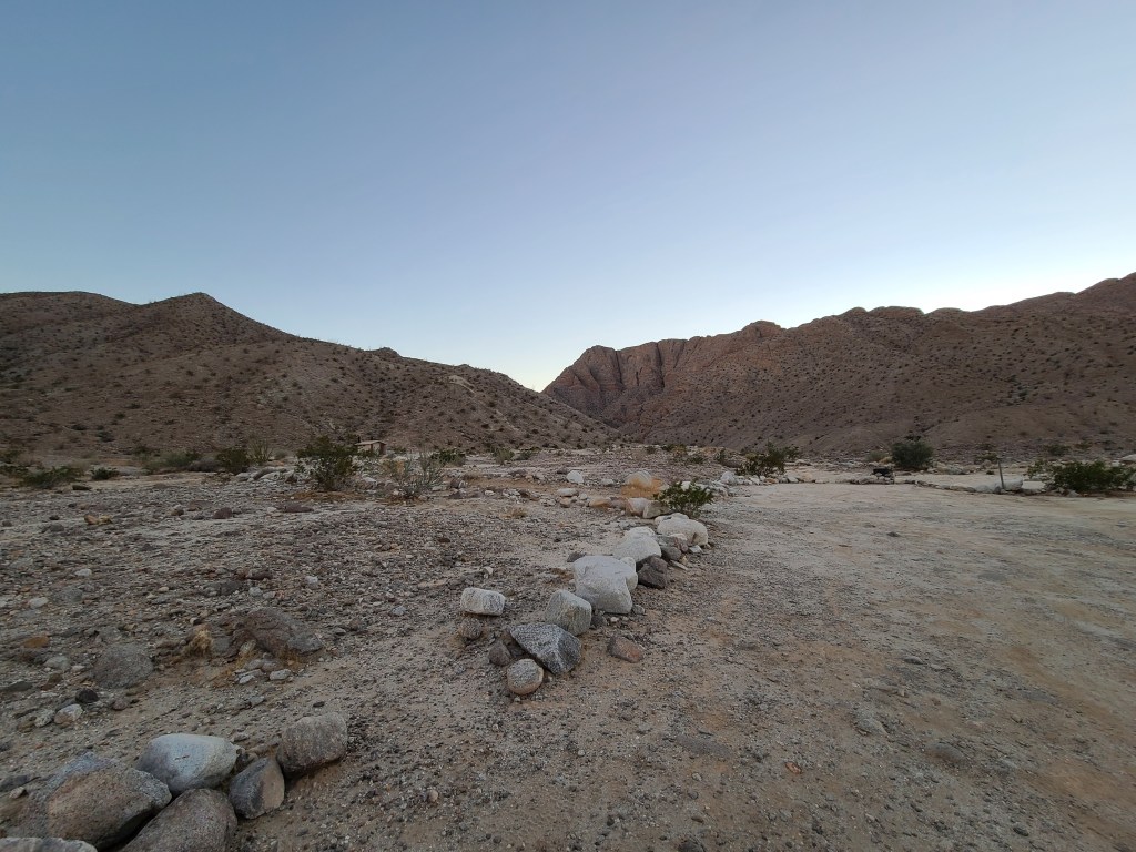
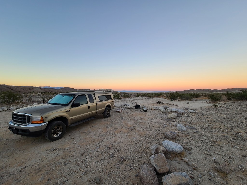
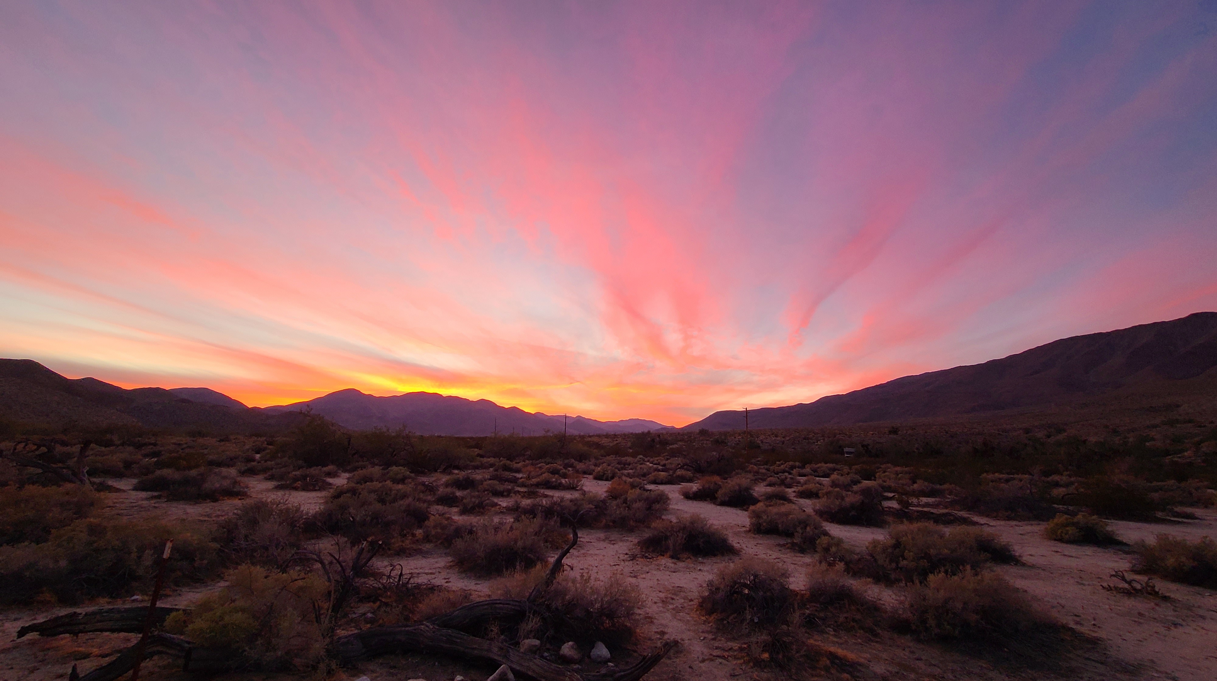
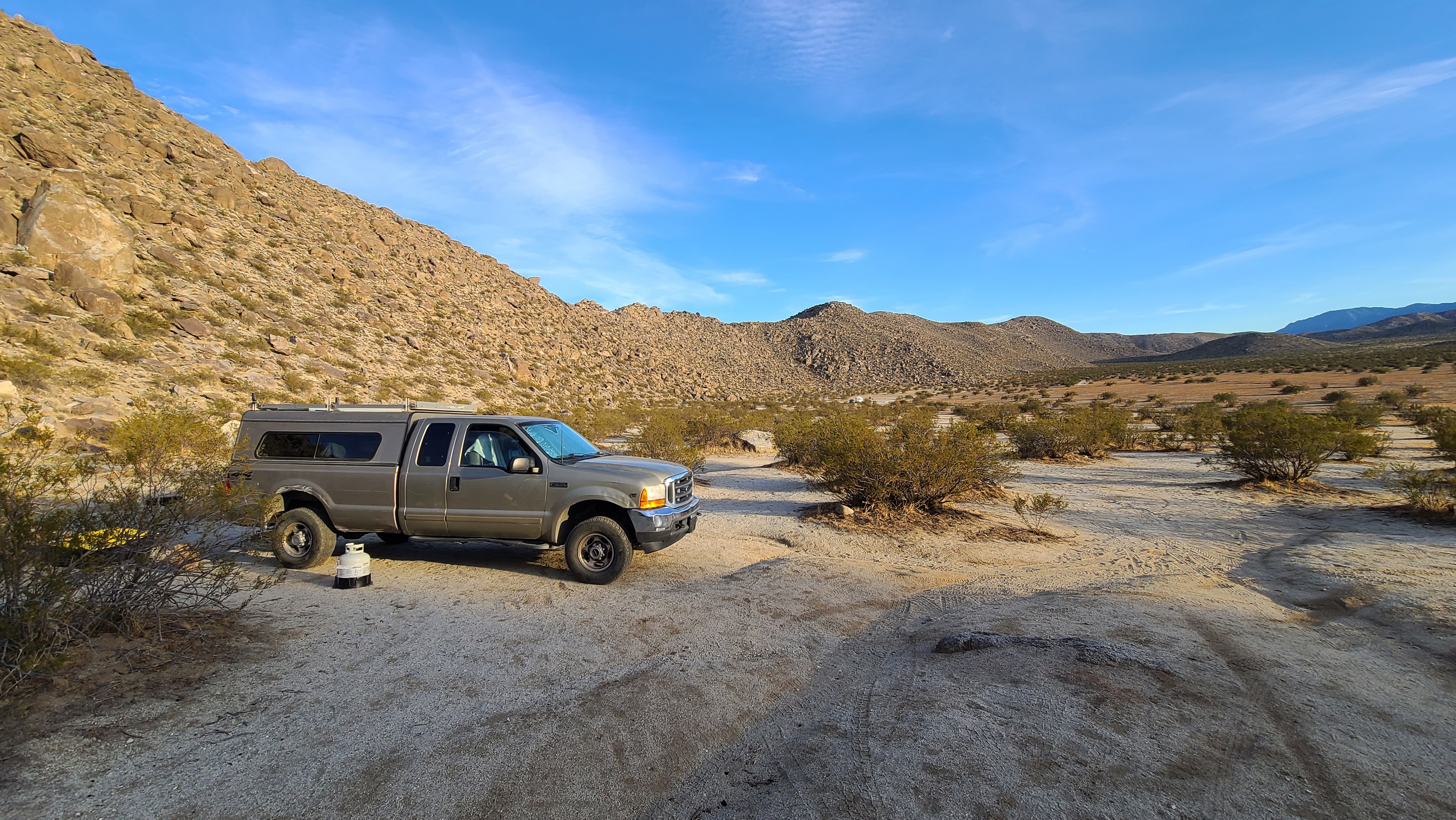
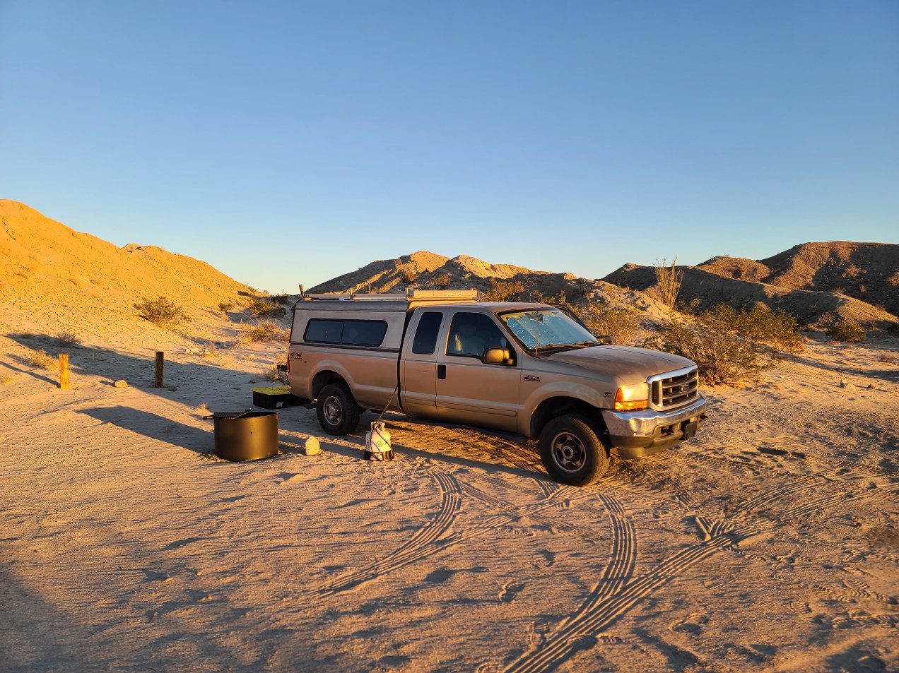
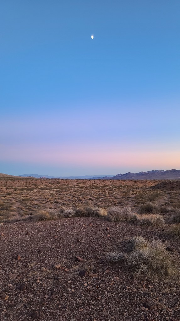
As I got to around 13-14 miles in (roughly the halfway point) I started looking for a place to spend the night. Around this point, the valley opened up and it was just beautiful. I had to stop somewhere around here! I spied a flat rocky spot right off the road, and I stopped to check it out. It seemed as good of a place as any, so I decided to park and set up camp.

Right away, I felt I had made a very wise choice in camping spots. It had the most solitude of any place I had camped so far in this expedition. There was no noise at all. No cars, no voices, no birds or bugs, and planes flew far away so you couldn’t hear them. It was like I was in a vaccum! I was 14 miles from a road and I saw only one car pass the whole afternoon/evening. At first, it kind of tripped me out. I love solitude, but not having people constantly interrupting that state is a strange feeling. As much as I loved it, I found it a bit odd.

Not having to mentally compensate for people entering my space was weird in a way I can’t describe. The last time I had been in a place so remote is when I camped in the middle of Mojave National Preserve 3 years ago. The people flying in the planes I could see off in the distance were probably closer to me than the next human being. It just blew my mind! As I got settled in however, I started feeling liberated from civilization. The feeling of freedom was intoxicating!

Looking down the valley.

I had finally located the place I was looking for on this journey. I’ve camped in so many different places on this trip. Some were better than others, but I never was really alone in any of those places. This spot was remote, and off the beaten path. It was a Friday in peak seaon, and no one seemed to travel this route. I don’t know why, it is beautiful and the road is easily navigable. It was a great spot to stumble into.

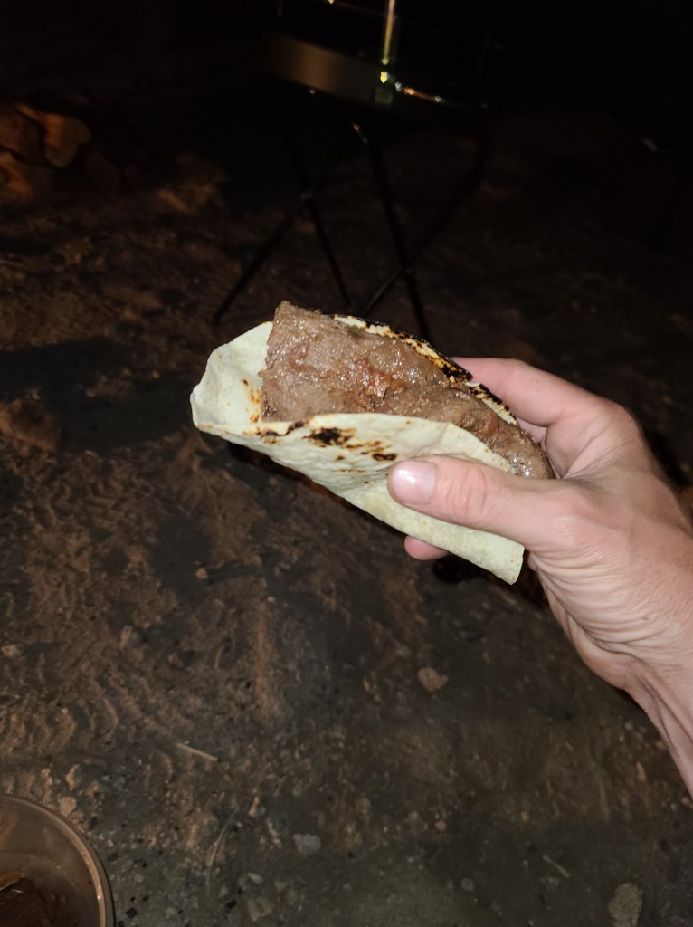
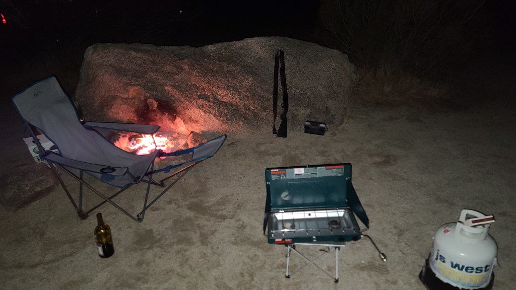
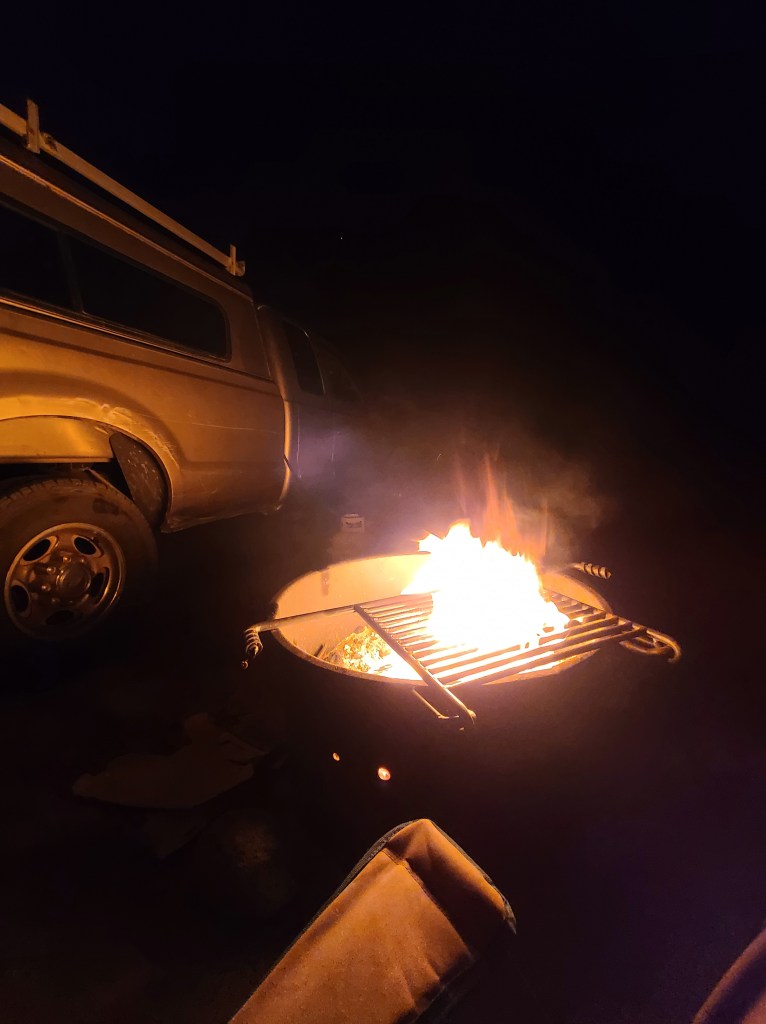
I had a stash of wine left and that tri-tip still to cook, so I poured some vino and started a fire in my grill. It’s not allowed to start fires where I was, but I really wanted to cook my tri-tip over open flame. I had a couple bundles of firewood (plus three nice chunks of hardwood I found alongside the road outside of Baker) that I was tired of packing in and out of the camper as well. After thinking about it, I decided to start up the fire. I had set up in an area with nothing flammable in a 15 foot radius, and there was no wind. I had my extinguisher at hand as well. I felt that I had all the necessary precautions to do it safely so I went ahead. At the first bit of wind, I had no problems with putting it out. I don’t want to set the desert on fire!

It was a bit nippy at 3600 ft. altitude, so the heat from the fire was definitely appreciated.

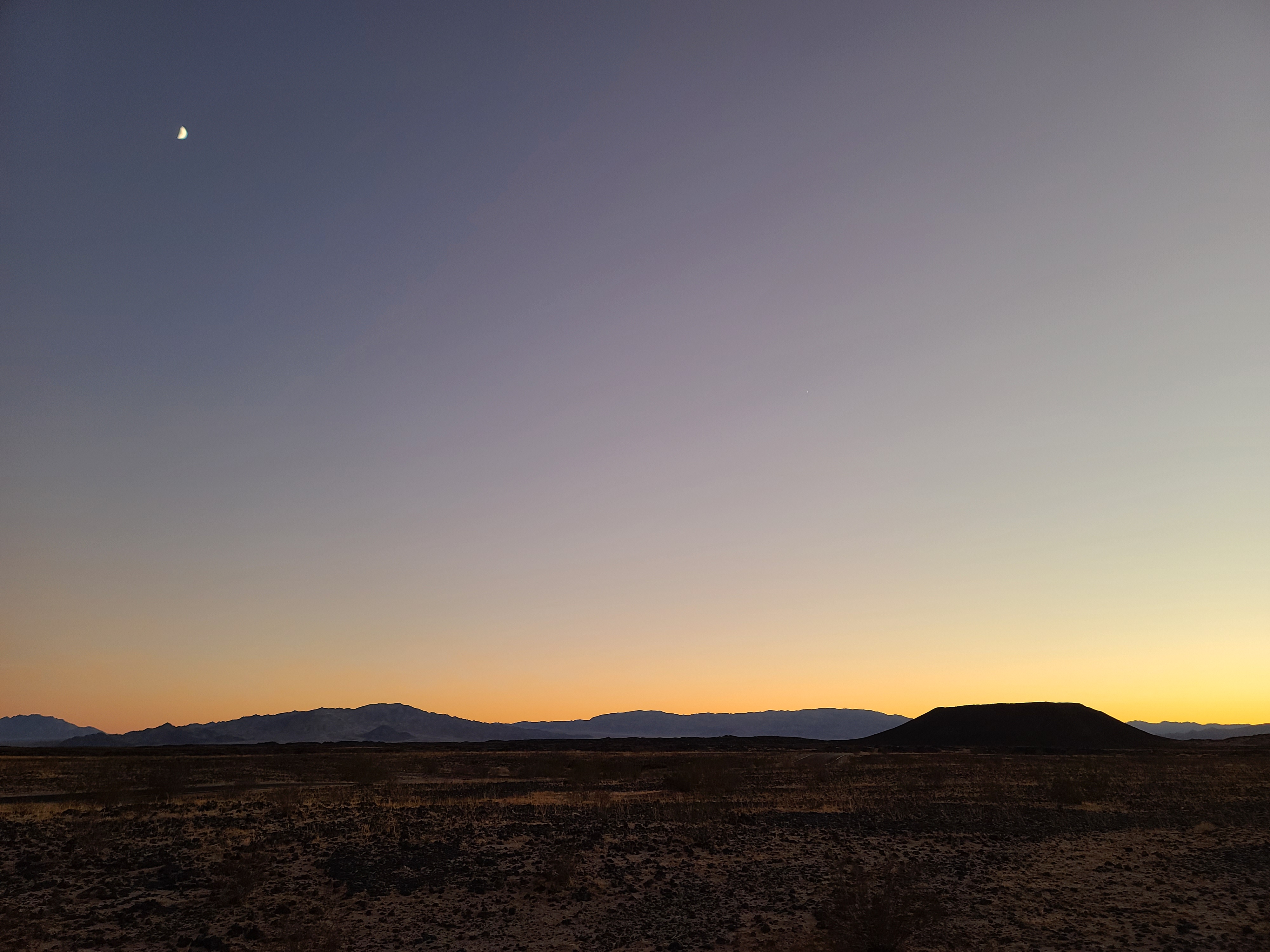
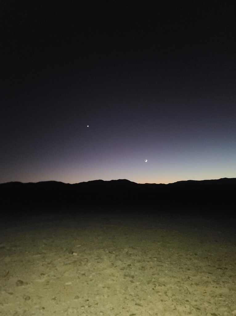
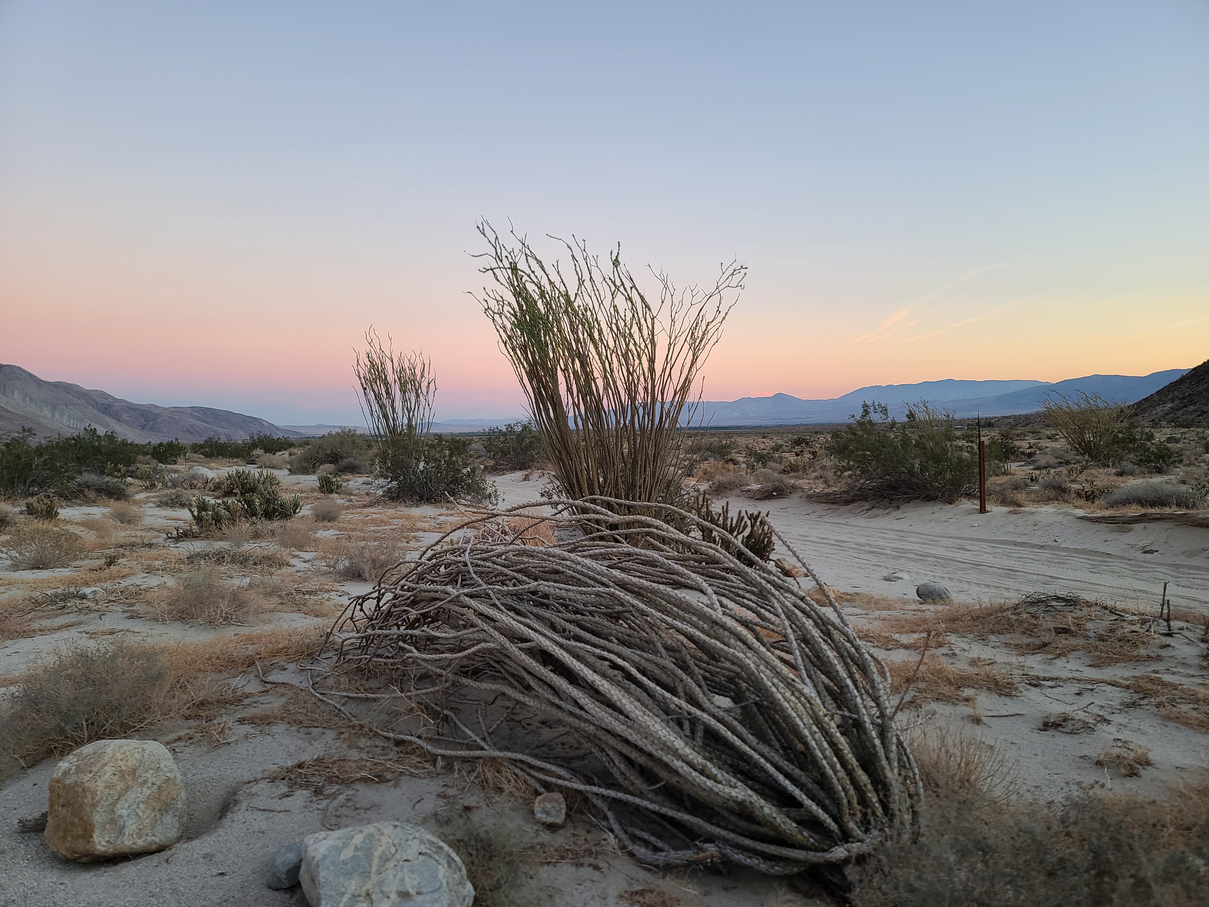
After I made a bunch of coals, I set up the rack and threw on my tri-tip. As I waited for it to cook, I did some stargazing. I started seeing some nice meteors zip through the atmosphere. Some burned for several seconds! I consulted my meteor shower app and found that I was smack dab in the Leonid shower! It’s one of the better meteor showers, according to the app. I believed it! I saw one about every five minutes or so. The shooting stars were amazing, but the whole night sky was beautiful as well. Death Valley is isolated enough so the light pollution is at a minimum. The stars were bright and filling up the sky. I have night mode on my phone and tried to take a few pictures. The results weren’t bad for a camera phone. I saw more stars in the picture than I could see with the naked eye.

I took a picture of Orion using night mode. Two-thirds of the stars in this shot couldn’t be seen with the naked eye. Someday I’ll have a camera that can photograph the Milky Way. For now, a phone will have to do.

It took a while, but my tri-tip finally got cooked and I tore it up! It was oh-so-good. I hated to break the rules and build a fire, but it was worth it to get that flame-broiled taste. If I’d had to cook it in a skillet, it wouldn’t have been anywhere as good. I was responsible with the fire and kept it in a container so it wouldn’t scorch the ground. I felt I did my best to keep it low impact.

All in all, it was a hum-dinger of a day. It was good to finally arrive at the ultimate spot for desert solitude. The whole trip led up to this day. I’m glad I decided to take the long way and experience this grand place. I might even stay an extra night, it’s pretty comfortable here! I’ll see how I feel tomorrow, I might just hang around.

Day 25

Altitude: 3627 ft.  Stoke level: 4 Temperature: 78-54 degrees       Conditions: sunny, clear, light wind

Wine causes the worst hangovers, and I had a doozy. I woke up around 8 when the sun got hot and I couldn’t go back to sleep. I couldn’t really do anything else, so I popped on some The Man in the High Castle and just chilled out. It was around 9:30 when I heard the sound of an approaching vehicle. There hadn’t been anyone by since sunset the previous evening, and that was the only person that had rolled through. Curious, I peek out the window and see it is a ranger truck. He passed by, but I see him come to a stop a few feet down the trail. “Uh-oh,” I think. “This is not good.” He backed up and parked across from me on the road. He got out and started to walk around my camp. I figured it’d be best to go out and meet him before he started banging on my camper, so I stepped out to see what he wanted.

He was a younger guy, maybe late 20’s to early 30’s. The dude seemed friendly enough, like most rangers I’ve met. He says, “Ok, there are two things here I’d like to discuss. One, you camped in a virgin spot, your tire tracks are the only ones I see here. Camping is technically allowed here but we only want you to camp in spots that have been used before. Secondly, fires aren’t allowed here. I see that you built a fire. I do give you credit in that you did build it in a metal container so it wouldn’t scorch the ground though.”

I just pled ignorance and he seemed to be cool about it. I understood that what I did was wrong, and he was right. I shouldn’t have built the fire. The parking situation was something that I had no idea about however. Well, now I know! I think that because I had my park permit and I kept the fire off the ground, he just gave me a warning. After running my ID and seeing that I was a law-abiding citizen he let me go. I had told him that the reason I was camped out here in the middle of nowhere was that I was on an expedition to experience desert solitude. When he left he said, “Enjoy your solitude out here!” What a cool ranger, he didn’t even make me move or give me a ticket.

I was glad that went well. The rest of the day was spent watching shows on my phone. I was in no shape to go anywhere. It was good to have one last blowout night out here on the trail, despite the hangover. From here on out, I would be trying to maximize miles instead of lounging around in places I found desirable. It was a good place to spend my last down day of the expedition. Tomorrow I want to head over to Pahrump, NV and get cheap gas & some other items. Also, it was the closest place I’d have 5G so I could upload my blog. After that, I was going to finally start on this Exit Road. It was going to be a full day.

Day 26

Altitude: -97 ft.  Stoke level: 8 Temperature: 86-55 degrees       Conditions: sunny, clear, calm

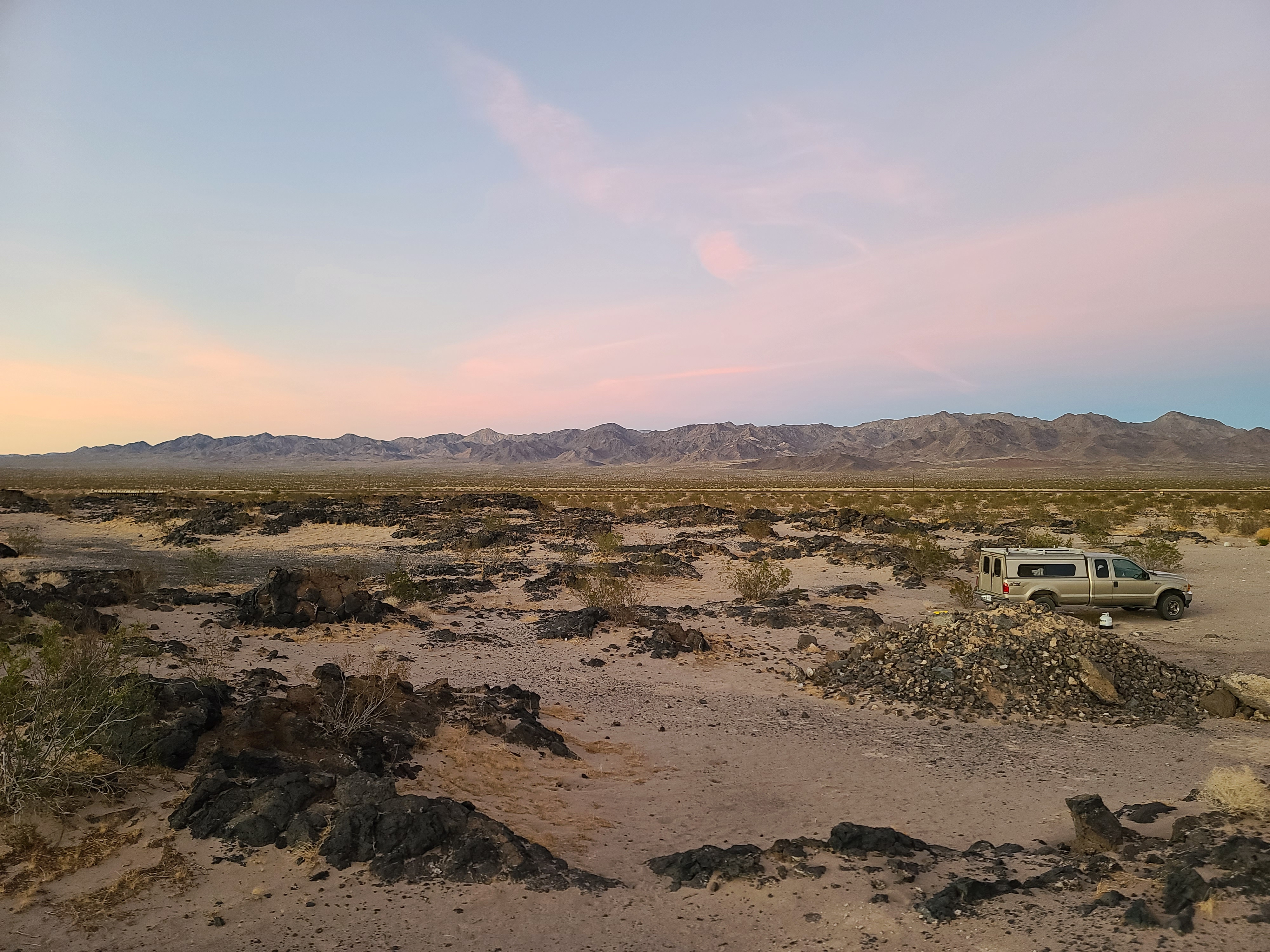
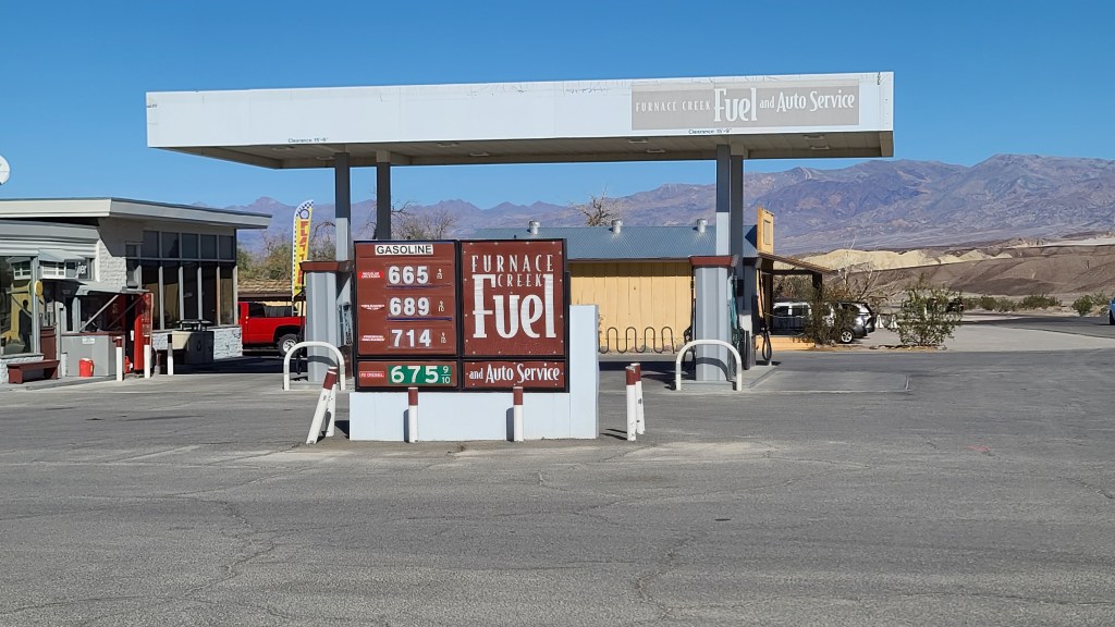
I got an early start and left Solitude Camp around 9. The remainder of the 13 miles out of Greenwater Valley went smoothly. I swiched back to 2 wheel drive and re-inflated the tires when I got back to the highway. First, I wanted to head to Shoshone and put a little gas in the tank. I was at a quarter full and I wanted to have a bit more before I headed over to Nevada. When I got to Shoshone, I saw that the gas there was almost 6 dollars a gallon! I had to have it, so I put in 40 bucks and it gave me a quarter tank.

While I was pumping gas & throwing away garbage, the lady on the other side of the pump backed up with the hose still in the gas tank and it popped off at the breakaway! I’ve never seen that happen in real life before. Fortunately, no gas sprayed anywhere. The woman was super embarassed and had to go take it inside to the attendant. At least she owned up to it though!

Goodbye Greenwater Valley. It sure was a pleasant stay.

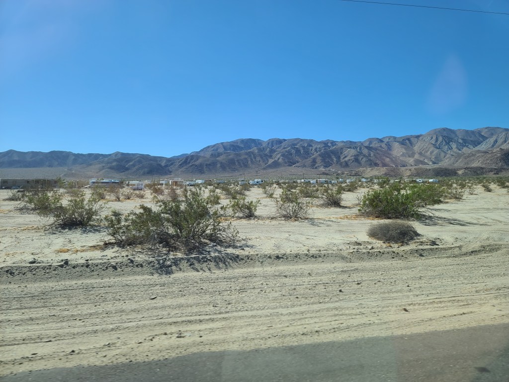
The road to Pahrump was just outside Shoshone. The sign said that it was 30 miles distant, so that wasn’t too bad. The road was pretty much straight as an arrow, and around 45 minutes later I arrived in Pahrump. I’ve been there before, it wasn’t my first time. I think the town’s main claim to fame is that this is where Art Bell lived and broadcasted Coast to Coast AM back in the day.

As I started getting into the outskirts of Pahrump, I spied a gas station. Gas was 3.29 here! It was 5.69 only 30 miles away, gotta love Nevada! After I filled up, I realized I was famished, so I looked to see what what they had to eat in town. I was craving pizza, so I went over to Pizza Hut. There’s a lot of pizza options out there, but there’s something about that pan crust they have at Pizza Hut that I’ve always loved. When I get there, I see that it is closed for some reason. Trying to think of an alternative to pizza, I recalled hearing the McRib was back at McDonald’s. I went over to the local Golden Arches to see if they had it. Lo and behold, they did! I got a combo meal and took it back to my truck to eat it. I haven’t had one in like 3 years, and it was good as I remember. McDonald’s is crap, but that McRib is just divine!

As I was eating the McRib, I got a call from Captain Pack Rat. I had told him I’d swing by and see him and Party Wolf on my way back. He wanted to see if I still was going to roll by. I told him I had a couple days left in Death Valley and I wouldn’t be able to make it this trip. I’d come up and visit after I got back from Louisiana. We chatted for a bit, it was good to catch up with my ol’ lodge buddy.

I hit up Big 5 sporting goods and Home Depot for some supplies, then hit the road back over the state line to Death Valley. With a tank full of cheap gas and a McRib in my belly I was ready to tackle some trail! I got back to Shoshone and drove about another 45 minutes south. I finally reached the Exit Route trailhead, and switched the truck to off-road mode. I plotted my waypoints on my OnX app, and set off down the trail.

A plaque giving the history behind the trail.

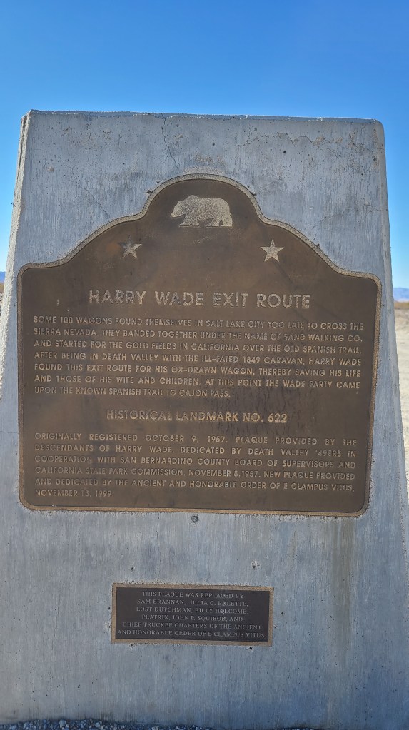
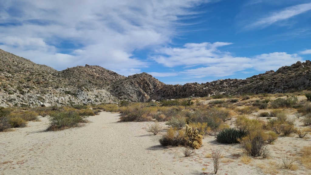
There was a little side-trail leading to what was called ‘Saratoga Springs’ on the map, so I wanted to check that out. It was hard to imagine a spring out here in the desert, that’s something I had to see. So the Exit Trail was a really great piece of road, you can tell it is constantly graded to keep it clear. Unfortunately, as a result of the grading, sand is heaped along the sides of the road 3-4 feet high. There’s no way that you can turn off and park. As I rode along to Saratoga Springs, I began to feel uneasy. There were a lot of ‘No Camping’ signs everywhere. I had counted on finding a camping spot along the route. As it was getting along in the afternoon, I started to worry about finding a landing spot for the night.

It looked like this pretty much the whole way down Exit Road. There was no way to turn off. Glad I didn’t run into anyone on this trail, it would have been tricky to let someone by!

I put that out of my mind for the moment. I had this spring to check out first! I found the turnoff and headed towards the spring. As I got towards the end of the road, I started noticing all the tall grass growing profusely all over. There was definitely a little oasis here! I saw that there was a trail going in the direction of the spring, so I went to see if it got closer to the water. I ran into a couple of groups of hikers who told me the trail got close enough to check things out.

The spring from a distance.

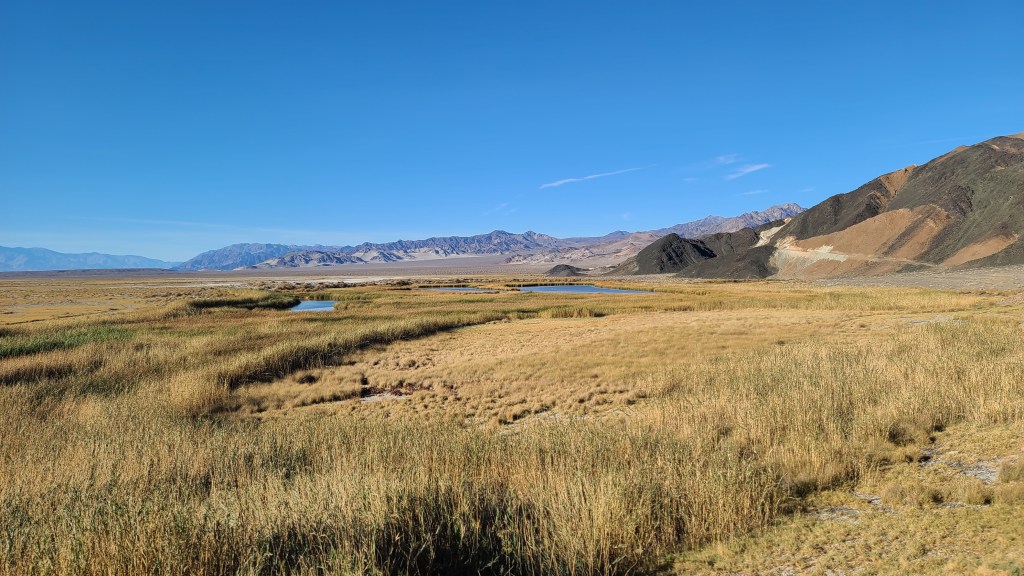
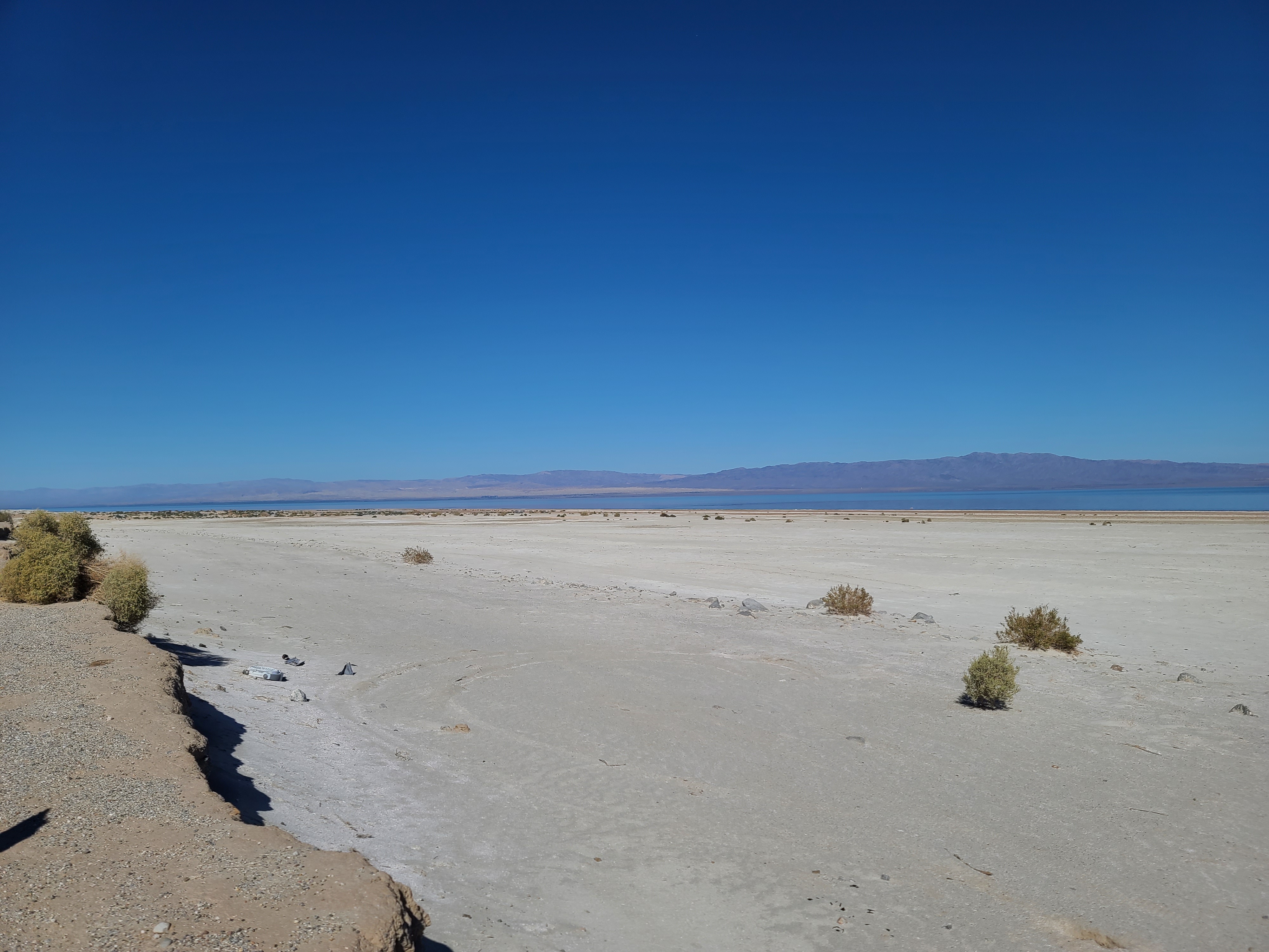
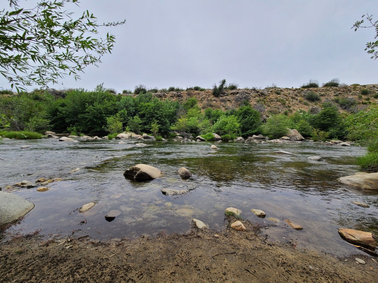
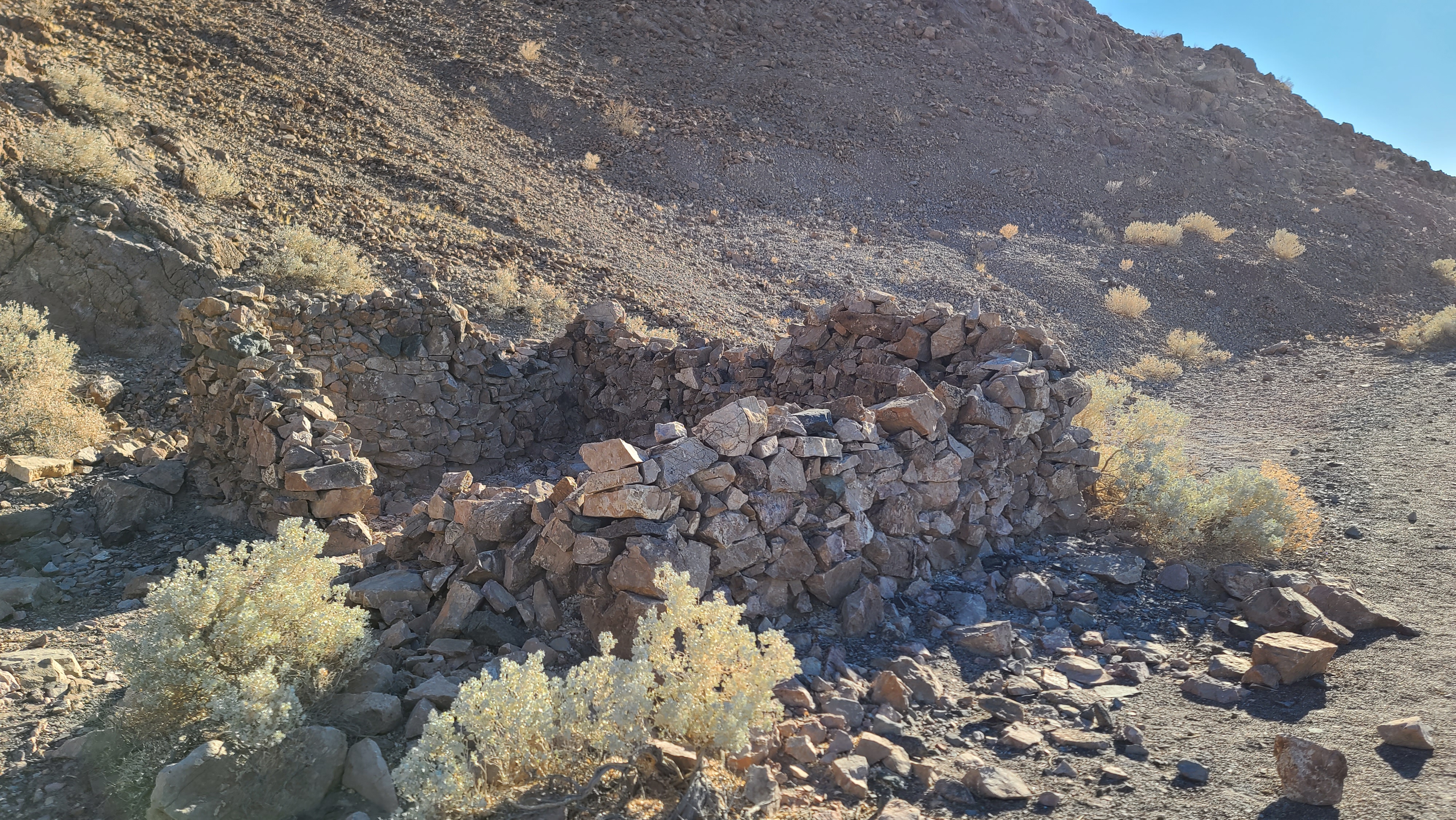
I walked down the trail that seemed to go towards the back of the spring. Along the way, I read a plaque that talked about how this was an important water source for all the overland traffic back in the old days. There was what was left of a old stone house on the way down, I wonder if someone lived in that or what? I could hear frogs croaking and see ducks swimming around, it’s amazing to see this out in the desert! It’s pretty neat how springs will flow in the middle of such inhospitable terrain.

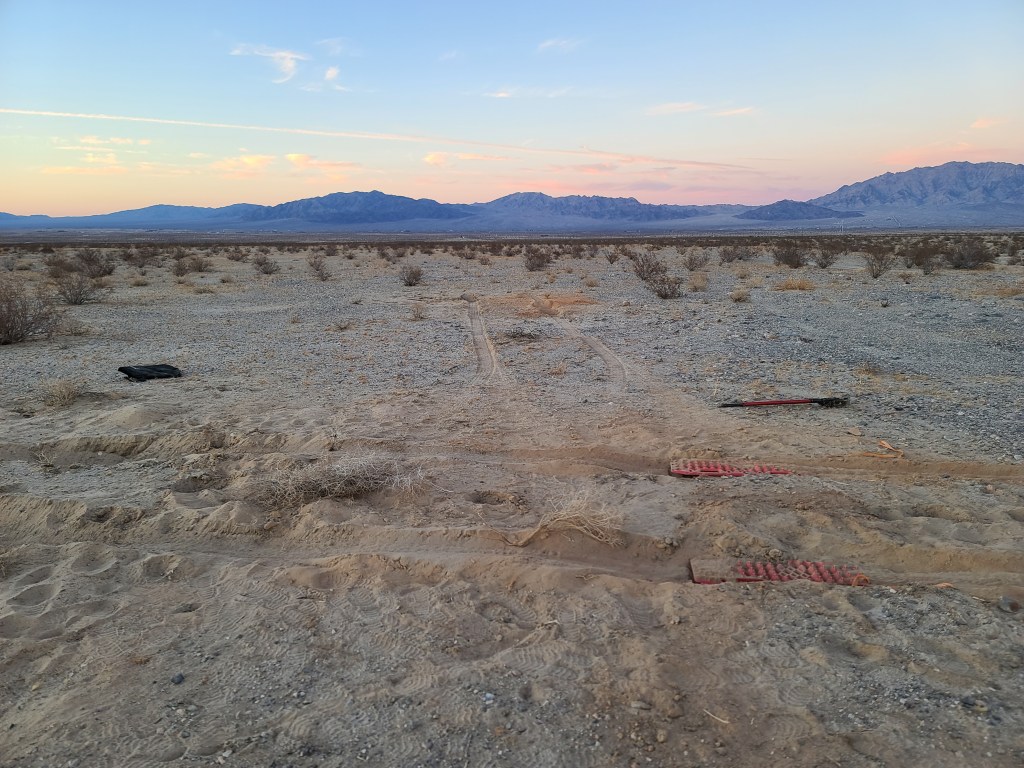
I would have liked to hike around the springs more, but I was wanting to get back on the road and make tracks. It was getting close to 3 o’clock and I hadn’t seen any spot to pull off and camp whatsoever on the road so far. I got back on the Exit Road and continued on my way. As the miles ticked by and the sun got lower, I really started to think that it was going to be impossible to find a spot for the night. There were little small pullouts, but they were deep in sand and I wasn’t about to turn my truck into that. Finally at around a half hour before sunset, I found a little turnout that looked promising. The ground there was very rough but stable. There was just enough room to back my truck in off the road, which I did. Thankfully I had found a spot before dark. It wasn’t the best spot, but not a single person passed by the whole time I was there! I set up camp and ate leftover red beans and rice, which were better the second time as they always are.

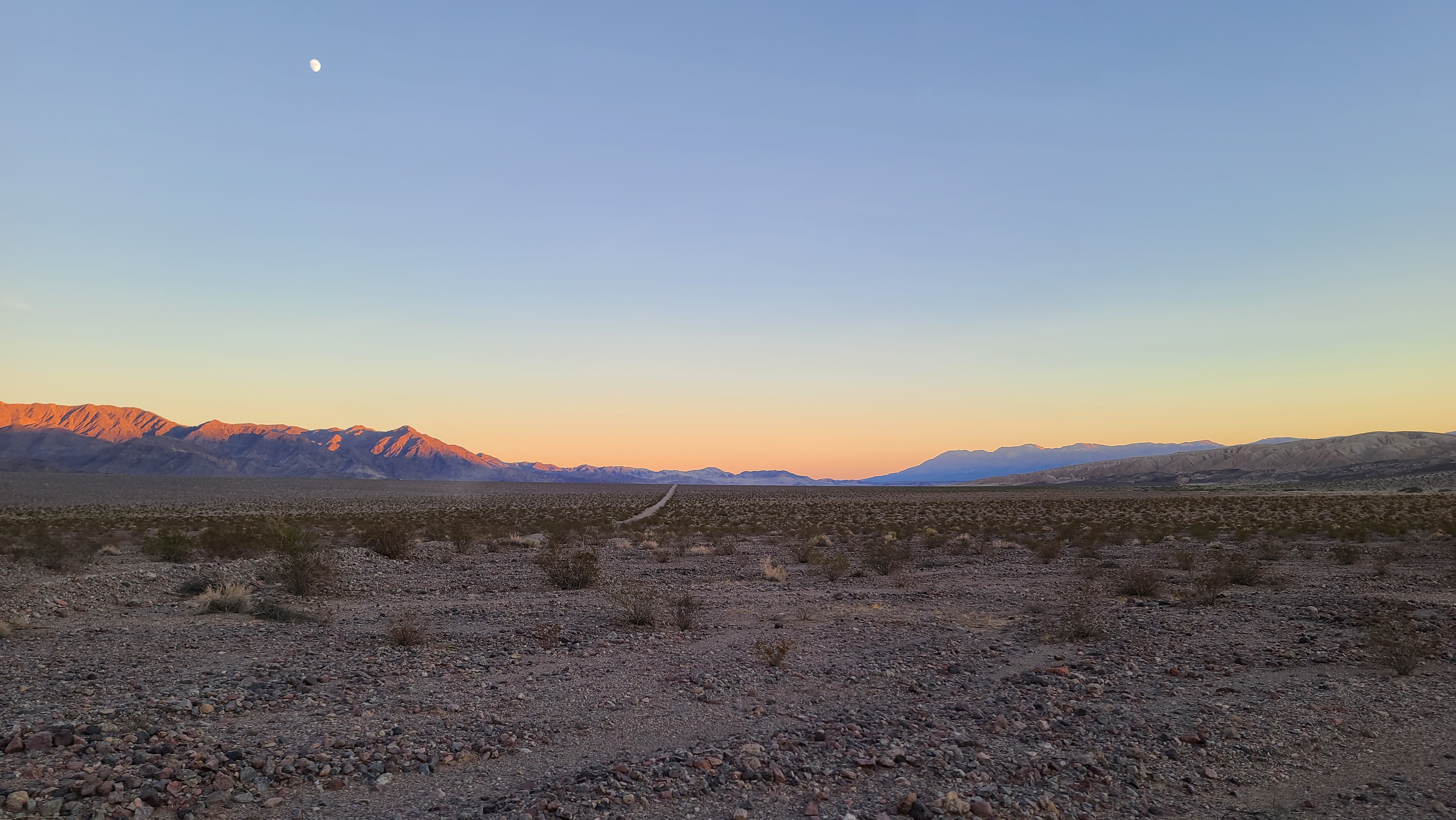
It wasn’t a bad camp for something I found at the last minute. It was just as isolated and peaceful as the last camp I had. I wasn’t sure if I was supposed to be there or not, but I planned to be out as soon as I could in the morning before the rangers rolled up. I did some writing and retired early, as I wanted to get an early start in the morning.

Day 27

Altitude: -226 ft.  Stoke level: 8.5 Temperature: 87-57 degrees  Conditions: partly cloudy, moderate-strong wind early, calm late

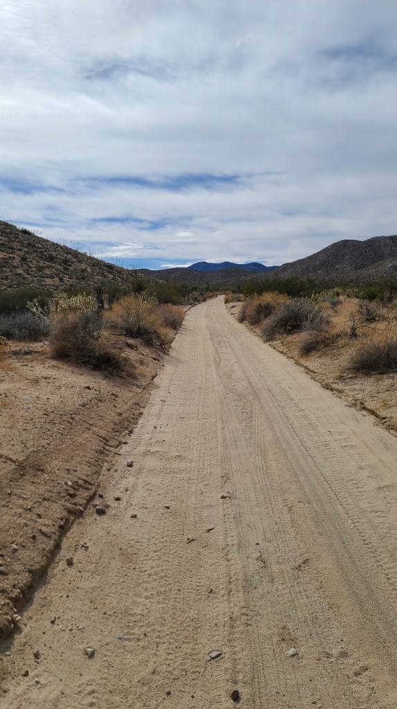
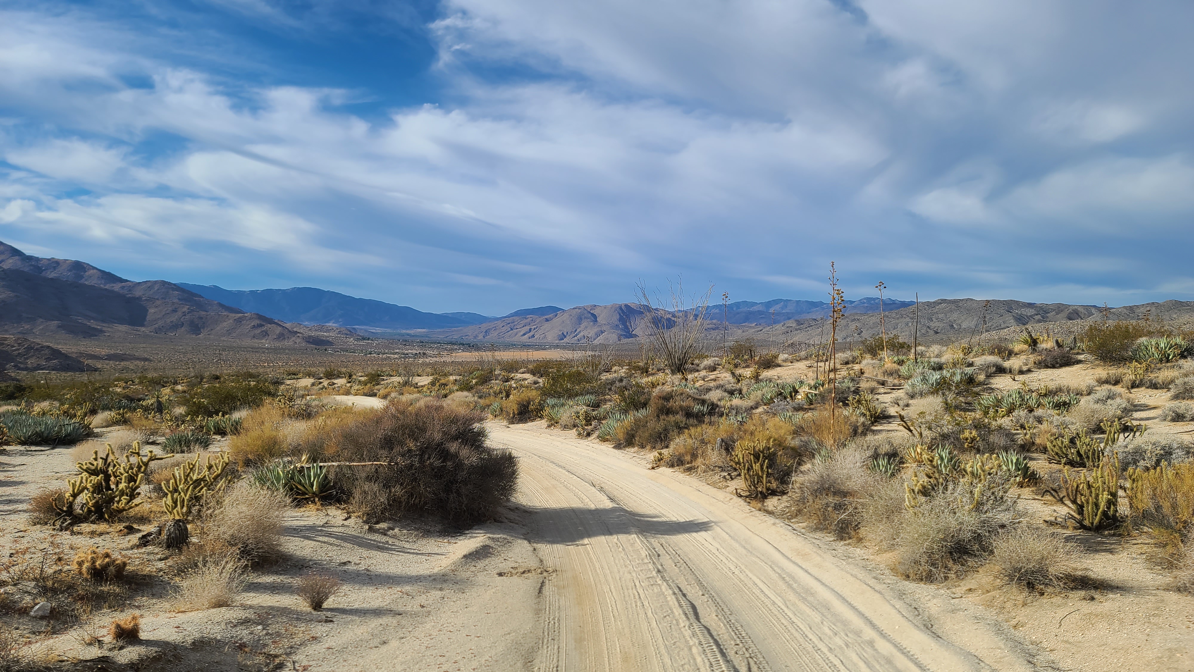
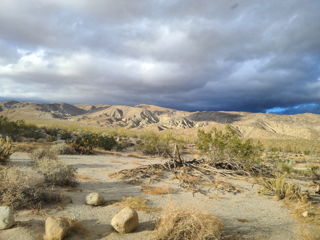
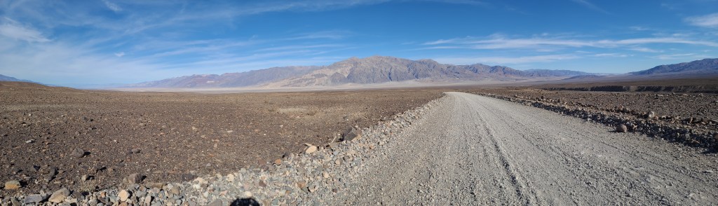
I got a good start this morning and rolled out around 9. The day before I had almost finished the Exit Route, so I finished up the last two miles and hit the highway. That had been a nice journey and the road had been in great shape, but the lack of good camping spots was a little disappointing. I liked the direction I was heading, and according to my maps I could continue my journey on the ‘West Side Road’. This road is the back road going up the west side of Death Valley. There were many off-roads heading into the Panamint Mountains that branched off this trail, so it looked like a great way to spend my last day of explorations in the valley.

On the short stretch of highway linking the Exit Route and West Side Road were the ruins of this old mill.

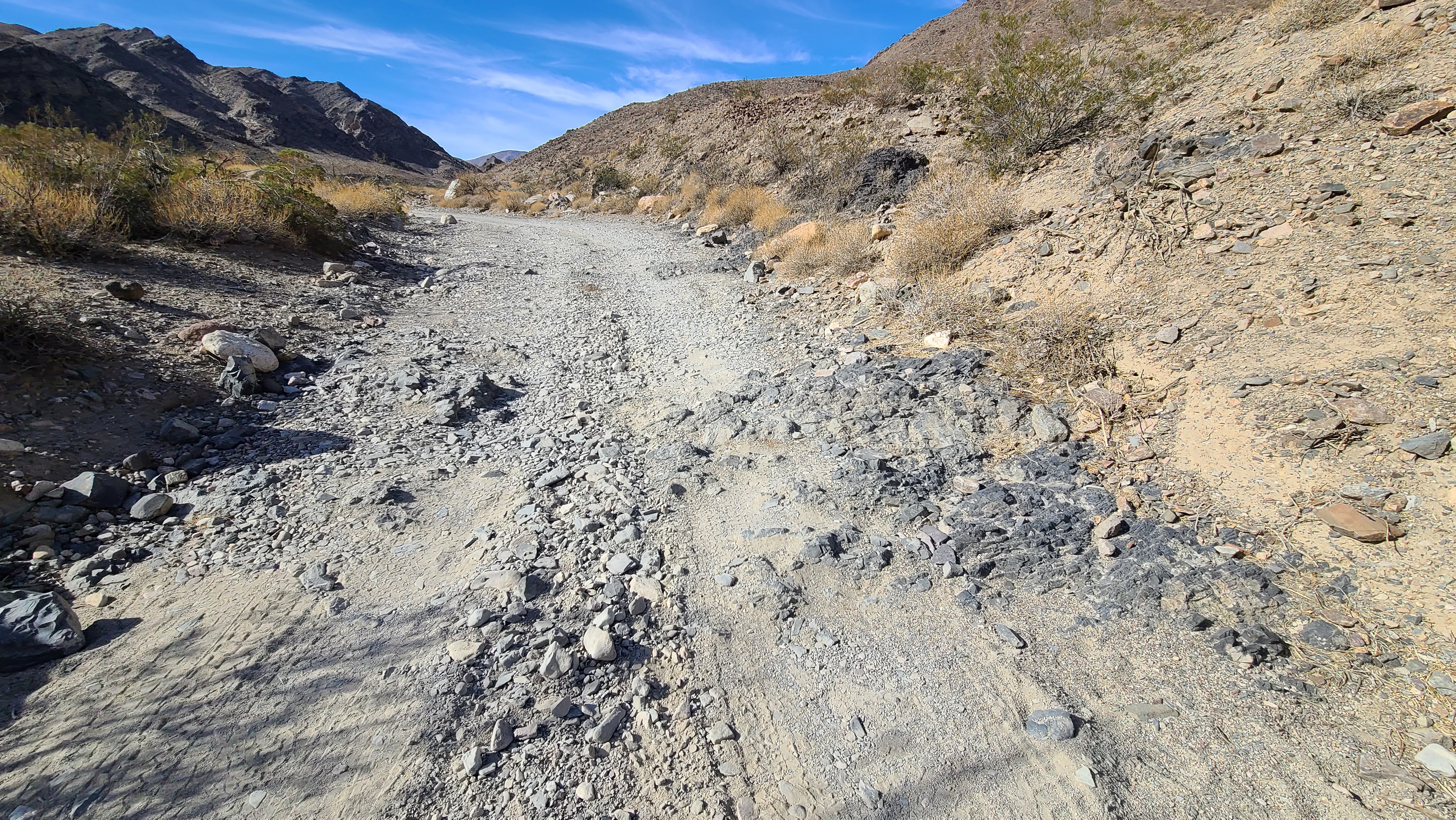
The West Side Road was in even better shape than the Exit Route. I decided I was going to take one of the side routes going up Butte Valley. There was an old abandoned talc mine up there, plus some old mine buildings to check out. The road was rated easy until about halfway, so it seemed to be a good destination to check out.

The West Side Road is in incredible shape. They are making good use of the park fees!

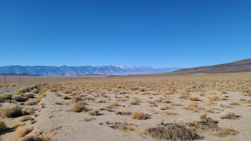
I saw the turnoff for Butte Valley, and I took a left turn headed for the Panamint Mountains. I immediately started gaining altitude, and soon started seeing some great views from this end of the valley. It’s such a better way to see it than from the paved road on the east side. That road is the main tourist route that goes to Badwater Basin, which of course is the lowest point in the US at 282 ft. below sea level. I camped for the first time below sea level last night as you can see.

The road to Butte Valley was a perfect 3/10. It was a lot more rough and rocky than the West Side Road, but it was well within what The Beast can handle. As the road was so rough, I couldn’t go more than 10 miles an hour. That was fine by me, I didn’t mind taking my time and enjoying the view. Every once in a while I’d stop, jump out and take pictures.

As I entered the mouth of the canyon, I began to see the talc deposits on the hillside.

After about an hour of steady climbing, I arrived at the mouth of the canyon. Since it was a canyon, I knew that there would probably be some challenges driving it. The canyon was wide, and the road was still in a good drivable state. I couldn’t miss the talc deposits starting to appear on my left-hand side. I started to look around for old mining equipment and sure enough, old rusted contraptions started to appear everywhere.

The road wound along the bottom of the canyon until I came to a fork in the road. It wasn’t on the OnX map, so I chose the right hand side and hoped that I was following the trail. Immediately the way got really narrow and rocky. I reached a point where it was really only wide enough for a Jeep to pass through unscathed. There were a couple of sharp ridges sticking up that would be unavoidable to run over in The Beast. If I would have had a spotter then maybe I would have attempted it. I got out and saw it didn’t get any better a few yards up the trail, so I decided to stop at this point and try the other path at the fork. Maybe the other way bypassed this rough part of the trail.

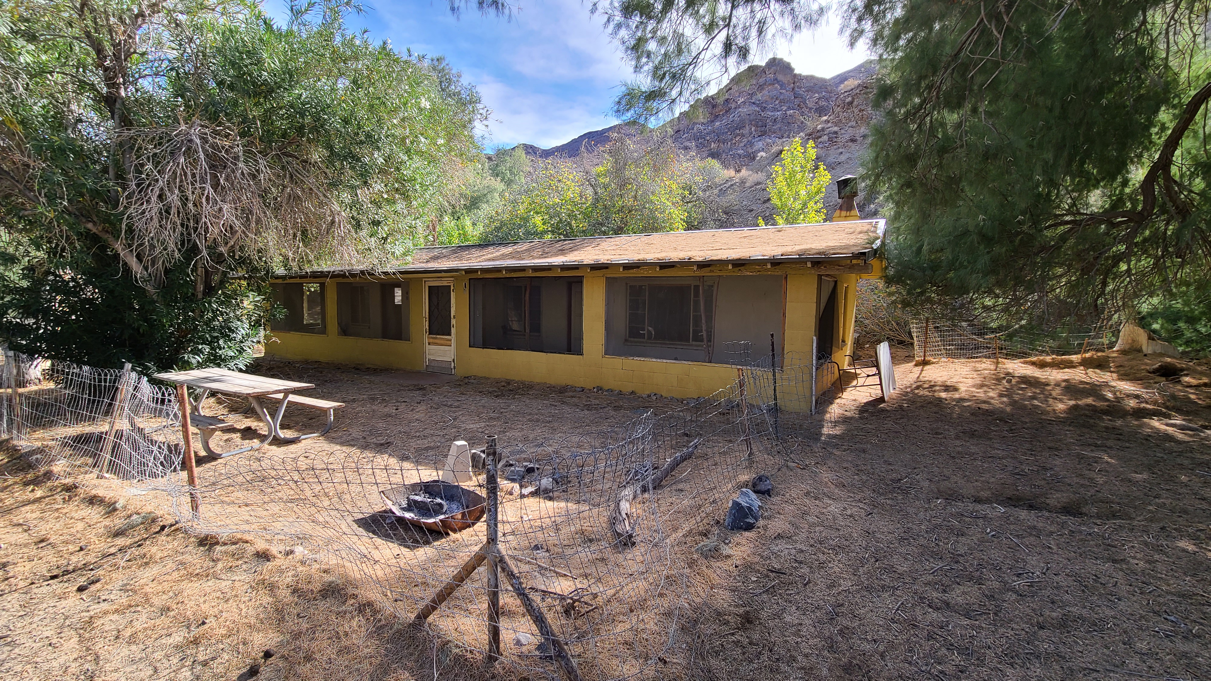
I backed up a couple hundred yards to the fork in the road, and I took the left path. I didn’t go up but maybe a hundred yards before I found myself in the middle of an old mining encampment. I found a sign that said this was the site of Warm Spring mining camp. The spring that the camp was named for still gushed forth and ran down the road that I came in on. I felt the water and while it wasn’t cold, it definitely wasn’t warm. Perhaps they should have named it Tepid Spring Camp?

Another miraculous spring gushing forth in the barren desert.

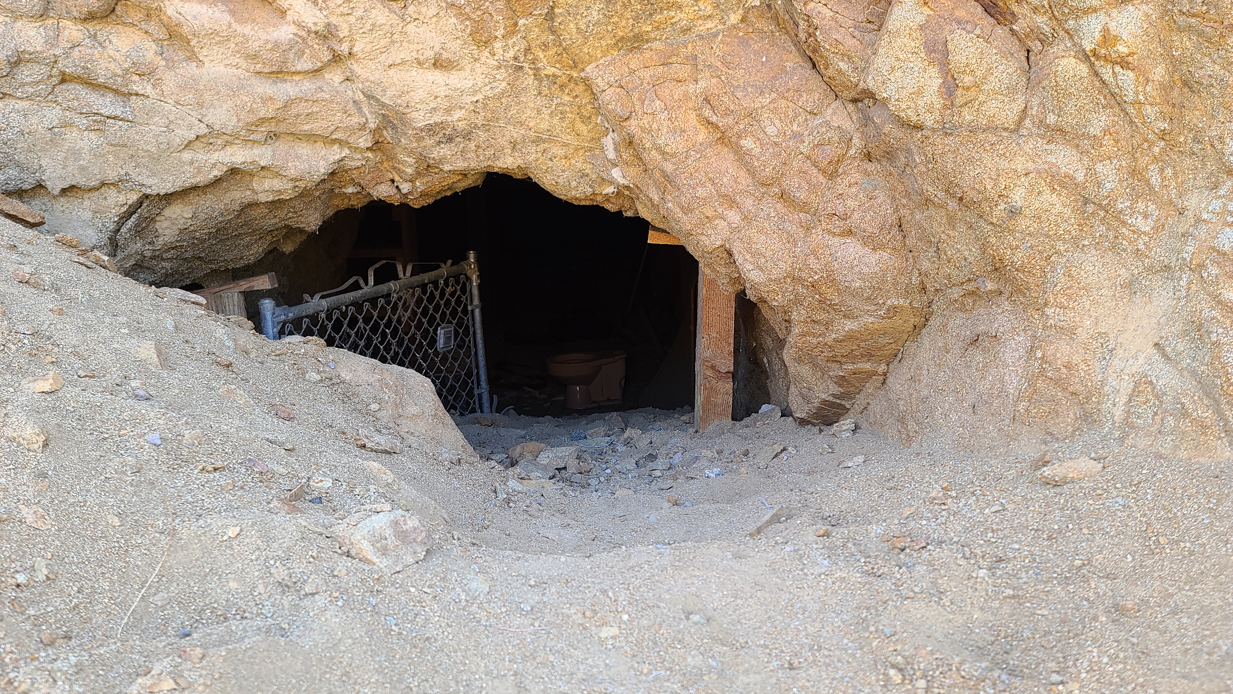
Looking over at the canyon wall, I saw the enterance to a mine. I walked over to inspect it. Unfortunately, it was gated off so you couldn’t go in. Probably for the best, as these old mines are super dangerous. Still, it would have been cool to go in just a little ways.

I ate some lunch and had a beer. It was so quiet and peaceful at this old camp. There was an eerie desolate vibe about the place as well. I really liked it! I thought about camping in the place for my last night, but I really didn’t want to make the hour and a half drive out of there in the morning. So I decided to poke around a bit longer to see what I could see before I made my way back down the mountain.

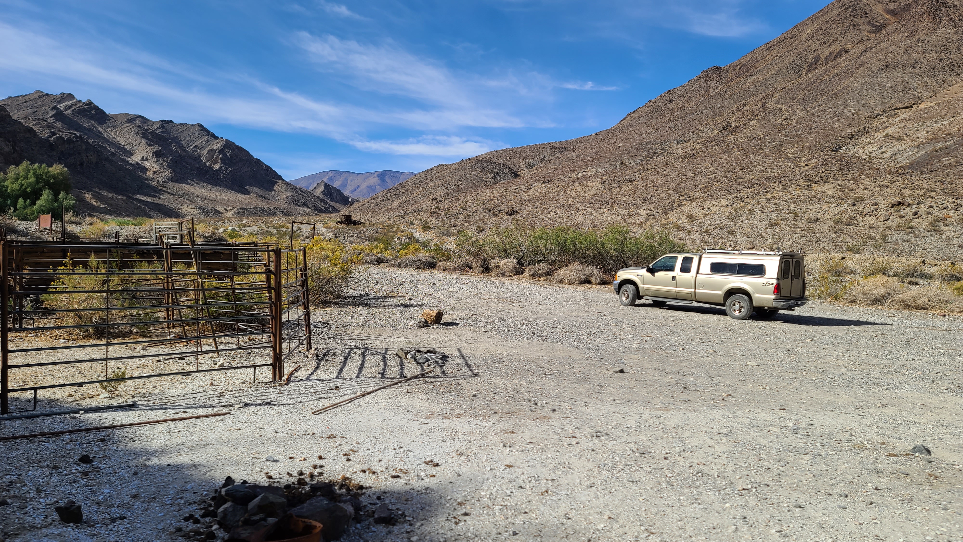
There were a couple of old houses that were used to bunk all the workers off to the side. I wanted to check out the interiors, but there were hantavirus notices posted warning not to go in there. Last thing I want to get is plague, so I just took pictures from the outside. In addition to the cabins, there was an old swimming pool there also. That was a good idea, you’ve got a spring running constantly so it was a perfect spot for a pool. I bet it gets hot as the devil here in the summer, so I bet it was nice to take a dip back when the pool was operational.

This old piece of mining equipment was really well preserved. Note that the old hitching post for the horses is still there. Probably still in use!

I had my fill exploring the camp finally, and with a heavy heart I turned around and headed back the way I came. I really liked this place, next time I come to Death Valley I’ll have to stay here at least a couple of nights. I headed back down the road, with my objective being a campsite I had spied on the way up. It was only a few minutes away from the West Side Road and still really private. When I got to the spot, I realized I had another hour before I needed to start looking for my camp. I decided to head back down to the road and head north. There were a few trails leading up into the mountains along the route, and I figured that I could find a better spot a little farther down the way.

Panorama of the Black Mountains coming out of Butte Valley. Dante’s Peak is somewhere up there.

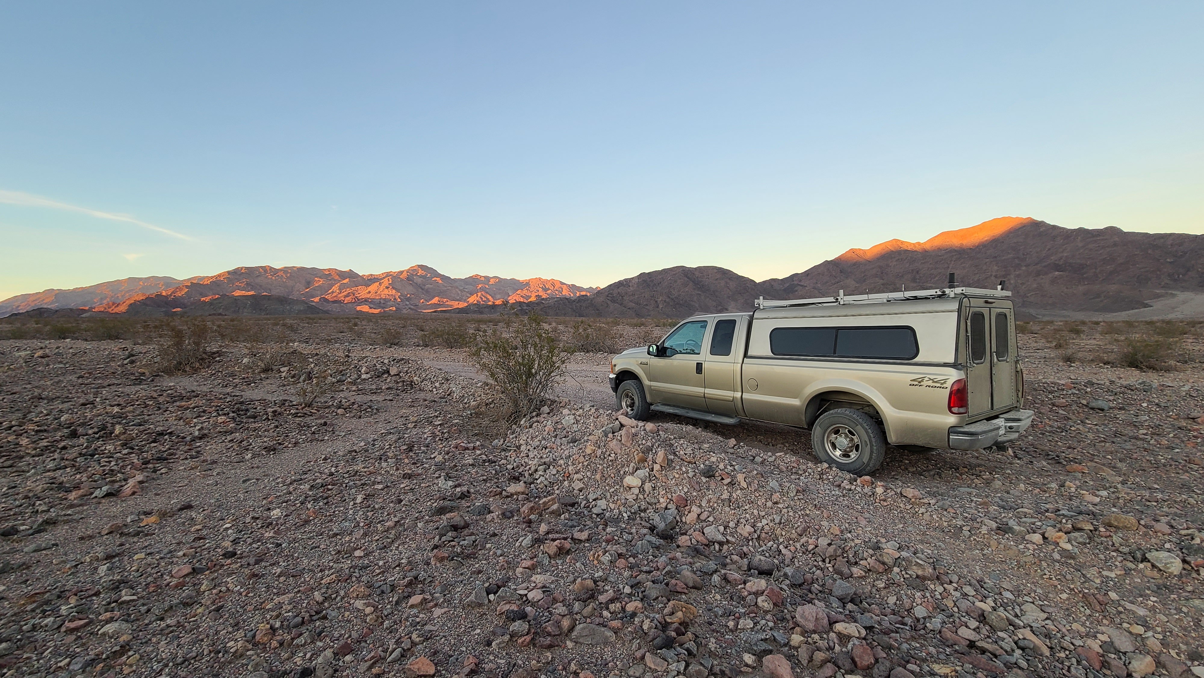
The views kept getting better and better as I headed north. After a bit of traveling, Badwater Basin appeared on my right. It was cool seeing it from this side. I decided to head up this trail named Hanaupah Canyon Road directly across the valley from Badwater. The road was really rough, really only passable by Jeep. I made my way about a half mile up when I saw a turnout. I had to get out and move some rocks around, but it was a perfect space to park The Beast. I had a perfect view of Badwater Basin and it was gloriously private. Every once in a while a car would pass by on the road, but they were few and far between. No one was going to come up here and bother me.

There wasn’t much of a sunset unfortunately, but these distant moutain peaks looked beautiful in the evening light.

It was a damn good campsite for my last night in Death Valley. For dinner I made carne asada tacos for my end-of-expedition meal. I was tempted to drink all the rest of my beers to celebrate, but I was pretty beered out. I knew the next day’s drive would be brutal even without a hangover, so I passed on doing that. I worked on my blog some and went to bed early so I’d be in the best shape for my return voyage.

Day 28

Altitude: 407 ft. Stoke meter: 6 Temperature: 82-64 degrees Conditions: calm, overcast early, clear after mid-day

I woke up around 7 and it was pretty chilly and windy. I had hoped to see a nice sunrise on my final morning. Due to overcast skies however, I was disappointed. By the time I was ready to break camp however, the it cleared up and it looked like it was going to be a nice clear day.

Another beautiful day in the valley.

I made coffee and had leftover tacos for breakfast. When I was done, I packed up and headed out one final time. The plan was to finish out the West Side Road which ended on the highway a little outside of Furnace Creek. From there I’d head out of the park via Highway 190 through Olancha. When I got close to the highway I stopped to inflate my tires to highway pressure. There were some interesting formations on the ground all over the place. I looked it up on the map and it was named ‘The Devil’s Golf Course’. It was pretty aptly named, no one but the Devil would want to play golf there!

What a huge mudhole this must be when wet!

I made my way up to the highway and headed out of the park. I had forgotton how long it takes just to leave Death Vally, I didn’t get out until around noon. From there it was a seven hour run back to Santa Cruz. Thankfully I didn’t run into any crazy traffic or anything, it was a little stressful driving through Bakersfield though. I got back to Santa Cruz around 8, and pretty much passed out from exhaustion as soon as I took a shower and ate something.

As I entered the 395 corridor, I had to stop and take a picture of the eastern flank of the Sierra Nevada. It was strange seeing snow-topped mountains after so long in the desert.

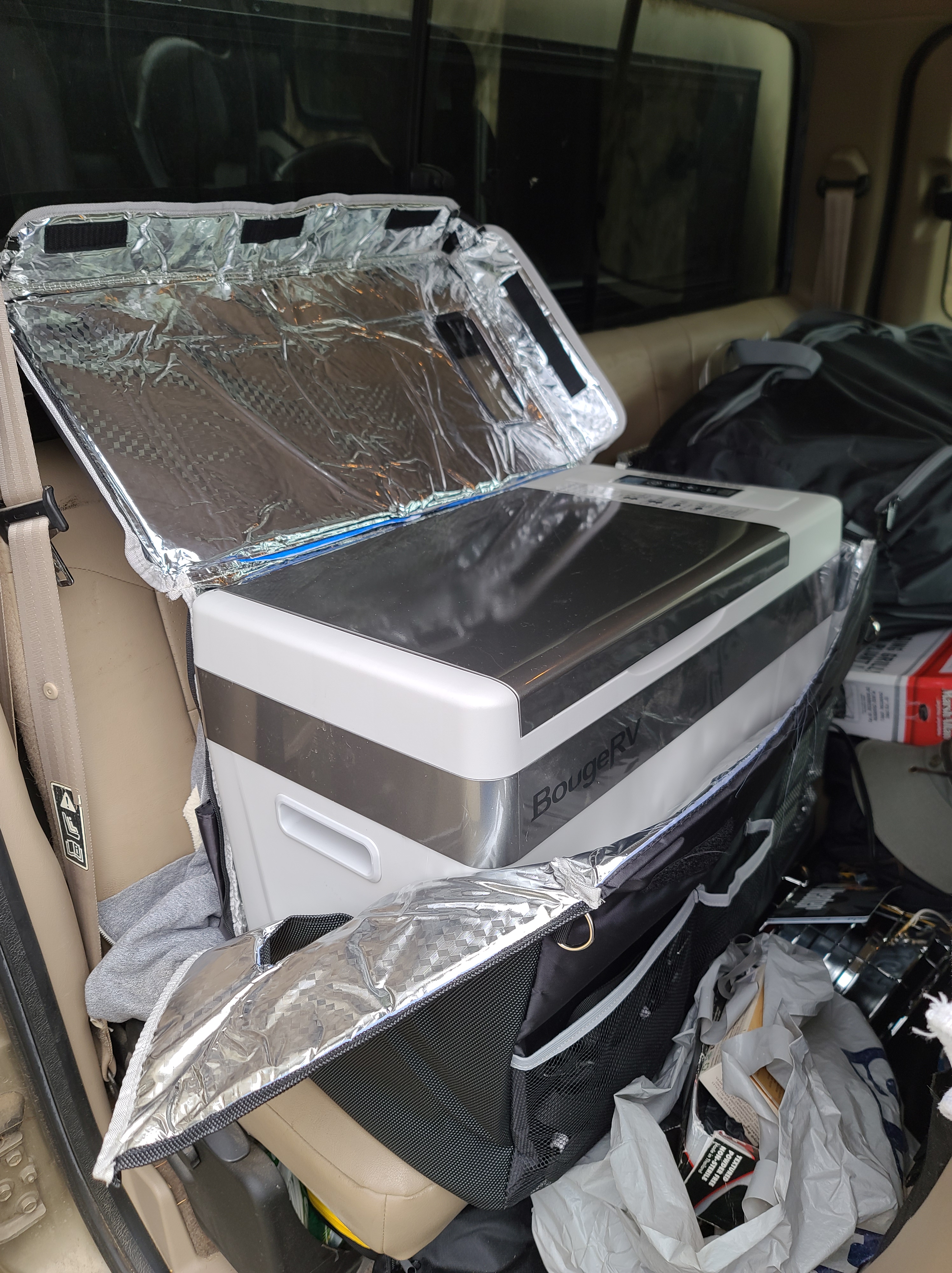
At last, I have reached the end of my expedition. I spent 4 weeks on the road to the day, so this trip marks my longest expediton to date. I could have kept on going, I really would have liked to have spent another week in Death Valley, but it’s all good. I really enjoyed myself on this trip, it was also my most successful trip ever. Other than getting stuck that one time and the usual struggles with bugs and wind, I camped in comfort. Thanks to my 12 volt cooler, I was able to save so much money not having to buy ice. It was also useful for saving money on food.

Well, that about wraps it up! Thanks for all you for coming along with me on the journey! Now I’ve got to switch gears and get on a plane as soon as I have returned from the desert. I’m New Orleans bound! I’ve got to move my stuff out of storage in South Louisiana and move it up north. After that I’ll be spending some time up at the family farm for Thanksgiving. I haven’t been home since before the pandemic, so it’s time to go see the folks. All right, I’ll holler at ya’ll later!

Standard
Camping, Off-Roading

Rally to Death Valley

Day 21

Altitude: 1433 ft. Stoke level: 6 Temperature: 80-51 degrees     Conditions: partly cloudy, calm early, moderate-strong wind late

I got up early and did some writing and blog editing before I broke camp. Afterwards, I checked the bond on my solar panel. It seemed to be stuck on pretty good. I took out my stainless steel zip ties and lashed the frame of my new panel to my rack. That will give me some added protection in case the adhesive ever decides to give way. I can’t be having my solar panel smash into someone’s windshield if it comes off as I’m going down the road!

Everything got checked out and packed up, so I finally got back on the trail again. I charted a course down Gold Crown Road. The road was nicely deserted and wide at first. After a few miles however, I came to my first obstacle. There was a culvert in the road that bridged a gully about 15-20 feet deep. I had about a foot on either side of my tires before I’d slip into the ravine. It wasn’t aligned straight with the road, so I had to back up and pick a better line. I’ve been through worse, but this was a bit stressful to navigate without a spotter. Right after this, I was faced with a hill that was kind of gnarly. The Beast and I were both capable of navigating this slope, but who knew what was on the other side of the hill?

Not super challenging, but I really didn’t like the tilt on this hill. I’ve come close to rolling The Beast before due to misjudging slopes, so I try to look ahead for problems before they occur.

I got out and walked up the hill to see what lay beyond. When I got up to the top I could see into the distance as the trail got narrower and rougher. It was definitely within my skill level, but my guts got in a knot thinking about the stress I’d have driving it. I decided to turn around and head back down. I wanted to see what was up the trail, but it just looked like more than I was willing to bite off at the moment. I had to go back over the tricky culvert again, which sucked. Since my daylight was running out, I made my way back to the general area I had previously camped. This time I chose a slightly better spot on the other side of the road however. I had a bunch of cardboard to burn, and this spot had a pretty nice fire ring already set up. I wanted to grill a tri-tip I’ve been packing around for a while as well.

Unfortunately, I never got to cook or burn anything. The wind came up pretty aggressively and refused to stop. I had to resign myself to eat cold food out of cans for dinner. Not the best meal by any stretch of the imagination. Some nights are like that out on the trail, especially when you have to cook your food outside on a propane grill. Wind really messes with the flame on the things, not to mention can even blow your whole grill over. That happened the first night I was in Anza-Borrego, fortunately no food was on it at the time, but it could have been a disaster!

I had many things to do tomorrow before I left town, so I got to bed early. My goal is to leave town no later than noon to get to the place where I want to be north of Baker. This damn time change has really screwed me up, now I have to start looking for campsites around 3 in the afternoon. It doesn’t give me a lot of time to explore unless I get up super early, which I am loathe to do unless absolutely necessary!

Day 22

Altitude: 668 ft.  Stoke level: 7 Temperature: 79-60 degrees      Conditions: clear, sunny, strong wind early, light wind late

The winds last night never let up, and it was quite chilly. When I got up around 7 it was nice and sunny, but the wind was still whipping around pretty intensely. It took longer than I would have liked to break camp, but I finally got out of there around nine. I got back to the highway and drove back into Joshua Tree to go to the only laundry in town. I’ve done my laundry there before, it’s not my first rodeo! It was insane how busy the laundromat was, nearly every washer and dryer in the place was in use. I guess they’ve got the monopoly on laundry in town, that’s where everyone has to go!

I love this desert tortoise that sits outside the laundromat! I’ve taken pictures of it before, but I thought I’d be nice to take a new one for the blog.

Finally, I found a couple of washers ready for use and I got my clothes on to wash. It took a couple hours to get everything clean & dried, and when I was done I hit up Home Depot, Walmart, Vons, and the gas station to get filled up on various supplies, water, gas and food. I had a huge load of garbage to drop off at the gas station, I kind of felt bad to fill up their can. Oh well, I was a paying customer so all good! By this point it was close to 2 o’clock, which meant it was too late to get up to where I wanted today. I had an alternate place to go though, a place called Amboy Crater. It’s between Joshua Tree and the Mojave National Preserve right off an old section of Route 66.

I’ve passed the Amboy Crater a few times on my journeys north from Joshua Tree, but always have viewed it from a distance. The crater is actually an old cinder cone that is left over from an eruption in the valley. The valley floor where it is found is absolutely flat, it must have been an old lake bed at one point. You can see Amboy Crater from miles away, it does look really odd on the horizon. It has a rather looming presence both far away and up close.

It sits on BLM land so it’s able to be used for camping. According to my app, the only spot where that was allowed was on the pavement in the overflow parking lot. I wasn’t thrilled to be camping on pavement, too damn civilized for me! Also there were busy train tracks close by, so it wouldn’t be quiet. It was the closest place I could get to in my timeframe where I wanted to go, so I really didn’t have a choice. Still, it would be really cool to set up camp there in the presence of interesting geology.

I headed back in the direction from which I came earlier. Back through 29 Palms I drove. I went and took Amboy Road north through Wonder Valley. I’ve been this way a few times before and it’s always cool how fast you can be in the middle of nowhere from the hustle and bustle of the Highway 62 corridor. The traffic, while light, was much more prevalent than in summer. There were lots of RV’s and campers for a Wednesday afternoon. They aren’t weekend warriors though, so they are all good in my book!

After an hour or so, I drop down into the Amboy Flats. I see the crater from ten miles away, it’s cool looking as ever! I took a left where Amboy Road meets good ‘ol Route 66 and went towards the crater. I found the road and went up towards the parking lot. Along the way, I spied the overflow parking and it wasn’t bad. There was no one there and there was a sandy spot in the back where you could back up to some cool-looking volcanic slag. I continued to the parking lot where there was only one car. The crater was at least a mile hike away from this point. Supposedly the trail goes all the way to the top as well so you can see down into the thing. I wasn’t about to attempt that now, so I took a couple pictures and headed back to set up camp.

I really like Amboy Crater. It’s got a really cool mysterious vibe. Plus there’s a whole bunch of volcanic rock around, presumably spat up out of the cinder cone many years ago.

Glad I got back to the spot when I did. Right as I got parked, some guy in a camper van pulled up and stopped. I could tell he wanted to park, but to his credit he went to the main parking lot and I never saw him or anyone else the rest of the night. As I got everything unloaded, the first of many trains came roaring by. I was only about a quarter mile from the track, so it was crazy loud! For some reason, it didn’t bother me as much as vehicle traffic does for some reason. Perhaps because the noise is more rhythmic? I’m not sure. I would definitely would have preferred to do without it, but what can you do?

There was probably a train coming through every 20-30 minutes all night long. It didn’t bother me too much though, at least for one night.

The winds were pretty gusty when I got there, but around sundown it completely stopped. Usually when the wind dies in the desert all the bugs come out to play, but this spot was remarkably bug-free! The conditions were just perfect. It stayed in the 70’s until long after dark. Since it’s so comfortable here, I thought that I might sacrifice one of my 5 remaining days to spend another night somewhere in the surrounding Mojave National Trails area.

After a whole lot of thinking, I decided I was going to proceed with my original plan to go up north. I’ve done enough sitting and chilling in places that I liked, now it was time to put some miles under the tires! I haven’t explored Death Valley in 5-6 years (I did drive through back in July 2018 and temps were 127 degrees, the hottest I’ve ever been) so I felt that visiting there would be the best way to end this trip. I had to drive all the way to the north end of the park to get a park pass to legally explore the southern end of the park. It would be a full day of driving to get up there, so I needed to get on it as quickly as possible. I’m looking forward to checking out what is called ‘The Henry Wade Exit Route’. It’s the way the 49’ers who gave the valley its name managed to get out when they first found themselves marooned there. It’s a new trail for me, so I’m ready to check it out!

Day 23

Altitude: 880 ft.  Stoke level: 9 Temperature: 86-59 degrees     Conditions: sunny, clear, light wind

I only had a couple beers and went to bed early, so I was able to get up around 8 feeling good about the day’s travels. I slept amazingly well despite the roaring of the trains. Good ‘ol earplugs come to the rescue again! I had thought that it would be cool to hike over to the top of the crater and take a look around, but I was ready to hit the road when I got up. I figured it would take at least 3 hours to go there and back, that’s a half day’s driving! At this point in the expedition, time is of the essence. I needed to get on down the road.

Couldn’t resist a selfie with Amboy Crater.

I got back on Route 66 and headed over to Kelbaker Road. Kelbaker Road is an old friend of mine. It goes up through the middle of the Mojave National Preserve and cuts over towards Baker. When I’ve explored the preserve in the past, this road would be my main re-supply route, so I knew it well. I drove north through the desert until I went under the I-40 underpass. After this point, I was back in the preserve. I had to holler! It was so good to be back. I wish I could have had more time or I would have stayed, I’m so fond of this place.

I’ve always liked these rocks at this vista point. I always like to stop here when I’m coming in from the south and just take things in.

About 20 miles in off to the left, you see the Kelso Dunes. They kind of look out of place, it’s like you took a detour into the Sahara or something! Like the Amboy Crater, this is something I’ve passed by a few times but never checked out. I decided to turn down the road towards the dunes to get a closer look. I drove about 3 miles in, and decided that was enough to get a decent picture. It looks like an amazing natural feature to hike up, again, like the crater. It would have been a cool thing to do if I had the time, but I just satisfied myself with a picture.

The Kelso Dunes (somewhat) up close and personal.

After I returned to the main road, it was a short distance to the old train depot at Kelso. It’s been there for a hundred years and used to be very important for freight being shipped up and down the line. It’s been restored in recent years and it is the Visitor Center for the preserve. It’s always been closed every time I’ve come through though, and this time was no exception. This time it wasn’t scheduled to re-open until 2023! Maybe someday I’ll get to check it out from the inside. Right as I was getting ready to leave Kelso, I messed around and broke my phone mount again! This is like the 4th or 5th time, it’s so bad. I guess it’s time to break out the Gorilla Glue again! I really need to break down and just buy a new one.

These cinder cones heading out of the preserve look like Amboy Crater’s siblings.

Continuing on my journey, I eventually made my way to the odd little town of Baker. It’s a weird crossroads of a place off the 15 between LA and Vegas. It’s always going off everytime I’ve been there, lots of folks are always coming and going. I pulled into the 76 station for gas and I saw this insane looking craft parked beside the gas pump. It looked like a jet aircraft without wings! I pulled in close to the thing and got out to take a look at it. This guy who was sitting in a truck attached to the craft’s trailer jumps up and I ask him if I can take a picture. He agrees and we start talking.

The guy tells me that he is a 4 time world champion land speed racer by the name of Jim “Jet” Neilson, and he’s been marooned with his jet car in Baker after his last race this past summer. He doesn’t have anywhere to go until his next race in Dubai in a few weeks. When he’s not racing, he lives down in Panama. Something must have gone seriously gone sideways in his life I gather, but he’s making the best of it. He can’t leave his rocket car, the same as I couldn’t leave my Beast out in the middle of nowhere. In the meantime, he is just hanging out at the gas station in Baker selling autographed t-shirts and talking to people. I imagine he’s had to cut some kind of deal with whoever owns the gas station.

The dude is pretty cool, he starts dropping names immediately. He claims to have grown up with Kurt Russell and acted in one of his movies. He’s also good friends with Vince Neil and some other rock n’ roll guys and actors. I guess jet car racers are just another kind of entertainer, they all run in the same circles…especially in this part of California. He told me that John Fogerty and Steven Tyler had both stopped to get gas and wound up buying shirts from him. The guy pulled out his phone and showed me pictures, and he wasn’t lying! John looked healthy, but Steven is looking pretty skinny these days. Steve was also holding a couple of Yorkie dogs in his arms, it was pretty funny! Jim said they were both super cool, and really admired his rocket racer. I liked the guy so I bought a t-shirt from him for 20 bucks. The shirt was pretty badass, and he even signed it to boot. I could have talked to that dude for a while, but I was already behind so I hopped back on the road.

The fastest man in the West! The engines on the thing are from a F-4 Phantom and it can go 400 miles an hour.

I still had another hour and a half journey up to my destination. Needing to get a pass for the park, I was going to have to drive a long ways up Highway 127 to get to Death Valley Junction. From there, I was going to have to enter from the east side of the park on the 190 and find a kiosk to print me out a paper pass. I’d have to then double back and re-enter the park on the southeast border. It’s a pain in the ass, but all the infrastructure for permits is in the north of the park. When you are on park property you’ve got to have it. It’s pretty expensive as well, 30 bucks! It is what it is though, sometimes you’ve got to pay the troll his toll.

Highway 127 went through some interesting terrain. You can barely make out the Panamint mountain range in the left background some 50 miles distant.

I was running low on smoke, so I saw that there was a dispensary up at Death Valley Junction. I was intrigued that there was a dispensary out in the middle of nowhere so I had to go check it out. It’s called ‘DVJ Fine Cannabis’ and it is a huge grow house complex out in the middle of the desert. I pull up and it is surrounded by high fences like it is a government building of some sort. There is a tiny trailer out front so I assume that’s the business end of the place. When I step out of the truck, I get a big whiff of ganja. I’m a couple hundred yards away and it is thick! They must have mad crops in there!

I go in and it’s pretty casual. Nothing is out on display, you have a whiteboard featuring the menu options and you order from there. You say what you want and the gal goes and gets it from the next room. The prices are really reasonable, particularly to be that far out in the desert. When I mentioned this to the budtender, she told me that it was because they grow on site and cut out the middleman. I got an 1/8th of small bud Wedding Crasher for 27 bucks. It’s usually 30, but I got 10 percent off because it’s Veteran’s Day. Right on!

After picking up the produce, I headed into the park. I knew that there was an automated kiosk about 20 miles down the road where I could pick up a pass. When I reached the spot where I could get it, there was a sign on the machine that said since it was Veteran’s Day, no fees were required that day. That’s cool and all, but I’m still going to need a pass for tomorrow and the days after. Since it was 3 o’clock already and I needed to stick around to get a pass anyway, I decided to go a few miles down the road to a spot where I had camped before.

It’s up a rough 4×4 road called ‘Inyo Mine Road’. The road is a 6/10 difficulty on my OnX so it’s beyond my capability to drive it fully, but the first couple of miles going in is pretty tame. There’s a lot of places to camp that gives great views of the valley below. Way back 5 or 6 years ago I almost got bit by a sidewinder up here, so that’s why I informally call this place ‘Sidewinder Camp’. Also the last time I was here I found myself in a biblical horde of flying grasshoppers, so the spot has a pretty interesting history for me. I have a soft spot in my heart for the place, I’ve had good times here back in the day.

I turned off on the road and drove up. You can’t camp a mile coming in from the highway, so I had to go up a bit. I looked around and found a spot that looked reasonably flat. I got camp set up and wrote on the blog for a while before I got around to making dinner. Tonight I was going to put some effort into supper and make some red beans and rice! As the sun set I broke out the camp kitchen and got to work prepping yellow and green onions, bell pepper and andouille sausage. I remarked on just how nice it was here in Death Valley as I cooked. There was a very light wind, hardly any bugs, and it was warm enough to be comfortable in shorts and a t-shirt after the sun went down.

For the first time on this trip, I wasn’t setting up in a sand pit. This area is very rocky, so not having sand get into everything was a plus. I got everything cooked up and sat down to eat in the moonlight, and let me tell you it was amazing! It was probably the best meal and locale I’ve enjoyed on this whole expedition. It’s rare that everything just lines up perfectly on a trip such as this. Good food and great surroundings are always something to celebrate when you’re out roughing it in the wilderness!

It was a very interesting day all around. I’m right where I want to be at the moment. After I get my pass tomorrow, I can either go over towards Pahrump and run this trail over on BLM land, or I can just go ahead and jump on down to the south end of the park and get started on that trail down there I want to do. Decisions, decisions! I’ll have to sleep on it. I’m down to four nights left so I have to really make my days count. Wherever I wind up, I’m glad I came up here. Death Valley has such a raw beauty that you can’t find anywhere else. It’s actually comfortable this time of the year, which is something I can’t get over. I feel I’m at where I need to be, glad I made the effort to return here.

Standard
Camping, Off-Roading

Beware the Desert Sands

Day 17

Altitude: 1410 ft.  Stoke level: 2 Temperature: 81-54 degrees  Conditions: sunny, clear, light wind

I was awakened by dawn by the sounds of artillery from the local Marine base and the hot-doggin’ OHV people. The explosion sounds I can live with, the mechanized whining of motorcycles, dune buggies and 4 wheelers, I cannot. There was not going to be a scouting mission to the next BLM parcel, I saw that this whole area was dirt central. I was glad to escape this noisy, kangaroo rat infested place. My stomach issues from the day before still persisted, which really dragged me down.

I decided that I was going to go over to the trail that I had marked as a route I wanted to take while I was here. I needed to stop and pick up a few things down in Yucca Valley, so I went and did that. In the process I uploaded my blog and downloaded some podcasts. The traffic was horrible, I felt like I was back in Santa Cruz! I’ve never seen it like this in the times I’ve been here. I’ve never been in this area during peak season, so I guess this is what it’s like. I have also heard a lot of Angelenos have moved here during the pandemic, I can definitely tell. My desert hideaway has been blown up!

I went over to the Visitor Center and it was just chaos. People were everywhere, I’ve never seen anything like it. On a Friday morning as well! There was a ranger posted up at a table out front and I went to talk with him about getting a park permit. The trail I wanted to run runs through Joshua Tree National Park, so to be legal I needed a permit. The ranger was very helpful in pointing out that the trail I wanted to run was on BLM land and ended before I got on park property. I wouldn’t need a permit to run the trail because of this. According to my maps, he was wrong, but if he said it was ok to camp without a permit I was going to run with it.

It was good to be back in Joshua Tree proper, but man o man, were there crowds! It was just ludicrous. It was with great pleasure I got out of town and headed to my destination off Highway 62 in the direction of 29 Palms. Thankfully, as I got out of town, the traffic got down to a normal level. I rolled through 29 Palms and it was the same as it ever was. I stopped at the Statler Bros. grocery and grabbed a few things. I was really craving pickles so I grabbed a jar of Kosher Dill spears and ate a couple, as well as a swallow of juice. I guess my body needed the electrolytes or something. Who knows?

I headed out of town about 10 miles or so to the east. I found the road I was looking for. It was named ‘Gold Crown Road’ and it led to the ‘Old Dale Road’ I was looking for. I turned off on it, deflated tires and locked the hubs. This was going to be a challenging road, so I needed to go in prepared. As I drove down the road, I was pleasantly surprised. It wasn’t bad at all, at least at this point. I saw all kinds of places I could camp, and as I had full bars of 5G, I should find a spot here and continue up the road tomorrow. It was around 3 o’clock when I started to scout out a camp for the night.

There was a track leading off the road that looked promising, so I headed off that way. The ground looked rocky and solid, so I had no qualms about driving around on it. I was at an area driving around about a quarter mile off the road when disaster struck. One moment I’ve driving around on solid ground, the next three tires are completely stuck! I leap out and assessed the situation. Immediately upon exiting the truck, my foot falls through the ground about 6 inches. It seems that I have run upon a desert trap! On the surface it seems normal, but it is just a thin layer on the ground. For a depth of about six inches or so it is empty space, and underneath it is powder sand. I just drove right into a batch of this nasty stuff.

I’ve never seen anything like this before in the desert. Three out of my four wheels were deep in sand, and my one wheel that was on solid ground wasn’t going to free me because I don’t have differential lockers. Even with half-deflated all-terrain tires and four wheel drive, The Beast got stuck like a duck! In all the time I’ve had this truck I’ve never been stuck like this. Fortunately, I was prepared for this kind of mishap. I got out my traction boards and hi-lift jack and got to work.

If you look at the footprints around my truck you can see the crust that my tires fell into. It was a tar pit of sand!
This is what it looks like when the desert fucks you.

I soon realized that I had made a grave error in only having two traction boards. What I had thought when I ordered them is that if two wheels out of four can grab ahold of something, it can get me out of anything. That thinking was oh so wrong. When all 4 wheels are compromised, you need 4 traction boards. So all of my wheels were spinning like mad. I tried 4 wheel drive to get out but that just made things worse. I realized that with two traction boards I needed to put them under the back two wheels and try to escape this trap with two wheel drive.

I brought out my hi-lift jack and jacked up the back end, then slid my traction boards underneath the rear tires. I got my shovel out and cleared as much of the sand around my tires as I could. I got behind the wheel and reversed until I ran out of board. I repeated this process 4 or 5 times and finally, I got free! I was so happy, I was beside myself. It took me around an hour to get free, I still had plenty of time to make camp.

I was finally free from the sand trap!

After getting all my off-road gear packed back up into my truck, I was so happy to be free from the trap that I made a critical error. Instead of reversing in the tracks I had made to that point, I tried to turn around. Guess what? I got stuck again! This time it was even worse than before. All wheels were a foot deep into sand. My tailpipe, which is usually a foot above ground, was only an inch off the sandy surface. I had to dig out a hole just so my truck could exhale. It was messed up! I almost called it quits for the night but I felt I couldn’t rest knowing that my truck couldn’t go anywhere. So I got my traction boards and shovel back out and got back to the grind.

I only had one hard point on the rear of The Beast, so that’s where I had to go when jacking the bastard up.

This stuck point was so bad. I tried to jack up the truck but the weight of the truck kept pushing the base of the jack into the sand. There is actually a slot built into the traction boards meant for a jack base, but as I needed the boards for traction I couldn’t use it for that purpose. It was a brutal ordeal, I would jack up the truck as high as I could, put the boards under the tires and reverse. I’d get about 6 inches and then have to do it all over again. It was infuriating!

During this process I really screwed up. I had left my jack engaged while I tried to reverse. I heard a clank and rushed to the back to see what was the matter. The rail on the high-lift jack had plunged into the back door of my camper. I tried to go forward to release the pressure and since I was in a hole, I couldn’t do it. I went back to the jack and tried to lower it, but the end of the jack dug into my back door on my camper and opened it up like a can opener. Not only did that happen, but it ground against my rear-view camera mounted in my bumper and took that out as well. I finally wrenched the rail out of my door, but the damage was done.

Fortunately my door was still able to open, close and latch properly. As for the camera, it only worked around 20% of the time so no big loss there. It was probably a wiring problem before, now I’ve got to install a whole new system. There goes another couple hundred bucks. I had long hated where they mounted it in the first place anyway. Next time I’ll get it mounted anywhere than right over the hard point.

So inch by inch, I kept jacking up the truck and sliding boards underneath the tires. By this point, the boards were pretty much ruined and my tires had big chunks of rubber taken out of them. I tried to be careful as I could to not spin out, but it didn’t matter. Finally, after two hours of getting filthy and sweaty, I finally emerged from the second trap and had all four tires back on solid ground. By now it was almost sunset, I had been dealing with stuck issues for 3 hours.

The aftermath of my Great Stuck.

I felt that this area was cursed, so I blazed back to the main road to find a place to camp that I know wouldn’t give me any surprises. I got to a spot only about 100 ft. from the main road and set up camp. I was so tired and dispirited that I didn’t bother cooking supper, I just made a sandwich. Oh well, the trip had been trouble-free so far. At one point something was bound to go wrong. I was glad I had managed to free myself rather than try and get hauled out, but it came at a cost. In the future I’ll be sure to take 4 traction boards with me, as well as the kind with replaceable studs. I also need to have a base for my jack so it doesn’t sink in soft sand. Sometimes the only way to learn is doing it the hard way. Every time I go on expedition I recognize the gear I need to have to do this properly, and this time was no exception.

At least Venus and the Moon looked really nice rising over the desert at sundown.

Day  18

Altitude: 1410 ft. Stoke level: 5 Temperature: 84-51 degrees       Conditions: clear, sunny, light wind

Today I was just going to take it easy. I was still rattled by the events of the day before so I just wanted to hang out and get myself ready for the solar panel installation. My birthday was tomorrow, and I wanted to have my new panel up and running by then. After I got up, I brought out all my solar equipment to get things assembled. Unfortunately, the directions were really unclear on how to mount the thing properly. I got on YouTube and watched some instructional videos, and everybody did it differently. I got frustrated and started pounding IPA’s, hoping for some liquid clarity. I soon got pretty buzzed and it got real uncomfortable trying to do this in the heat of the desert sun. I finally just gave up and passed out for a while.

Around sunset I woke up and felt a little bit more clear-headed. I drank some Arizona Green Tea and that helped some as well. By this point I was pretty familiar with all the nuts and bolts I needed to use, and I slowly started to figure out what I was doing. I got brackets on the thing and hauled it up on the roof. Next, I had to connect the wiring and hope I had gotten the right parts. Amazingly, I was right on the money with getting all the parts I needed for the wiring job. Now all I had left to do was apply the bonding tape. This part was critical, because the space I had to install the panel only has about a half inch on either side clearance. If I didn’t get it exactly right, the panel would not lay down properly when I lowered it to a flat position. This would cause it to be exposed to the windstream and threaten to rip it off as I was going down the road. Once the mounting tape encounters a surface it pretty much is stuck there permanently, so I had to get it right the first time.

Installing a solar panel in the dark is fraught with difficulty.

I climbed up my stepladder and took a deep breath to steady my nerves. I then placed the panel down as lightly as I could and checked the sides. I was over one one side a bit too far, so I wrenched up the panel and adjusted it. I checked it again and I had done it! I had my clearance on both sides. The panel wasn’t able to be budged after this, so I got real lucky it hadn’t stuck the first time. I mashed it down all around so I’d get a good bonding. I was overcome with relief. It took me from 5:30 to 9:30 to get it installed, it was quite the ordeal. Now all that was left to do was wait until morning to see if the panel was fully functional. I should have tested it before I permanently bonded it to my roof, but I didn’t think to do so. I guess I’ll see in the morning if it is any good or not. Fingers crossed!

Day 19

Altitude: 1410 ft. Stoke level: 9 Temperature: 82-55 degrees   Conditions: clear, sunny, light wind             

Happy Birthday to me! The first thing I did when I woke up around 8 was to check my voltimeter. I was pulling 5 amps and the sun was barely up! GREAT SUCCESS! As the morning wore on, my voltage and amperage kept rising. Around noon I was pulling 16 volts and around 9 amps. This new solar panel was savage! Usually around that time with my one fixed solar panel, I’d pull around 13 volts and 3-4 amps so this was a vast improvement. Being able to tilt the panel towards the angle of the sun is a game-changer. I bought another set of tilt brackets for my fixed panel, but I’ll worry about that some other time. I’m pulling all the power I need for now. It didn’t take very long at this rate to fully charge up my battery. It’s such a relief to not have to worry about power issues any more. I was thrilled, it was a great birthday present to myself!

The rest of the day I drank a bunch of IPA’s and watched 90’s grunge videos on my phone. Now and then I’d talk & text with people who wished me well. It would have been nice to be in a better camping spot, but as I stated before, I needed to let my panel adhere for at least 24 hours so I couldn’t go anywhere. That was fine by me, I really enjoyed my day. I spent it the way I wanted to in a place I dearly love.

It was very satisfying seeing my new panel installed and doing its thing.

Day 20

Altitude: 1410 ft. Stoke level: 2 Temperature: 80-56 degrees   Conditions: clear, sunny, light wind

I paid today for the revelry I had yesterday. I had a king-hell massive hangover. The concussions from the bombs being dropped at the nearby Marine base rattled my truck and rattled my head. It got hot and I was miserable. I was going to head further up this road I’m on today but I could barely stand up without feeling I was going to pass out. Looks like I’ll be spending another day at this camp. I just chugged Gatorade all day and kept trying to nap just to not feel like garbage for periods of time.

I really hated to lose another day, as I’m entering the final week of my expedition. I took advantage of the downtime and thought about how I wanted to finish this trip up. I had planned on heading up to Mojave National Preserve and maybe running the Mojave Trail again. It’s a pretty technical trail however, and I really don’t want to be stressed out the last few days I’m here in the desert. Using my OnX app, I took a look at some trails up in the lower part of Death Valley National Park that I’ve never been on. I’ve explored up the area around Furnace Creek quite a bit, but I’ve never been in the southern end of the park. The trails are marked 1-3 difficulty on a scale of 1-10, so that sounds perfect for what I want to get into.

I think tomorrow I’ll head up this road I’ve been camped alongside the past 3 days and spend one more day in the Joshua Tree area. After that, I need to do laundry and pick up the supplies I need for this final push. I’m hoping that this expedition will get back on track and I’ll finish it up in grand style. I just got to watch out for that desert sand in the meantime!

Standard
Camping, Off-Roading

The Slot is Quite a Spot

Day 14

Altitude: 635 ft.  Stoke level: 6 Temperature: 84 to 60 degrees  Conditions: sunny, clear, no wind

Today I was in a foul mood for some reason. I was having problems with glitches on my WordPress app when I was writing up my blog this morning. I use a Bluetooth keyboard and for the most part it works all right. Today my page kept scrolling up and down constantly as I’d type. It took a lot longer to do than usual.

I did get a text from Home Depot saying that they had my solar panel for pickup! It wasn’t due until the 11th, so this is amazing news. If my other gear comes in on time, I’ll be sporting 200 volts of solar panel power by this weekend! This news lifted my spirits a bit. I then went to town and got a bunch of groceries, refilled my water supply, and did gas/garbage. The whole time I was annoyed by everything around me. I thought I might be hangry, so I made a turkey sandwich and that helped somewhat.

I had in mind to head towards this place called Hawk Valley. It was right next to The Slot, so I’d be right in striking range to hit it tomorrow. I made my way over to the spot, but my navigation app directed me to The Slot for some reason. At least I know where it is now! I found the turn-off about a mile back down the road and turned towards the campground. Around this time. I was horsing around with my vent mount for my cell phone when I broke off one of the supporting clamps. I’ve broken it in this spot 3 times already, so hopefully I can superglue it for the 4th time.

The sand on the road was really deep, deeper than it had been over at Font’s Point the other day. I kept it in 4 wheel drive but didn’t bother deflating the tires, and I made it through just fine. I went up this tight canyon and came upon the spot. It wasn’t very big, only a couple hundred yards across. It could accomodate 6 groups of campers, max. There was one group there already, I saw with disappointment. I would have liked to have such a small campground to myself, but I can’t be lucky every time!

My tube of Gorilla Glue was dried up in my center console, so I had to drag everything out of the camper to get at my stash of super glue in the off-road bin. I applied it to my broken part and it refused to bond. I might have to find a new mount if I can’t glue it back together. As I was trying to fix it, the dudes over at the other camp started whooping and blaring classic rock. This really got me on edge and I almost lost it. I got ahold of myself, popped a beer and mellowed out. I wasn’t sure why I was so pissed off all day, it’s probably just expedition fatigue.

It’s happened before around this time in my journeys. I get frazzled a bit by always having to troubleshoot, strategize and plan the trip. Not to mention the constant driving and exposure to the elements. It passes pretty quickly, I’ve learned I have to ride it out and not dwell in it too much. Even on pretty successful trips it can strike without warning.

It’s actually a pretty cool little canyon. It’s probably the most protected from wind than any other campsite so far. Once in a while there will be a slight puff of wind, but that’s all. Since I’m surrounded by steep canyon walls, the sky view is greatly limited. It’s pretty protected from the sun as well, the sun set around 4:30 and it will probably be around 9 o’clock before it shines in here again.

I’ll be out of here as early as possible to hit The Slot. It looks like a really cool place to explore. I drove right on up to the parking lot earlier and didn’t come across any crazy hills like I heard about. There’s a loop I’m on that goes all the way around the loop and approaches The Slot from the other side, so maybe that’s where it is. I kind of would like to drive it, it’s on my OnX app as a 5/10 difficulty road. I only do 4/10 and under trails, so maybe I’ll pass. I’ll see how I feel once I’m done going through the slot canyon.

Day 15

Altitude: 321 ft.  Stoke level: 9 Temperature: 91-70 degrees       Conditions: clear, no clouds, no wind

I got up today feeling super stoked about taking on the slot canyon. I headed over there around 11. I was hoping the sunlight being somewhat overhead around that time would make better lighting for photos. I arrived at the trailhead, which I knew the location of since I had been there the day before. I had heard that the trail down to the canyon wasn’t obvious, so I did a little bit of scouting around. The trail wasn’t that hard to find, but I can see how someone could miss it. I turned down into the ravine and hiked down into the slot canyon.

From the top, it doesn’t look very impressive.

As I made my way down the canyon got narrower and narrower. It was exciting knowing what was to come next! At first the way was pretty wide open and clear.

It was pretty wide open at the beginning.

Starting to close up a bit!

I walked on, and the walls gradually got closer together until it was almost like I was in a cave! The sides narrowed until I had to start going through sideways for some parts. I loved it! The rocks were really cool looking, since they’ve been worn smooth by eons of water. It’s not really colorful, (unlike Antelope Canyon in Arizona) but it has some really interesting geological features. It’s great fun to go through one of these slot canyons.

My favorite shot. There’s a big stone pillar that has wedged itself in above the canyon. It’ll really junk up the canyon when it falls, hopefully not on anybody!

The trail through where the canyon is very short, maybe around a quarter of a mile. After I navigated this stretch, it opened back up again. The trail went on for a ways further before hitting the main road and you could walk that back to the parking lot. There was a path to go the other way which made a loop that involved climbing out of the canyon somehow. I elected to do that, as I was wanting to spend more time in the canyon and not be hiking down a dusty road.

It started opening back up again on the other side.

The canyon was pretty well done by this point.

I doubled back and looked for another way up out of the canyon I might have missed. I walked back up the way I came and found another trail off to the side. It looked pretty well traveled judging from the footprints. I decided to give it a shot and see where I wound up. At first it was pretty wide without many obstacles. Soon however, it started heading upwards pretty sharply. It began to get pretty challenging to traverse as well. I was definitely off the beaten path!

The trail started to get to places like this where you had to pretty much crawl through.

I soon caught up to a couple of guys walking ahead of me. I asked them if this route took you back to the parking lot, they had no idea. They were just exploring and hoping like myself! I referenced my trail app and it showed I was going in the direction I wanted to go in. It also appeared that the trail I was on dead-ended in a contour line. I was getting close to the top, so maybe I could scramble up the rest of the way if I ran out of trail. Sure enough, about 30 feet from the top the trail went kaput. At first I was bummed that I’d have to go all the way back down, but after inspecting the cliff, I reckoned I could indeed climb up to the top. I scrambled up the hill, and I made it up sucessfully! There was a great view from up there. I could see back down into the canyon, and I could see the parking lot on the other side of the ravine about a quarter mile away.

Really great views from up top.

I could look down into The Slot at this point.

There was no way I was going to get across to where The Beast was parked from where I was at. I set off overland on some trails heading back the way I needed to go. I didn’t have to go far to arrive back at the point where I first went down to the canyon. What a great experience that was! I’m hooked on slot canyons now. I briefly thought about maybe heading up to Antelope Canyon in northern Arizona for my birthday on Sunday.

I had talked to a group of hikers while I was admiring the collasped pillar who were from Arizona, and they told me it was like a 7-8 hour drive from where I was at. It was tempting, but it would cost me money and more importantly, time. It’d be a day there and back, plus a day or two there. My main mission was to explore the California desert, and besides that I was itching to pick up my solar gear in Yucca Valley as soon as I could. It would be a really cool thing to do though!

I drove back into Borrego Springs to pick up some Gorilla Glue, then went back down the same road that went to The Slot. My goal was to get to the trailhead of Fish Creek Wash/Sandstone Canyon and spend the night at a campground there. It was late in the day, and I didn’t want to traverse the canyon at this hour. My destination was the Mud Caves, only reachable by this route. I had heard that the canyon was pretty easy to navigate, but there were some tight spaces that might not work for driving The Beast through. I wanted to do my research before possibly getting myself into a hairy situation.

I got to the Fish Creek Primitive Campground and I was in luck! The campground was small, only six spaces, but it was deserted! Not only that, but I got strong 5G signal being on the Salton Sea side of the mountain, and I had a good view to boot! It turned out to be one of the best campsites I’ve had so far on the trip. For dinner I made some carne asada I bought from the market. It didn’t come pre-cut, so after I cooked the steaks I tore them in half and stuffed them in my tortillas. It was so good, nothing better than tacos in the desert!

I love an empty campground!

I could almost see the Salton Sea from here.

Desert tacos rule!

It was another great day out in the desert. The Slot Canyon definitely lived up to the hype, and ending the day at a great camp with tacos was the cherry on top. Now I’ve got to decide if I want to take on this trail or not. I’ll do my research tonight and decide in the morning. I do want to see those mud caves for sure!

Day 16

Altitude: 2689 ft.  Stoke level: 7 Temperature: 97-45 degrees  Conditions: clear, sunny, light wind

After a morning doing research, I decided to not take the trail to the mud caves. There were a lot of videos on YouTube of people running the canyon and the narrow parts looked like they would be trouble for The Beast. Jeeps could get through fine, and 4 Runners and Tacomas could get through just barely with a spotter. I didn’t feel like tearing up my truck, so I made the decision to abort the mission. I really hate to not go through with plans, but I’ve learned from past disasters that sometimes it’s just not worth it. There are plenty other trails that will work fine for me in other places.

Since I wasn’t going to go to the mud caves, I was done with Anza-Borrego. I was ready for some new desert to explore, and I was itching to pick up my items in Yucca Valley. I got packed up and headed over to Ocotillo Wells campground where I heard they had pay showers. I haven’t showered in over two weeks, so it was time! On the way, I passed this huge community where everyone lived in RV’s and storage containers. It looked like a real tweaker nest! I’m not used to seeing places like this in California, it looked more like something you’d see in Nevada. Pretty place for a tweaker camp, they picked a good spot for it I guess.

For over a mile, it was tweaker central.

I made my way over to the campground with the showers. I was expecting the worst, but found that not only did the showers work, but they were spotless as well. They worked on quarters, you got around a minute a quarter. The water was hot and good pressure also. I took an incredible shower, it’s good to wash all the grime off when you get a chance on an expedition! I usually take baby-wipe baths every 2-3 days or so and that works pretty well. I have a camp shower but I hardly ever use it. It just takes a lot of water to use, and the spray isn’t that great. Still, it is good in a pinch!

After I took a shower, I was ready to make the 2 and a half hour run up to Joshua Tree. I orginally had planned on circling the Salton Sea, but I wanted to be up there by four so I’d have to pass on that. The banana museum I wanted to check out on the north shore was closed anyways. I did however get off the highway at Salton City and drive down as close as I could to the water. It’s a pretty sad town. You can tell where they laid out the streets and subdivisions thinking all these people were going to come live there. There’s maybe like one house per block in the desert, and they all look pretty run down. Every once in a while there is a nice house, but they are few and far between. This place has definitely seen better days.

I got down to the beach, and you can see where the water used to be and where it is now. The water has receded something like a quarter mile from where it originally was. I hear on the other side of the lake the water has receded even further than this. It was pretty desolate, but the view wasn’t bad. There were some paragliders flying around to the north, so it looks like some people are still having a good time down here.

These cats are having a good time though!

As I started driving north along the Salton Sea, I started getting into the Coachella Valley. I started seeing massive orchards of date palms, yet another thing I don’t think I’ve ever seen in California. I’ve never come up through Indio and Palm Desert before, so I was looking forward to the scenery. There must be a reason why they have the Coachella festival here every year. It’s a pretty lush region for the desert actually. The whole area seems like one big oasis.

I made my way into Palm Springs and saw a sign for Popeye’s, so I had to stop and grab a fried chicken sandwich and a big cup of sweet tea. That really hit the spot! A little bit of driving on I-10 later, I came to the Highway 62 turnoff for the Morongo Valley, and now I was in familiar territory. It’s been 3 years since I’ve been here, and I was glad to be back. However, I started feeling a bit nauseous and anxious. I don’t know if it was the caffeine from the tea, a hangover from last night’s beers, being stressed over picking up my gear, or trepidation over getting to my destination later than I wanted, but it definitely knocked some of the stoke off of my day.

I got to Yucca Valley and tracked down all my gear. Everything was as I ordered, and picking it up went without issue. In addition to the things I got delivered, I picked up a small step ladder so I can reach my roof to work on things up there. I’m so glad I could have all this sent to me on the road! I figured I’d be dealing with this electrical issue until I got back to Santa Cruz, but through the magic of the Internet I’ve got everything I need to be truly self-sufficient power-wise now. I’ve just got to get this panel installed on my camper roof. It’ll take a day for my mounting tape to set, so I need to find a good spot I can hang out for a bit and get this panel put on.

My destination was a BLM campsite about a half hour’s drive north of Yucca Valley to a place I’ve never been. I was hoping being so far out of town would give me a better chance at having some privacy. I arrived at the place about an hour before dark, which is way later than I like to arrive at my camp for the evening. The camping place is this flat sandy area that used to be an ancient lake bed, I think. My nearest neighbors were about a quarter mile away so I thought I was all good.

It seemed like a decent campsite at first.

Unfortunately, after a few minutes of hanging out at the site, I realized I was in one of those damn SRVA areas! My neighbors were cruising around on four-wheelers and motorcycles making a hellish racket. It wasn’t just them, it seemed that I’d landed right in a thicket of motorized campers. Drat my luck! As it was so late, I was pretty much stuck were I was at for the night. I resigned myself to the aggravation and set up camp.

I got unpacked for the night while the crew next door zipped around all over the place. I don’t like to hate on people who are trying to have a good time out in the wilderness, but it just twists my guts into knots having to listen to all the racket when I’m out here to find peace and quiet. They also cranked up their sound system and what do you know, here’s another group that likes to listen to crappy classic rock. They’d probably be good buddies with the crew from the other night at Hawk Canyon! At one point they even started shooting off fireworks. That actually was pretty cool, at least they’re getting their kicks that way and not discharging firearms in every random direction. That’s one good thing I can say about them.

Looks like this campsite is chock-full of my old desert friends, the kangaroo rats! As I was cooking dinner, I looked down and saw a rat right next to my foot. I kicked at him and he ran away, only to come back a few seconds later. His buddy came at me from the other side, when I’d shoo one away, I’d look over to the other side and the other would be sitting right next to my foot. A couple of times they even ran up on my feet! I think they were trying to climb my legs to get at my food.

The little bastards were everywhere! They actually are pretty cool little creatures. Their tails are long with a little tuft of fur on the end, and they have great big back feet. They don’t scurry, instead they hop around like little kangaroos! They’re pretty entertaining little jokers. I didn’t see any of these critters down in the Colorado Desert, maybe they are only native to the Mojave. I remember the first time I camped in Joshua Tree they would climb all over my truck. I spent all night trying to keep them out of my camper, I’ve never seen a place so infested with vermin! This is nothing compared to that, as long as they stay out of my space I won’t mess with them.

Oh well, I guess this camp is a wash. I definitely don’t want to install my panel here tomorrow and have to spend another night, so in the morning I’ll have to hunt for a better location. There’s another BLM parcel next to this one, so I’ll scout it out tomorrow. I’ll let my new panel adhere for a day, then head into Joshua Tree Park proper on Saturday. I know this trail that runs north to south across the park. I’ve never gone that route so it’ll be something new to experience. I’m sure that there will be some good dispersed camping along that route. Hopefully the weekend warriors won’t be clogging things up too badly. I have my doubts though, this is peak season for visiting this area and there was so much traffic on the way in. I imagine it’ll be a complete clusterfuck until Monday. Oh well, at least I made it up here! I’ll make the best of it.

Standard
Camping, Off-Roading

Good Times in the Bad Lands

Day 10

Altitude: 322 ft.  Stoke level: 8 Temperature: 98-70 degrees        Conditions: sunny, light wind

I finally managed to pry myself away from my campsite in Arroyo Salado. I needed to go into town to reload on supplies and upload my blog, but first I wanted to check out this BLM campsite about five miles down the road in the direction of Salton City. I knew that this campsite would have a nice view of the Salton Sea, and I wanted to see that sea for the first time. I drove down the road and located the spot without a problem. Like most BLM land, it was wide open and there was quite a vast area there with many places to camp.

Sure enough, the site had a great view of the Salton Sea! I had always thought of it as this dying, shrinking inland sea (and it is) but it still stretches from horizon to horizon. I was still 10-15 miles away and I could smell the faint odor of rotten fish on the breeze however. The water has retreated so fast in such a short amount of time. I’ve seen documentaries and pictures of all the dead fish everywhere as a result. The Salton Sea is not a natural feature, it was created artifically. Back in the 50’s developers planned a ‘California Riviera’ type community around the lake, and for a while it went pretty well. Lots of people bought homes and businesses there.

Unfortunately, over the years it has dried up and created a blighted community. The legendary ‘Slab City’ is located at the southeast end of the sea next to a military gunnery range. It’s a lawless, Mad-Max style tweaker community that I hear actually has a little art and music scene going on there. I’d like to check it out, but if something went wrong with The Beast and I broke down there I’m sure those bastards would strip my truck. Dealing with suspicious tweakers is not on my desert agenda at all. I’ll probably at least go check out Salton City and Bombay Beach though. There’s supposedly a banana museum over there, that sounds pretty interesting. I’ll have to get around to that next week sometime.

The gully behind my campsite on BLM land. The Salton Sea can be seen in the background.

Amazingly, at this spot I got almost full bars of 5G data! I was able to upload my blog and my UFO & fox videos to YouTube without a problem. That saved me a trip into town. Of course, I still needed fuel and supplies, but that could wait another day. The BLM spot was pretty wide-open, but the highway ran only about a quarter mile away so it definitely wasn’t quiet. Also, there were a lot of OHV trails in the area so there were dune buggies and motorcycles constantly zipping back and forth. Still, it was reasonably private and I had good signal, so I would stick with it for the night.

I had been meaning to get to Font’s Point all week, so since I was only about a 15 minute drive from the trailhead I headed that way. I found the trail to be in a wash with deep sand, definitely only accessible by 4 wheel drive. I deflated my tires and locked my hubs for the 4 mile trip to the location. It’s always amazing how good The Beast can handle bad trail conditions with my all-terrain tires. A couple of times it threatened to bog me down, but I just kept steady throttle and managed to get through the deep desert sand.

Deep sand was no problem for The Beast to plow through! I really liked the wide trail on the way to Font’s Point as well.

I arrived at Font’s Point to find that I was the only one there! It’s the most popular view in the whole park and I was to have it all to myself. What a stroke of luck! I got out and walked up to the vista point, and I was completely blown away. I had heard the place was called ‘California’s Grand Canyon’ and I can see why. I’ve seen a lot of cool formations out in the desert, but nothing like this. This is a proper canyon for sure! I mean, it’s no Grand Canyon, but it has a similar feel of space and awe.

It’s a photographer’s dream, and I hear sunset and sunrise are the best times to take photos. There’s just so much texture in the landscape, as well as color. I had learned from the Visitor Center what each level of the canyon corresponded to in geologic time. Since at one point this all used to be a sea (and then the Colorado River came through and carved it out, same as the Grand Canyon) you can tell by the sediment colors whether they were from land or ocean strata.

Looking towards Borrego Springs.

Panorama of Font’s Point, south to west.

Font’s Point towards the northwest. Behind that mountain in the middle of the shot (Coyote Mountain) is a valley called Coyote Canyon, where I camped at when I first got here.

I was very impressed with Font’s Point. I was glad I had made the trek out there. I’m a sucker for any kind of novel geologic formation! It was incredible to have experienced it without anyone else around as well. Font’s Point, like the Grand Canyon, doesn’t translate as well to film as it does to the naked eye. Pictures don’t do places like this justice. Just being there, looking out into this huge void makes one feel insignificant. I’ll be forever amazed by what nature can accomplish!

I made my way back to the BLM land around 3 o’clock. Some group of RV’s had claimed my spot, but there was plenty open land with good views of the Salton Sea. There was also a nice canyon behind my campspot, I could just pull up right to the edge. It was a sort of mini-Font’s Point in itself! I set up camp and enjoyed the view.

Great camp, noisy location though.

When night fell, it was very lit up and lively! It was totally unlike my previous spot on the other side of the ridge. For starters, the lights of Salton City filled the horizon to the east. From the northeast to the south I saw the lights of cities, from Palm Springs, to Indio & the Coachella Valley, to Joshua Tree, on down to Calexico and Mexicali. I love being out here in the desert, you can see for miles! There were all kinds of lights everywhere, it’s neat to look at but I hate the light pollution overall.

In addition to this, the lights and noise from the highway took off some love I had for the place. There were also a lot of people out on their buggies and dirtbikes at all hours of the night. I definitely don’t need to camp near an SVRA any more! (SVRA is State Vehicle Recreation Area by the way. These are places where it’s legal to take your off-highway vehicle to tear up dirt to your heart’s content.)

I’m still having issues with my 12 volt cooler. It uses just a bit more power than my 100 watt panel can provide for a day. The voltage has been getting lower and lower every night. Last night it was at 12.0 which is very bad. I can’t risk ruining my battery over a few cheap foodstuffs, so what I think I’m going to have to do is go to town tomorrow and find a cheap cooler of some type and some ice. I hate to do it, but if I don’t give the battery time to recharge, I could mess it up. The way it looks is that I’m going to have to ice my perishables down one day out of every 4-5. I’m still saving money, but it is a huge hassle.

Unless I’m on the move, the cooler will have to stay off. That sucks because I mostly use it to keep beer, Powerade, green tea and water cold. It’s been sweltering out here the last couple of days so cold drinks are almost a necessity. I’m definitely going to order another solar panel, one with tilting brackets so I can change the angle of it with the sun. I’ve still got room space to expand, so I think that will be the easiest, cheapest way out of my solar predicament.

Day 11

Altitude: 1449 ft.  Stoke level: 8.5 Temperature: 91-61 degrees        Conditions: sunny, light clouds, light to moderate wind

When I got up this morning, my battery was at 11.8. This simply will not do. As much as I hate to do it, I need to go get myself a cooler and some ice. I can’t let my battery be damaged trying to keep ten dollars worth of food cold. I got back on the road and headed to Borrego Springs. I went to the market and got a few items, most importantly a small styrofoam cooler and a 7 lb. bag of ice. I did the usual gas/garbage dump pit stop and planned out my day.

Borrego Springs is known for all the metal sculptures in and around town. I looked up on Google Maps where the biggest concentration was at and headed that way. The one I was looking most forward to was this dragon sculpture that appears to undulate under the sand on either side of the highway. I drove over to see that one first. I drove up to it and it didn’t disappoint! It’s pretty famous around town, you’ll see representations of the dragon all around Borrego Springs. There were a few people around, so I waited until there was a gap in the crowds for a few moments and took some pictures.

Very impressive dragon! Note how it’s designed to look as if it’s going underneath the road.

The tail of the dragon looking back the other way.

On the other side of the road about a half mile down from the dragon were a whole bunch more animal sculptures. I drove over there to go check them out. It is really bizarre seeing life-sized amimals standing still and not moving around! I guess this is the appeal of such sculptures.

Other than the dragon, this one was my favorite. It think it’s supposed to be a giant ground sloth.

After I looked at all the sculptures, I decided to go south out of town and check out that part of the park. So far I have checked out the northwest and northeast parts of the top 1/3rd of the park. Now I wanted to go check out the southeast and south parts of the north 1/3. This place is so vast, I’ve been here a bit more than a week and I’ve seen less than a third of the park!

My destination for the day was a dispersed campground called Yaqui Wells. As I headed out of town on the highway south, I saw another area filled with metal sculpture! I had to stop and check it out. First there was an eagle sitting by itself, then across the road were a lot of saber-toothed cats attacking wild horses. Such great art, you could imagine these very same animals out here living their lives so long ago.

I made my down to the campground up in a place in the mountains called Lizard Canyon. The turn-off was easy to miss, so I passed it and had to double back a couple of times to find it. I was pleasantly surprised to find the place deserted other than a handful of other people. I was nervous about trying to find a new camp on a Saturday, but it really worked out. It’s designed where no one has to camp within a couple hundred yards of one another, which I really like. Like every camping spot I’ve been to here though, it’s close by a road and the noise is continual. I can’t wait until I get up to the Mojave and be truly out in the remote desert. No noise or traffic, and a lot less people await me.

I had a really great dinner. I made some dirty rice along with Glory Southern-Style Butter Beans. I was impressed by the southern food selection of the small market in Borrego Springs. They had all kinds of Louisiana brand fish fry and a few canned vegetables like the Glory Brand. I can get the Glory Brand mustard & turnip greens in the Santa Cruz area, but not the butterbeans. It was a real score! I’ll have to stock up before I leave town.

The only better butter beans you’ll have is if your mama cooks them!

Getting ready to cook up dirty rice with help from The Beast’s doors in order to help combat mean dinner-depriving winds.

As I was cooking dinner, the sun began to go behind the mountains. There were enough clouds in the sky to promise a great sunset, and I was not let down.

I could tell that it was going to be a great sunset!

Best sunset of the expedition so far.

Today was a pretty good day, all things considered. Other than the issues I’m having with my battery and the 12-volt cooler, everything went pretty well. I’ve made all the arrangements I need to fly back to Louisiana on the 18th of November, so the expedition has a deadline now. I’ve been doing a lot of thinking about what exactly I want to do in the short and long term on this expedition. Tomorrow I’ll either go to this cool slot canyon or this place called Blair Valley. After I see these places I want to go see these mud caves that they have here.

When I’m through with these places I’ll be pretty much done with all I want to see here. I’m wanting to go check out the Salton Sea, then drive this trail I’ve never been on in Joshua Tree National Park. After that, I’ll go spend some time up in the Mojave National Preserve. That’ll pretty much fill up the next couple weeks. I’ve still got things to see here in Anza-Borrego before I leave though! I figure I’ll head out around mid-week.

Day 12

Altitude: 2570 ft. Stoke Meter: 9 Temperature: 86 to 61 degrees Conditions: sunny, light clouds, moderate wind

After a night off from having to keep my cooler charged, my voltimeter was at 12.4 this morning. It was a bit less than I had hoped for, but anything is better than the readings I’ve been recording the last few days! It was actually pretty chilly when I woke up, the temps at 7:30 AM were only at 61, but it was around 50% humidity which is really rare for the desert. I guess it’s the effect that Lizard Canyon has on the local micro-climate. It sure made the air a lot more chilly than usual!

I figured I’d take my time on getting into the day so the weekend warriors could filter out a bit. I was going back and forth on whether or not I should go to Blair Valley or The Slot today. After much thought, I decided that the slot canyon would be much better experienced away from the weekend crowds, so I decided to put that off until the upcoming week. Blair Valley would be my destination for the day!

I wanted to be in a cool spot for Halloween. Blair Valley made me think about The Blair Witch Project and Linda Blair from The Exorcist, so that sounded like a good place for me to wind up for the evening. Since I had no signal for Google Maps to work with, I left the campsite in the general direction of where I wanted to go. Unfortunately, after almost an hour of driving, I realized I was heading in completely the wrong direction. After a string of cussing, I managed to catch myself and get back on track.

I still did really good though, and managed to find the entrance to Blair Valley 3 hours before the sun went down. I charged down a really nice stretch of off-road towards some land that was marked on my map as being a dispersed camping area. After trying out a couple of potential spots, I finally found my camp for the night. The cove in the mountain only had one other camper within a quarter mile vicinity, so I felt that it was ok. Incredibly, somehow I had almost full 5G connection here as well! This camp was going to be a good one! I got set up for the night, and put my phone to work downloading and uploading the many files needed to keep this expedition on the rails.

This place is just gorgeous. I had a nice little fire-pit spot about twenty yards away from where the land was flat enough for me to park, so I got my campfire kit out in preparation for my upcoming Halloween bonfire. While I was doing this, I had to take time out to take pictures of the sunset. While the mountains in front of me blocked out a lot of the lightshow, there still was enough sunset to light the sky up real pretty.

Blair Valley sunset.

It was around this time when things started to get a little weird. I heard a single gunshot from my next-door neighbors. Normally I wouldn’t trip out about it too much, as people out here in the middle of nowhere sometimes like to shoot rounds off for shits and giggles. I’ve been known to do this occasionally! Nevertheless, it stuck me as weird that there was only one round fired from what sounded like a big caliber handgun and nothing else after that. I started to get a bit nervous, so for the first time on this trip I got my shotgun out and loaded up a few shells. Better safe than sorry!

I actually just made a nice upgrade to my stock Mossberg 88 12 gauge shotgun. I got a magazine mounting bracket for a light to put on the thing. For the light, I shelled out 120 bucks for a Streamlight high-intensity tactical flashlight that is designed for firearms. It was the most expensive light I’ve ever bought, but man oh man, is that thing bright! The way I think about it, the light is just as much of a defensive weapon as the shotgun. It can burn your eyes out at night if you’re looking at it from the wrong end. In addition to this new light, I added a clip-on fiber optic bead to my barrel which is a huge improvement to my aim.

My new Streamlight and enhanced fiber-optic bead.

By my fire, I had set up my new Kaito survival radio so I could listen to Coast to Coast live on the air. I’ve stopped subscribing to the show since I’ve don’t like the direction that it is going in these days, but on Halloween I’ve got to tune in for old time’s sake! The reception here is pretty crappy, but after winding my 25 foot antenna in the top of a nearby creosote bush I got a decent signal from AM 600 out of San Diego. It wasn’t the best show, but I felt good that I followed tradition and listened in along with the C2C nationwide audience.

Everything I need, all close at hand.

All things considered, it was a good place to spend Halloween. I’m going to make the Blair Valley & Little Blair Valley loop tomorrow, looking forward to seeing more of this spectacular place!

Day 13

Altitude: 2560 ft. Stoke meter: 7 Temperature: 82-60 degrees Conditions: partly cloudy, light wind

I was up until dawn writing, and only got about 3 hours sleep. I was feeling pretty haggard and hung over. I’m at the point in the expedition where I can’t waste days any more, so I got myself together and prepared to break camp.

The sunrise was breathtaking this morning.

I actually was feeling pretty proud of myself. Since I had such a good signal last night, I got online and managed to track down the parts I need to expand my solar capacity. I ordered my wiring and mounting brackets on Amazon and had them shipped to a Amazon box up in Yucca Valley, which is up by Joshua Tree. They couldn’t send the actual 100 watt solar panel there due to the size, so I did an in-store pickup order at Home Depot also in Yucca Valley. I searched and searched all over for a place I could go pick this stuff up, I was even willing to drive the hour to San Diego. This is the only way to go about it unfortunately. I’ll be up there around Joshua Tree in a few days so I that’s why I ordered ahead. The parts will be in on Thursday but the panel will come in sometime next week. My expedition will almost be over by then! Oh well, I’ve been long needing an upgrade for my setup, I’ll think of it as a birthday present for myself!

I hit the road around 11 and started making my way around the loop. The Blair Valley trail makes its way through Blair Valley and loops around the other side of the mountain through what is called Little Blair Valley. The road is in good condition, and this being Monday, there was no traffic at all. I was glad for this, as the road was only one lane and it would have been an aggravation having to find a place to pull over to let people by.

The road was about as good as it gets for off-roading.

After a short distance, I came up on a kiosk that told me about the interesting hikes that were located right off the trail. I remember reading about them beforehand but I had completely spaced it. I was barely in good enough shape to drive, not to mention hiking in the desert sun! If I would have remembered, I might would have taken the extra day to recover. I didn’t want to miss these trails however.

There were three trails to consider. One was to an old homestead where this anthropologist lived at in the early 1900’s, and the other two were of native people’s pictographs and villages. I decided to skip the homestead trail for another day and just focus on the native people’s trails. I was tired and kind of shaky, but sometimes you’ve just got to force yourself to do things…especially if you know you’ll regret not doing it later.

I soon came across the trailhead for the first spot called the ‘Ehmuu-Morteros trail. ‘Ehmuu means “bedrock hole” in Kumeyaay, the local tribe that lived in these parts. Morteros means “mortar” in Spanish. The Kumeyaay had a village down here, and there are mortar holes in the rocks where they used to pound grain, hence the name. As I set out on the trail, I began to feel the magic of the place. I can totally see why they settled here, the place is just incredibly beautiful. The terrain is really interesting as well with big boulders everywhere. My hangover soon disappeared from the excitement I felt from being in such an interesting spot. There was a healing energy about the place.

Looking back from the way I came in on the ‘Ehmuu Morteros trail. This place is the definition of desert solitude!

There was a handy pamphlet at the trailhead that gave the history of the place, as well as explained the meaning of the numbered sites along the trail. First thing I noticed was the different species of desert plants up here. There were yuccas, juniper, and agave all over the place. Since I’m at around 3000 ft. elevation, different species grow here than down in Borrego Valley. I also saw some different species of cholla and cactus I hadn’t seen before.

The All-Stars of the high desert. Agave in front, cholla in the middle and a yucca in the back.

The little map in the pamphlet wasn’t the best, so I had trouble finding the sites. I just kind of blundered into most of them. I really wanted to see the mortar holes and pictographs, so those were what I was keeping an eye out for. While I was taking pictures of big rocks, I just stumbled into the first site. It was pretty neat! The holes were pretty deep and perfectly round. The natives must have pounded on these rocks for a very long time to make holes like this. I spent some time there just wondering what it was like for the native peoples that lived here. Thanks to the park service for preserving the place to be like it was a 1000 years ago. I felt the energy of the place, I almost expected to run into a Kumeyaay ghost at any moment! I love historical places, it’s almost like time travel in a way.

I was overjoyed at finding the morteros, so now it was time to go find the pictograph. I set off down the trail. I walked and walked, and soon my feet began to kill me. I had stupidly worn my off-road Crocs, which are not good at all for rock-hopping and desert work. I finally reached a point where I had enough. Regrettably, I turned around and headed back up the trail.

The point where I turned around. Nice view though!

I was really sad about not finding the pictograph. On my way back however, I noticed a small directional sign I had overlooked. I followed it, and what do you know, I found the pictograph! It was in really good shape, it looked like it had been freshly painted. Who knows how many years it had been there?

Mission success! I stood there for a while just wondering what it meant. No one will ever know except the artist themselves.

After I got my fill of enjoying the pictograph, I turned and headed back up the trail. I was distracted by thinking about the pictograph, and I didn’t pay attention to where my body was in relation to the many prickly things along the trail. Suddenly, I got a poke on my right calf. An agave plant had stabbed me, and left a nice wound. Blood immediately started gushing out. It soon started pooling in my Crocs, so I made the hike back to The Beast with pain in my leg and sticky blood in my shoe. I guess that was the price that the trail demanded for seeing the sites, a blood sacrifice was in order! I somehow got lost on the way out and hit the main road a quarter mile away from my truck. I knew where I was at so I wasn’t truly lost, but it was good to find The Beast where I had left him.

No expedition would be complete without a wound or two.

Fortunately, I have first aid gear in my truck so I got cleaned and patched up from my injury. Those agave plants are as sharp as cactus, I’ve got to watch out for them in the future. I was ready to go check out the other trail, so I drove a mile and a half to the next trailhead. This trail called ‘The Pictograph Trail’ promised more pictographs after a mile hike in. My leg hurt a bit from the poke, but not enough to keep me from hiking. This trail was a lot wider and easier to navigate, but it was a lot longer than the other hike. It took around 40 minutes to get to the end.

The trail appeared to dead end in this box canyon. This must be where the pictographs are at!

I followed the trail through the end of the box canyon where it abruptly ended in a 40 foot cliff with an incredible view. I looked everywhere for the pictographs but couldn’t find them anywhere. I hoped to stumble across them like I did before, but no luck this time. I did find another mortero site though. I really liked the place however, it was worth the hike even though I didn’t find what I was looking for.

End of the trail. No pictographs anywhere!

I did find these as a consolation prize however.

On my way back, I ran into a couple of old guys hiking up the trail. I told them I couldn’t find the pictographs for the life of me, but I wished them luck on their search. I got back to my truck and as it was getting later on in the day, I decided to finish the loop and camp somewhere near where I had camped the night before. I started up the east side of the loop which ran through Little Blair Valley. It was just as beautiful as the other side, most of it consisting of a dry lake bed. It was almost like a savannah instead of a desert.

I returned to the dispersed campground on the other side of the mountain once I finished my loop. I found a site close by where I camped the night before. I was too tired to write, so I made some mac and cheese and watched The Man in the High Castle for a while. What a day it was! Tomorrow is going to be a writing and provisioning day. I’m going to get set up to take on this slot canyon that I’ve been hearing so much about. It’ll probably be Wednesday before I tackle that. I hear there’s a pretty hairy hill to go down, it might be a problem for The Beast. I need to gather info about the best way to tackle it. We’ll see how it goes!

Standard
Camping, Off-Roading

UFO’s, Foxes, and a Damn Good Campsite

Day 7

Altitude: 855 ft. Stoke level: 10 Temperature: 79-64 degrees Conditions: sunny, clear, calm

Today was probably one of the finest days I’ve ever had out exploring the desert wastes of California. I finally managed to get the motivation to pack up my campsite and head to town. I had some shopping to do as well as to upload my blog. As cellular signal in town is lacking, I needed to find a place with wifi to upload. I was craving a cheeseburger, so I found this place named Carlee’s that had both wifi and burgers! They had green chilie cheeseburgers (my favorite) so I ordered one. I ordered mine medium-rare and it came out pretty rare, but that was fine by me! It was one of the best burgers I’ve ever had, and the beer-battered fries were top-notch as well.

I managed to get my blog uploaded, got a few groceries and topped off my tank before heading out of town towards the east side of the park. I wanted to find a place to camp close to Font’s Point so I found a dispersed campground called Arroyo Salado close by. I found the campground completely deserted, which is a big reason I love exploring during the week! I followed a trail off to the side which led to a little nook which contained a couple of campsites with fire pits. I knew that this was the camp for me so I parked and set up shop.

Looking west back towards Borrego Springs. The mountains in the background were where I saw the weird light flying around later that evening.

I made a fire and got prepared to grill a steak over the coals. It was a calm clear evening with only the slightest bit of wind blowing. The temperature was perfect, I didn’t need the fire for warmth but it was nice to make a fire for the first time on this trip. It’s a pretty busy air corridor as I’m pretty close to San Diego and a few military bases, so there were a lot of aircraft flying around the sky. They are pretty easy to identify, with their red & green lights blinking and straight flight paths.

Nothing better than making a nice fire out in the desert.

As I was grilling my steak, I saw a light appear over the mountains to the west. At first I thought it was a plane, even though I didn’t see any navigation lights on it. It was flying south to north in a straight line when suddenly it started to make huge loops and move in really odd ways. The speed at which it was making these maneuvers was impossible for a normal aircraft to make. I must have watched it for a minute when I realized I needed to be recording what I was seeing, so I pushed record and filmed what I saw.

It was an incredible thing to witness! It was easy to see with the naked eye but when I reviewed the film, the results were inconclusive. The mountains were set in relief by the light pollution coming from San Diego, so I had a visual reference to see the erratic motions of the craft. In watching the video though, you just see a light in the darkness. The camera can’t pick up enough light to show the mountain range in relation to the unidentified light. As I’m tracking the object with the camera, you can’t see the relative motion. I got on Google Photos and applied image stabilization which helped, but it blurred the light too much with visual artifacts. I then processed it with full brightness which helped see the motion of the object somewhat.

I can see it move around in loops and odd directions, but I don’t know if anyone else will be able to. Still, I saw what I saw, and this is the evidence I gathered. If I see something like this again I’ll stay zoomed out and not follow the light with my phone. It was a really cool thing to witness, that’s why I like stargazing out in the desert, you never know what you’ll see! The lack of light pollution results in an amazing display of stars & the Milky Way at night, so even without UAP’s flying around there is so much to see out here in the darkness.

At the end of the video, I stopped recording and tried to reacquire the light again with my naked eye. Within moments it just vanished, never to appear again. What it was, I’ll never know. I’ve never seen anything so brightly lit up move with such agility. It must have been moving hundreds of feet in the blink of an eye, moving at high rates of speed. There’s no way it was a manned craft to move so fast. The closest thing I can compare it to is an insect flying around a light source at night. Its movements were just so random! Plus it was lit up as bright as an airplane, so who knows what it was? It certainly was an exciting thing to see!

As I was trying to come to terms with what had happened, I saw movement from around the front of my truck. I shone my headlamp on the visitor to find a desert fox staring at me! It turned tail and ran away, I chased after it to look at it better. Every now and then my headlamp would illuminate its eyes with a blue reflection. It would have been pretty spooky if I didn’t know what I was looking at! With the UFO and now the fox sighting, I felt incredibly blessed by my choice in campsites. That, along with the delicious cheeseburger I had earlier and the perfect conditions gave today a 10 on the Stoke Meter without question. Days like this are why I go through so much trouble and expense to do trips such as these. So far this expedition has really delivered, I hope it keeps going this way!

Day 8

Altitude: 855 ft. Stoke level: 9 Temperature: 84-70 degrees Conditions: sunny, clear, calm

I woke up late after staying up most of the night hoping the UFO/UAP would make another appearance. I orginally had intended to go explore Font’s Point while the crowds were away, but I didn’t want to take a chance on having someone claim this excellent spot while I was away…so I stayed put. I drank many beers while watching the video I made the night before. I did everything I could to try and show what I saw with my naked eye on video, but no matter what I did I wasn’t impressed with the results. With brightness cranked to 100% you can see the grain behind the image and that kind of gives perspective to the motion of the craft. In the end I was disappointed that it didn’t show what I saw with my eyes exactly, but it’s better than not having a video at all.

I made my first big blunder of the expedition so far. I noticed that my cooler was having trouble staying below 40 degrees during the heat of the day (it’s set at 32 degrees, actual temperature is 5-7 degrees above what the display reads). This is on ‘Eco’, which is the most energy-efficient setting. Usually this is fine at night and uses very little power, so it’s my go-to setting. I decided to set it to ‘Max’ setting to see how that worked out. At first, it worked out great, the temperature started to drop back down into the 30’s. I then made the critical error of passing out most of the afternoon. When I woke up around sunset, my energy meter showed I had way overblown my energy budget for the day. My solar battery was dangerously discharged. I had used more power than I had taken in during sunlight hours. I have to be careful about discharging my battery more than 50% in a day, it’s harmful to it if I dip below 12.2 volts. I got right to 12.2 at the low point last night because of my flub, that can’t happen again. I’ll have to take my chances at the ‘Eco’ setting and hope that nothing gets too warm & I get food poisoning.

It turned out to be another perfect night condition-wise. I made a big batch of Mi Goreng Indonesian noodles with snow pea pods, mini corn and fried spam. It takes a lot of prep to make such a meal, but it was worth it. As I cooked, I’d occasionally drop bits of food in the sand which I would throw away towards the perimeter of my campsite. At one point I thought I saw movement and shone my light in that direction. It was the fox, it had returned!

This time it showed no fear of me, and I got good film of him. He was running around gobbling up all the bits of food I had dropped making my noodles. At one point it got within 5 feet of me! I had never been so close to a fox before. At one point I thought he might possibly try and bite me, even though he showed no aggressive behavior and wasn’t foaming at the mouth or anything. He was just a brave little fox. I was honored to be visited by this desert animal. The desert appears to be barren but obviously there’s a lot of life out there running around. I take care on where I walk because I know there’s sidewinders and scorpions out here roaming around at night as well. Still, seeing some wildlife so close was a real treat. As I say in the video, it was a real ‘National Geographic’ kind of moment!

As far as sighting any mysterious crafts, I did witness a strange blinking red light going back and forth across the mountain in roughly the same spot as the object the night before. It would jump around a bit, but nothing like the object did the night before. I made a video, but it really didn’t show that much. I reckoned it could have been maybe a search-and-rescue helicopter looking for someone. I stayed out until around 10 o’clock but didn’t see anything else. There were little moths flying around everywhere, they constantly would fly into my eyes & ears. Eventually I got fed up with the bugs and decided to retreat into the relatively bug-free environment of my camper for the remainder of the evening.

As for tomorrow, I’m not sure what I’m going to do. The week is starting to wind down once again and the weekend warriors will soon be back. I really want to explore Font’s Point before the crowds show back up, but when I’ve found such a quality campsite I’m super hesitant to leave. I want to explore new places, but finding new campsites day after day is sort of a ‘hit-or-miss’ proposition. My main reason for coming down here is desert solitude, and not having to drive around having to burn expensive gas is a huge plus. Wherever I’m at on Friday is where I’ll have to spend the weekend though. I’m in no hurry to go anywhere, but if someone shows up at the other campsite here (weekend warriors love to get up in your space) it’s going to totally ruin this spot. It’s such a lovely campsite, free from the human stain. If a bunch of loudmouth yakkers show up it’ll piss all over my solitude. So I’ll see how it goes. It’s great not having a schedule and being able to do as much or as little as I want!

Day 9

Altitude: 855 ft. Stoke Meter: 9 Temperature: 90-70 degrees Conditions: sunny, clear, slight wind

Nothing really happened today. No foxes or UFO’S made an appearance. It was a real hot day, and I was just completely drained. Still in high sprits though! I’ve always wanted to watch Amazon’s The Man in the High Castle so I started watching episodes of that show today. I’m pretty impressed with it so far. I’ll definitely be leaving my camp tomorrow. It’s been a great camp, one of my all time favorite places actually. It’s time to make tracks however. I need to let my solar battery recharge, I had another low voltage situation last night. When I’ve got the 12 volt cooler plugged in all day it can’t recharge properly under load. A few hours running off the starting battery should remedy that.

I’ve got a full plate planned for tomorrow. As it is Friday already again, (can’t believe I’ve been here a week!) the weekend warrior plague will be drifting back into town. I need to go do town stuff, as well as upload this blog, check out Font’s Point, and scout out another campsite. It’s going to be a busy day!

Standard
Camping, Off-Roading

Operation Desert Solitude Begins

Day One of Operation Desert Solitude

Altitude: 2905 ft.  Stoke level: 10 Temperature: 71-56 degrees        Conditions: partly cloudy, light wind

It was such a huge relief to finally hit the road at long last! I managed to get out ahead of a run of bad weather hitting the Monterey Bay, which was nice. For at least the next 3 weeks or so I’ll try my best to outrun Autumn weather by heading south. I left town on a good note, actually. I had a great conversation with a captain Bethan referred me to up in Anchorage, a fellow named Thor. Captain Thor told me he’d be glad to take me on as deckhand for the next summer season. The season would run April to August, so at least I’ve got employment locked down for that point in the future. I’m looking forward to getting in some good commercial fishing experience. It’s going to be a long cold winter in the meantime. Oh well, best think about that later.

It was so good to hop on Highway 25 and make the run down into San Benito county. When I hit Tres Pinos I know I’m home, it’s always such a welcome feeling. The trip was uneventful, and it was a nice day weather-wise. I got really lucky on my arrival to the campground, my favorite spot was available! There’s only 6 camping spots up at Laguna Mountain, and my favorite spot has the best views in my opinion. It kind of has its own secluded driveway as well, so it’s the most private. When I’ve got my spot locked down I know I’m gonna have a real good time! I got my camp set up, which took quite a bit of time since I had a lot of new gear to integrate into my camp plan.

Out of all my new kit, my 12 volt cooler has been of particular interest to me. I love the thing, it’s got enough room to fit a couple gallon jugs of water with room to spare. It’s a miracle how something can just sip current, yet still be able to keep ice cold temperatures at the same time. Even though it sips power, it still is a steady drain on my power systems. I can power it by the main truck battery when I’m on the road, so no problem there. The issue is whether or not I can keep it going all day with just the solar battery. With the sun so low in the sky this time of year, it’s hard to get a good charge. Together with partly cloudy skies, it’s gonna be difficult to keep it going. I wanted to make this upgrade in tandem with upgrading my electrical system, being able to charge my house battery via the alternator would be a huge help right now. I had to choose one or the other so I chose to have the 12 volt cooler. We’ll definitely see if this was a wise decision on my part. So far so good though.

Another upgrade I’m really appreciating is basing all my propane needs off of a 20 lb tank. No more having to deal with those little 1 lb propane canisters! Now I can power my in-camper catalytic heater, my new stove, and this neat little gadget called a ‘Mister Heater’ by merely swapping out hoses. It’s a much better way to do things than the way I was doing it before. The Mister Heater is a infrared heating element that threads on top of my propane tank. Once it is installed, you just light it up and it makes a great heater! I got this for occasions when I want heat at night but can’t make a fire due to restrictions.

I’m really loving my new Coleman camp stove. I’ve always wanted a proper two-burner. Got a new T-Fal 12 inch non-stick skillet to use on it as well!

I had a really good first night out here at Laguna Mountain. I stayed up till probably 4 AM drinking wine and enjoying the nice clear evening. At one point I turned on my new survival radio to run through all the available bands. About the only thing on was really maniac strange Mexican music and Christian rock. Radio around here really sucks, ha ha! It’s fun to play around on my new Kaito radio. I’ve got a 25 foot wire antenna to put on the thing, so maybe after I do that I’ll pull in some interesting stations, who knows.

Day Two

Altitude: 2905 ft.  Stoke level: 7 Temperature: 72-59 degrees  Conditions: partly cloudy, moderate breeze

My stoke meter slid 3 points due to a massive hangover. I’m still in really good spirits though. The cooler ran like clockwork all night and into the day. I don’t know what kind of charge I’m going to have left come sundown. I might have to pull the plug tonight, only time will tell. I’ve got only some ham, cheese and mayo that can spoil. I kind of saw this thing coming so I intentionally left out a lot of fresh food until I can see how this cooler situation pans out.

Not really doing too much today at all. Before I left, I downloaded ‘Squid Game’ off of Netflix and have been watching that all day. It’s a pretty messed up series, but wildly entertaining! I’ve got to get up early for the journey down south tomorrow, so no partying tonight. It’s going to be a 8 hour run down my least favorite stretch of road in all of California…I-5. Plus I’ll have to skirt nasty LA traffic, I’m not really looking forward to it. I’m looking forward to being at my destination however!

Day Three

Altitude: 3292 ft. Stoke meter: 6 Temperature: 73-61 degrees Conditions: mostly sunny, clear, windy

Well, the cooler barely used any power at all last night, and it held barely above freezing the whole time. I don’t think I’m going to have any problems keeping it on 24/7, especially now that I have arrived down at Anza-Borrego. The forecast is for clear sunny skies the next few days. I should be able to get a pretty decent charge for my battery on a daily basis while I’m down here. Gotta love that desert sun!

It was a taxing trip down from San Benito county. I left a couple hours later than I would have liked, for starters. It was a pretty good trip until I got to LA county. From Pasadena to Temecula it was nasty. I spent 4 hours in bumper-to-bumper traffic, it was pretty rotten. I took the most direct route, but next time I think I will drive out of my way to completely bypass the outskirts of LA. Other than the insane traffic, it was a good drive. It’s been a while since I’ve driven such a distance. It feels good to get some miles under my tires!

Since I left so late, my arrival time here in Anza-Borrego was due to be right around sundown. My cardinal rule about desert camping is to set up camp no later than two hours before the sun sets, so I was nervous about my late arrival. As I made my way into the home stretch of the park, I remarked on how similar it is here to Joshua Tree. The rocks are smaller (but still have that Joshua Tree look to them) and there’s no Joshua Trees, but other than that the scenery and vibe is the same.

The sun fell behind the mountains a good 30 minutes before I arrived, so there was barely any light when I got to the campground. I chose to camp at one of the free dispersed campgrounds since I wouldn’t have time to scout out a place in the desert. Anza-Borrego has miles of off-road you can camp off of, the only limitations are that you can’t park more than a car’s length off the road and can’t set up camp 100 feet from a water source. After this first night I plan to camp well away from the public, but for now I’ll have to deal with being around people.

This being a Friday night, I was well aware that the weekend warriors would probably be infesting my chosen campground. Indeed they were doing so, I found out upon my arrival. All the spots were taken, but I managed to find a little nook that had been overlooked. I had enough room to back up my truck to a private space, and that’s all I needed. I set up my stove and heated up some canned menudo for dinner. The wind was gusting and made setting up camp difficult, but I’ve been through worse out in the desert. I’m surrounded by people, this seems to be a pretty popular campground. I want to be far away from people as possible, for tonight I’ll just have to deal with it though. 

Tomorrow I plan to hit up the visitor center and see what they have there. I’ll probably focus on finding a good remote camping spot way off of the beaten path. I can wait until Sunday or Monday to actually start seeing the sights. With so many people around, I imagine a lot of the good spots to go check out will be totally inundated this weekend. I don’t mind staying out of the way until the crowds have passed. I’ve liked what I have seen so far, can’t wait to fully explore this place!

Day 4

Altitude: 1013 ft.  Stoke level: 7.5 Temperature: 82-64 degrees      Conditions: clear, sunny, strong winds

After a good night of sleep, I got up around 9 AM and broke camp. My mission today was to check out the town of Borrego Springs and get myself acquainted with the place. I also wanted to see what the park vistor center had to offer. I had to descend from the top of the mountain down to the valley floor where the town and the rest of the park was located. The winds continued to blow unabated. I got to a vista point and took a couple of pictures, the winds were so strong I had to hold my phone with both hands to keep it from blowing out of my grasp!

Great views of Borrego Springs and of Anza-Borrego from the highway vista point.

When I got down into town, I saw that they were having a small festival going on called ‘Borrego Days’. It was set up inside a small park in the middle of the town’s only roundabout. It looked pretty fun, they had all kinds of festival food stands and live music. I had a lot to do so I didn’t stop to check it out. The first thing I went and did was get gas. Gas is extremely expensive here, I put in 50 bucks worth and it gave me a little more than a quarter tank. Now I remember why it costs so much money to explore the desert! I checked out a few shops for various items and they were just as expensive as the gas. Things are even more expensive here than they are in Alaska! Cellular internet was pretty crummy so I got a 10 dollar margarita at a local Mexican restaurant to use their wi-fi. It wasn’t much better than cellular, but I was able to take care of internet stuff.

It’s good that I don’t use diesel! Eight dollars a gallon is insane!

After I got fueled up, I made my way over to the Anza-Borrego Visitor Center. I was pretty impressed with it, they had some nice exhibits. Probably the highlight was the mammoth skulls and fossils they had on display, as well as a replica of a tortoise shell that was the size of a 4-wheeler. I guess back in the day the desert was more like a savanna. There were many species that lived here, including sloths, saber-toothed tigers, mammoths, camels, and zebras. Before all the megafauna existed there was an inland sea here so there were a lot of ocean fossils on display as well.

I asked a ranger where a good place to get away from crowds would be, and he told me to head up to the north end of the park to a place called Coyote Canyon. As it was getting rather late in the day I finished my business in town and proceeded to head that way. I only made it about 45 minutes up the road when I saw an inviting turn-out that looked to be a good place to camp for the night. I didn’t want to be fumbling around in the dark for a campsite so I decided to stop for the day. I’m right off the road (which is the only legal place to camp) so it’s not as private as I would like. Still, it’s a far better spot than I was at last night. Other than the occasional Jeep roaring by it’s pretty isolated. I even have a bit of 4g Internet here which is a bonus. The wind keeps on blowing steadily however. All night long my truck keeps rocking back and forth. It’s warm though, and inside my camper shell it’s pretty cozy.

Tomorrow I plan on driving further up the canyon and check out what’s further up the road. There’s a 55% chance of rain on Monday so I need to keep an eye on these washes to make sure I don’t get stuck in a bad spot anywhere around here. Flash floods can get pretty crazy out here in the desert. After Monday the weather’s going to be nice so I’ll start checking out some of the more popular spots then. As for now I’m going to continue my exploration of this canyon and hope a lot of the weekend warriors start filtering out tomorrow.

Day 5

Altitude: 1013 ft.  Stoke level: 8 Temperature: 84-60 degrees  Conditions: sunny, light clouds, light wind

All morning, traffic streamed out of the canyon. I didn’t leave my spot until around 11 as I wanted to give the weekend warriors time to filter out. I set a course on my new OnX off-road app and headed up the canyon. I made it up a couple of miles, and in that time I had to pull over to let traffic by several times. The road narrowed quite a bit once I got past my camping spot so it was really aggravating having to let people pass. Not only was the road narrowing an annoyance, but the road became really rocky and sandy. Even with deflated tires and 4 wheel drive engaged it started to get challenging to drive. If I didn’t constantly have to dodge traffic it would have been fine but with so many other vehicles coming the opposite way it got really annoying really fast. Driving a big truck like The Beast off-road is hard enough without having other people to dodge! After a couple of miles, I got fed up with the situation and returned to my camp of the previous evening.

This was mounted to a rock at my campsite. Turns out back in 1775 this spot was the route used by Lt.Col. Juan Bautista de Anza to deliver settlers through this region.

Since I wouldn’t be going anywhere, I decided to get uproariously drunk. I decided to assemble this grill I got so I could build a fire in it, but never got around to making the fire due to wind. I felt like talking to somebody so I gave my nephew a call and had a really nice conversation with him. During the call I fell out of my chair and dumped a full Solo cup of wine all over me. I got pretty scraped up from this, all in good fun though. The last thing I remember is flopping into my bed sometime around midnight and I passed clean out.

Sunset of my wine-soaked evening.

Day 6

Altitude: 1013 ft. Stoke meter: 7 Temperature: 77-59 degrees Conditions: sunny early/rain late, strong wind

Another morning, another hangover. This one was pretty rotten. I woke up and couldn’t find my glasses anywhere. I looked for like 3 hours and couldn’t find them for the life of me. After searching all over my camper and cab, I decided to check my campsite. I found them buried in the sand a few feet from my camper door. I must have been wrecked to not have noticed that they fell off of my face last night! I washed them off and they were fine, no scratches on them or anything. No harm, no foul! I was pretty banged up from falling over last night though, my elbow and knee were scraped up pretty badly. All par for the course when I’m out on expedition!

I had a decision to make. Should I stay and rest up from my debauch the previous evening, or should I hit the road and start seeing more of the park? I was torn, as I wanted to do both things equally. After much debate, I decided to take it easy and not deal with the aggravation of packing up camp and rolling back through town. I would need to stop at the market in Borrego Springs and I just couldn’t handle the thought of grappling with civilization today. I’m not in a huge hurry, but weekday time is precious to me. The time outside the weekends are prime exploratory time. I don’t like to contend with the weekend warrior crowd so I prefer to roam around during the week.

The weather was another factor to take into consideration. The remnants of the storms that pummeled Northern California were making their way down to the desert in the evening and I wanted to be in a good spot in case it got bad. So the rest of the day I just recovered and waited for the rain to arrive.

Storm clouds rolling in.

The winds kept picking up as the evening wore on. Soon my truck was rocking and rolling from the gusts. The temperature dropped and I started up my heater. Rain started to fall eventually, but it never got too heavy. Eventually the storm blew through but the wind never died. It’s been steady the whole time I’ve been here actually. It makes building a fire or even using my stove almost impossible. Hopefully I can find a spot with more protection, this wind keeps things cool but is a huge annoyance.

I’m going into town tomorrow to resupply and then go to this place called ‘Font’s Point’ that has been called “California’s Grand Canyon.” It’s the most popular view in the park. Hopefully there will be some good spots over there for camping. The road over there has been rated a 3 out of 10 on the difficulty scale, so The Beast should be able to handle it without issue. It’s been nice hanging out in Coyote Canyon but the show must go on!

Standard
Camping, Off-Roading, Fishing

The Beast Gets Some Upgrades

Hunter S. Thompson had a line in his book Generation of Swine that went “the days dragged by like dead animals.” I can’t think of a better way to describe these last few weeks. I’m not a fan of December to begin with, and this one has been clipped by the curveball that is COVID-19 to make it even more wretched than usual. The Beast has been having mechanical issues and I’ve been too low on funds to do anything about it on top of everything else.

It hasn’t been all bad however. One of the reasons I’m broke is that I spent all of my money on a badly needed propane heating solution for my camper. I did my reasearch and found that a Camco Olympian Wave 3 catalytic heater was exactly what I needed. They aren’t cheap at a couple hundred bucks apiece, but these heaters are the most economical way to heat a small space like my camper shell. The problem was finding one when I finally had the money to purchase it. They were sold out everywhere, and prices were over 300 dollars for the ones that were available on Amazon and Ebay.

I finally located one from an RV company in Tennessee and placed my order. Of course, I had to throw down on a hose and connecting equiptment, leg stands for portable use, a heater cover (the catalytic pad is sensitive to dust so you have to keep it covered when not in use) and a carbon monoxide detector. My friend Cole hooked me up with a 20 lb tank so that saved me some bucks. All in all it cost me around 350 dollars, but it was a great investment. Now I have the ability to cold camp anywhere I wish and stay warm. I’m going on almost 3 weeks using it an average of 5 hours a night and I’ve still got plenty of gas. I’m loving this little heater!

My heater emits passive radiant heat, so I have to put it right next to me to stay warm. It only warms what’s right in front of it. Since the only place to put it was right next to my cot, I repurposed my portable aluminum table to act as a buffer between the heat and flammable materials behind it. I also got a new weather station to replace the one I lost in the fire. I just love to know what the temperature and humidity is at all times, so getting a replacement weather station really makes me feel like my life is stabilizing somewhat.

This a different model of LaCrosse weather station than the one I had before. This one is more of an alarm clock than a weather station. One huge thing that really stood out to me was that this model comes with a nice Bluetooth speaker, so now I don’t have to watch movies and shows with just the sound from my phone’s internal speaker. This is only a small thing, but it has really made a world of difference in how I enjoy my entertainment.

Another thing I got for my camping rig was another string of remote control lights. I already had one strand up, but it was only long enough to stretch across half of the space I needed it to. It was also in only one color, I wanted to have a whole bunch of different colored lights if I was in the mood for that. Having good lighting is a huge part of making my space comfortable, so it is important that I get it the way that I want it. The lights were only 20 bucks, and I got 100 on a 33 foot string which wrapped all the way around easily.

They also have really crazy strobe light modes as well. If I’m feeling like getting wild I can just sync up both strings and let ‘er rip! It’s nice to be able to have fun with free power from my solar array.

As the year draws down to a close, the seas have become less favorable for fishing due to the predominant swell from the northwest. The fish stocks are pretty depleted by this time of the year as well. Despite this, I decided to go out and fish with my good buddy Beartits a couple of weeks ago. Beartits works as a fishing guide in Alaska in the summers, and inspired me to get a job in the same field. We’ve been friends for a while but I’ve never gone fishing with him.

It’s a mystery why he calls himself Beartits (his real name is Barrett) but one time he punched a bear that stole a fish from him. Maybe that’s where the name originates, I don’t know. Anyways, we went out on a sunny but cold morning. The fish weren’t really biting, but he got a nice ling cod and I caught my personal best canary rock cod. Canaries were illegal to keep until recently, so it’s nice to be able to keep these beauties. I think they are by far the most beautiful and tasty of the rock cod family. It was really large for these local waters, this fish was more the size of the ones you catch down in Big Sur.

We had these plus a handful of small rock cod. More than enough for some fish tacos!

I hope everyone reading this had the best Christmas possible in these trying times. Let’s hope the next year brings a return to normalcy so we can all get on with our lives. Summer seems such a long time away, I sure hope that this virus can get squashed so I can get on up to Alaska. Stay safe out there ya’ll!

Standard
Camping, Off-Roading

My Birthday Escape

Well, it’s that time of year again for me. The older I get, the less I care for birthdays. If I’m doing well in my life it’s not so bad. If I’m not doing well, it’s pretty gloomy for me. I always measure myself by how I was doing the previous year at that time, and of birthdays gone by.

The past two birthdays I’ve had have been at the lowest points in my life. My 40th birthday in particular was the absolute rock bottom. In years past, I’ve done things like going spelunking, glider flying, diving with Great White sharks, and camping in cool remote spots. I always envisioned myself on my 40th to be somewhere on some tropical island, living it up. Unfortunately, on that day I was as far from my ideal as I could get. Not only was I far away from everyone I knew and loved, it was rainy, I had to work, and I spent half the day at the Mandeville DMV in Louisiana.

It was what it was. All one can do is just try to improve their situation from year to year. Anyways, I’m not the kind of person that wants to be the center of attention, so throwing a big party isn’t my thing. I do like to go on a cool adventure though, or at the very least eat some good food. It’s all about treating myself in some way. If I don’t do it, I feel like I let myself down.

This being the case, the Saturday after the election was my birthday. I found myself in a much better life situation than I was in the past couple of years. That, plus the welcome donation of funds from some loved ones inspired me to want to go out and get into something good.

After consulting with my good friend Jer, I decided to light out towards the south. He had first suggested to me this place to go up to in the Ventana Wilderness called ‘Indians’. Since he is a Monterey native, I was keen on taking some local advice. It had been unseasonably warm in the lingering Indian Summer, but that weekend a brutal cold front moved in. The temperatures were forecast to drop to below freezing levels, and high winds were poised to scuttle any kind of outdoor plans anyone could make.

Nevertheless, I was intent on getting out there and getting into some shenanigans. If I didn’t, I knew I would never forgive myself. At the last minute, I found out that access to Indians was temporarily denied for some reason. Jer told me that the spot he would go to at this time of year besides Indians would be the campgrounds around Hearst Castle. So on the Saturday post-election when Biden was declared our new President, I hit the road down towards San Luis Obispo.

I drove south on the 1 all the way down. This is a very special highway. For those who have never driven it, it’s a world class drive, and it is also the way I came up when I first came to Santa Cruz over 21 years ago. I hadn’t been down that far south in many years. There’s nothing better than scouting out new and seldom-seen territory on a birthday or any other time methinks!

Unfortunately, I left much later than I originally had intended to. You see, I kept wavering back and forth about going down south on the 1 towards Hearst Castle, or heading southeast towards my favorite area to camp down in San Benito county. Normally I would have defaulted in going out to the places I love around the Pinnacles area. Unfortunately with the aforementioned cold snap coming in, temperatures were going to be down in the 20’s where I wanted to be. I didn’t have a propane heating setup for my truck yet, and it was forecast to also be rainy and windy. It was doubtful I would be able to build a fire to keep warm, I thought. Ultimately I decided to go down to check out those Hearst Castle campgrounds where it was forecast to be warmer.

It was a nice drive down the coast. There were some dark clouds, but it never rained. As I wound my way down towards Big Sur, I noticed that traffic was still at summer levels. Normally at this time of year there is a noticeable drop in the amount of people driving around and camping in that part of the coast. Obviously, due to all the COVID restrictions and joblessness, there were a bunch of folks down there who felt that was the place to be. I can’t say that I blame them, I was down there as well for the same reason!

Mostly cloudy down around Pt. Sur at sunset.

Since I left so late, it was around 7 PM when I arrived at my destination. I rolled up into the campground to find out that on the weekend they only let in people who had made reservations. It was all due to COVID, of course. I guess the campgrounds all had to adhere to a protocol that prohibited them from having a certain occupancy density. I went to 4 campgrounds until I finally gave up. By this point, I was in Morro Bay, so I drove down to the beach and parked there.

It actually wasn’t that bad of a place to stop and camp out, except for the fact that 20-30 mph winds were blasting through due to the cold front.  I had been driving a long while, and I also was rather sleep deprived from partying the night before. Between these two things I was rather thrashed and needing to crash. I had a great stash of wine, so I got into my camper, drank a bunch of vino and then passed out after a long while of listening to the savage wind blow itself crazy.

I awoke in the morning with grit in my teeth and eyes. When I turned on my phone, it showed that it was 9 o’clock. The wind continued to blow just as strong as it had in the night before. My truck was rocking like it was going down the road from the breeze. Despite the windy conditions, it was a beautiful clear day. I had to think about my next move. Should I just pack it in and head back to base, or should I go to this new place I found up in the mountains on BLM land and suffer extreme cold?

Where I spent the night in Morro Bay. It actually wasn’t that bad compared to most right-on-the-road spots.

Well, if you have been reading this blog, you can probably guess the answer. I decided to brave the cold and check out this spot I’d never been to. “Fortune favors the brave” and all that. I had been disappointed by my camping experience the night before, and I was determined to find a nice camp spot somewhere out in the middle of nowhere. I just wanted to make a fire and enjoy some peace for a night.

I did a bit of online searching and I found this place about an hour and a half to the north off the 101 called Williams Hill Recreational Area. It was a BLM camping spot, which I am partial to. On BLM land, you get to camp for free in really beautiful, wild country which is the best thing. Usually those lands are off the beaten path so there’s few people around. Lastly, on BLM land firearms are legal to shoot and sometimes encouraged. This was the case at Williams Hill, as Google said it actually had a shooting range.

I had my shotgun on me, but I wasn’t in the mood to shoot off valuable shells. Since I still don’t have a California driver’s license after being based out of Louisiana for a year, I can’t buy ammo here in California. I keep a couple of boxes of buckshot in my gun case that I bought back home. I think it is technically illegal for me to bring out-of-state ammo into California but I don’t give a shit. Fuck California’s bullshit gun laws! They are unconstutional!

Before I left Morro Bay, I needed a good feed, so I drove over to Cayucos to get some vittles. I had never hung out in this place, but a few months ago I was on Reddit and someone mentioned that there was a spot down there that served the best fried fish. As a fan of all fish that are fried, I marked it on my Google Maps for future reference. I’m real glad I did that at the time, so I had a bonafide good place to go get some food.

I went on down to downtown Cayucos. This place was pretty unique for most seaside communities I’ve been to in California as the downtown was right on the beach. It had a cool vibe that was equal parts southern and central California. I parked a couple of blocks away from the place I wanted to go to and took a little stroll down the wharf. No one was out fishing that day due to the strong winds, but it seemed relatively fishy.

As I was walking back towards the shore on the wharf, I witnessed a cool phenomenon. Since the wind was so strong, occasionally as the waves came in the tops would be blown back as they swept to shore. I was watching this at the perfect angle to see this beautiful rainbow light up in the spray. It took me a few tries, but I was able to capture this effect on video so ya’ll could see it as well!

By this point, I was starving, so I went to the restaurant that had the good fried fish. It was a place called ‘Duckies Chowder House.’ It was one of those joints that do only a few food items, but do them very well. I decided to get the fish and chips, and let me tell you, I was not misled. Both fish and chips were 10/10. The cod was perfectly battered and flavored, and the fries were fresh cut and cooked just as well. It any of ya’ll wind up in those parts and want some good California beach town food, I very much recommend ya’ll go there.

Where the magic happens.

After I ate the best fish and chips I can recall, I put the location of Williams Hill into my Google Maps and headed north. Just a couple miles outside of Cayucos, I drove by this reservoir up in the mountains. Seeing large bodies of water in inland California always makes me marvel at the sight. It was a pretty good looking bit of watery real estate.

I looked it up, and this is known as Whale Rock Reservoir. I bet that there are a pile of fish up in there!

As I wound my way up north, I ran into Highway 46. This little stretch of road means a lot to me. It is the highway I took the very first time I was in California to get to the Pacific Ocean. It runs through wine country, and is a pretty little stretch of road. As I got close to Highway 101 in Paso Robles, I was witness to a crazy sight. A whole flotilla of Trumpers was making a parade through the town! Keep in mind this was one day after the election results were called in favor of Biden, so I guess this was in reaction to that.

Now, I normally wouldn’t include any kind of political nonsense on my blog, which I feel is kind of a sacred artistic neutral space, but I thought I’d include the clip I filmed as a sociological observation. My comments do give my feelings on the matter away however. Bear in mind that while I disapprove of Trump, that doesn’t mean I love Biden. I hate both of them, I voted 3rd party.

I’ve decided that after this election, I’m going to start writing in Teddy Roosevelt on my ballot. I wonder what the vote tabulators will think of that? Perhaps I can bring the Bull Moose Party back from the dead! Ya’ll spread the word and let’s make this happen!

Yeah, I have to admit I am a bit of a Teddy Roosevelt fanboy. I do believe he was our greatest President though. It was through a camping session with John Muir that he came up with the idea of our National Park system. What a beautiful idea that was. At the time he did that, industrialists were closing in on the last beautiful places here in America. Teddy put a stop to that. What an amazing man he was to tell the land-raping corporations NO!

He was an imperialist, yes, I will admit that. I do not approve of that, but I will say in defense of him that at the time, that was the logical geopolitical strategy for an up-and-coming superpower like the United States. Besides that, I feel that Teddy was a man’s man and he made decisions during his Presidency that showed that he was thinking about the health of the country he loved in the long term. That’s more than I can say about our modern politicans.

Ok, I digress. So I made my way up the 101 to San Ardo. The weather started to worsen a bit, I ran into scattered rain on the way up. I rolled into San Ardo and got gas, and then headed up to Williams Hill. The road was gravel, but it was well-maintained. I made my way to the top of the mountain, and to my delight I found that only one other campsite was occupied. It was chilly, but the winds were dying down, and the sporadic rain was wearing itself out as well.

I set up camp and got comfortable. I was estatic that I had found such an awesome campsite. It was everything I wanted in a place to land.

I could tell that I found a magic spot.
I needed a new Tinder pic, so I got into some selfie action. I think it came out pretty good!

For my birthday I gifted myself a nice Bowie knife. It is an Ontario Knife Company Spec Plus Marine Raider. These knives are made for the United States Marines. I’ve wanted a good Bowie knife for many years now, and I finally decided to pull the trigger and get one. I am in love with it, and I feel that I just acquired a life-long companion. It is built like a tank and can come in handy in so many ways around the camp. I could paddle a boat with it if I needed to!

I built a big fire with the firewood I had brought and settled in. I knew it was going to be cold that night, but I had no idea how bad it was going to get! So after the sun set, I started to put on clothes. In the end I had on 4 layers on my upper body, 3 layers on my lower body, two pairs of socks on each foot, gloves, and a beanie and hoody on my head and still froze. My firewood was only sufficient to last half the night. Around 2 AM it got down to 28 degrees, and I decided to start up my truck and turn on my heater. My fingers were so numb it took me 5 minutes just to be able to turn over the key in my ignition. I finally got my truck going and blessed warmth started flowing eventually. Finally, the day broke and I was saved by the sun. I took a long nap and drove back to Santa Cruz in the afternoon.

That concludes the story of my birthday escape. It was short but sweet. I know that ya’ll must be wondering how my camping outdoors in the 20’s could be anything but horrific. It was cold, but it was so nice to be out in a beautiful spot on the top of a mountain. The air was clean, no one was in my space, and I could see the stars without hardly any light pollution. I think that really made my experience incredible despite the frigid temps. I’m really glad I created a nice little experience for myself on my birthday.

Before I go, I would like to ask ya’ll to give me a like here on the WordPress platform if you enjoy what you read. Comments are great as well, don’t be shy! Both these things mean a lot to me. This is the only social media I do these days, so feedback helps me out a lot in how I present my blog. Thanks ya’ll!

Standard
Camping, Off-Roading

The Expedition Draws To A Close

Day 19

Altitude: 2542  Stoke level: 9  Temperature: 100-75 degrees  Condtions: windy, sunny

I had already written about much of the day in my previous post, so I’ll start from mid-afternoon where I left off. Like I mentioned before, after my Zanax-assisted sleep and the good steak I ate for breakfast, I felt like a million bucks. I felt the most relaxed I had felt on this whole trip. I’m getting into the rhythm of this place, I think.

Later on when the lake and the wind died down, I planned on trying one last time to catch a catfish. Instead of fishing directly off of the shallow beach where I am at, I’m going to cast off some rocks over to the left of me a short distance. There, the water is deeper and has a better chance of being fishy. I have a big light-up cork for night work. I’m going to try and drift some nightcrawlers in the top part of the water column instead of fishing off the bottom like I usually do for catfish. There are a lot of weeds down there, and perhaps my rig had been getting lost in the underwater thicket.

Well, that was the plan anyway. I wound up getting so comfortable I passed out for the night. I absolutely hated to lose a whole evening, especially the last one I planned to spend there. I guess I needed the rest!

Day 20

Altitude: 2896  Stoke level: 1  Temperature: 99-81 degrees  Conditions: calm, partly cloudy

I woke up around 5:30 AM after a solid bit of sleeping. I could have slept in longer, but as I was going to leave this place today, I wanted to at least try my plan of drifting a nightcrawler under a float to see if I could get anything to bite. I rigged up and climbed up on the local rocky point to see if I could capture the interest of any fish. Unfortunately, after a couple of hours, there were no takers. I did get a close look of the mystery fish and they were indeed carp. I could have tried to catch them with bread balls, but I just didn’t feel like bothering with them.

After this fruitless exercise, I returned to The Beast and started getting everything stowed away to break camp. I wanted to go into town and get one last bit of ice before heading north along the Kern River. There were free dispersed camp sites up that way, which was the direction I was going to go in anyway. The idea was that I was going to spend one more night on the river before I returned back to Santa Cruz. Maybe, just maybe, I could finally catch a trout, or at the very least get in some fly rod practice in.

As I headed up Kern Canyon, I noticed that every single free place to camp was just loaded with people. I figured that in the middle of the week most folks would be at home but I was wrong. I was feeling exasperated and craving a decent meal, so when I passed McNally’s burger stand advertising their “World Famous Burgers” I had to stop. The burger, fries and a large coke set me back 15 precious dollars, but it was worth it. The burger was the tastiest I had eaten in a long time. It was perfect. The fries were awesome as well. That cheeseburger was the only reason that this day scored a 1 today or it would have been a flat 0 on the stoke scale!

I made my way back to a halfway decent open campsite back at the beginning of the canyon I’d skipped over in the search for something better. A short walk led me down to the river and it was really beautiful. I got out my fishing rod and tried to do a bit of bait dunking but there were tons of weeds in the water that kept snagging me up. As my frustration levels kept rising, I remembered that there were a couple of gold spots left that I hadn’t checked out! As it was getting on the afternoon, I should have stayed put, but the gold fever took ahold of me and I took off in search of color.

I should have stayed where I was at. I went on a 3 hour, 60 mile wild goose chase. Both sites were, you guessed it, closed due to coronavirus. I was pissed that I wasted some 20 bucks in gas on this spontaneous jaunt. I rushed back to my original site in low spirits, hoping that it was still unoccupied. Amazingly, it was! I sat down, opened a beer and just stewed in my own failure. When I opened up my camper to get something, I smelled wine. Horrified, I looked and an almost full big bottle of Pinot Noir had fell over and lost its cork. The whole contents had dumped themselves all over my dirty clothes basket and all my clothes were soaked in wine.

Flying into an unholy rage, I bagged up all my white clothes and threw them away. There was no amount of bleach that was going to get rid of those stains. This happening was the final straw, I just snapped. This is what it all came down to at the end, squandered wine and ruined clothes. I was done with this trip. No matter what I did, it allways turned out to be a waste of time and resources. It was time to head back before something else went completely to shit. I’m down to my last 170 bucks and 3/4 of a tank of gas. I dread the misery I’ll be in back in the Cruz, but hardly anything on this expedition has gone right. It was time to get back to where there is hopefully some work waiting for me so I won’t starve.

Goodbye road, goodbye freedom. Hopefully I can return and do this trip proper when the corona restrictions are finally lifted. What I really hope is that I get the go-ahead to head up to Alaska here soon. I’m tired of living my desperate Santa Cruz existence, but right now it’s the only existence I’ve got. I’m hoping I’m not returning to a nightmare, maybe things have stabilized in the last three weeks since I have left. I’ve got no choice but to see for myself.

Day 21

Altitude: 1827 ft.  Stoke level: 5   Temperature: 107-63 degrees  Conditions: calm, partly cloudy

My last wakeup of the expediton. Goodbye road, it was an adventure.

This morning I woke up with a heavy heart. It was time to return to Santa Cruz to face whatever lay in wait for me there. As I prepared everything to get ready to go, I found this huge spider that had been hanging out on the curtain over my head all night. Glad he didn’t mess with me. As I said before, spiders don’t really bother me that much when they aren’t in my living space.

Since my camper is far from airtight, I get a lot of spiders in my cab. Ninety-eight percent of the time they are the tiny little ones I don’t mind hanging out with. You’ve got that two percent of big ones that I do not like to have in there with me however! I like and try to catch and relocate them when I can. This one got his ass crushed for being all up in my personal space though!

I don’t think he was venomous or anything. It would have not been a good thing if it fell on my face while I was sleeping!

When I had gathered up everything and was ready to go, I took off. My route took me through Kernsville and I bid farewell to that sweet little town. I can’t wait to return someday a bit better prepared. I took the highway down Kern River Canyon towards Bakersfield. It was a nice drive following the river down the mountain. There were a bunch of pull-offs where people had stopped to fish. I checked out a couple of places and was tempted to cast a line to see if I could catch anything. I was just in a mood to get on down the road and decided not to stop however.

The trip back was uneventful. The main difference was seeing how life changed as I drove further north and west. Everyone was back to wearing masks everywhere, and there was a real sense of doom that I hadn’t experienced the last 3 weeks over on the far side of the Sierra. I could almost pretend that The Great Ruiner wasn’t a problem anymore where I had been operating out of. People seemed free and happy in places like Bishop and Kernville. Usually I am glad to return to Santa Cruz after a time away, but the closer I got to the sea, the gloomier my mood became. I felt like I was returning to prison after a temporary furlough.

When I got back to town, the first thing I did was drop off my firearms and most of my excess camping & fishing gear at my storage unit. I held on to my favorite pole and tackle box, because now that I have my licence I’m going to be hitting up some beaches for perch! Being down to my last hundred bucks, I’m likely to be fishing more for food than for pleasure. I returned to where I had been staying and was greeted warmly by my buddy and his wonderful dog. It was good to see them both. My friend had been having some bad health problems while I was gone but he seemed to be doing ok now.

Unfortunately, it seemed that he and my other friend that owned the property were still having serious problems and it looks like he won’t be around much longer. I had hoped things would have calmed down the three weeks I was gone but that doesn’t seem to be the case. I’m most definitely going to have to find a new place to stay really soon. I do have another friend who has offered to let me stay with him so tomorrow I’m going to hit him up.

As for work, my buddy has relinquished his supervisory role to my other friend, so he couldn’t tell me what was going on with that. Being very nearly broke, there better be something happening on that front or The Beast and I are going to be facing some empty bellies real fast.

I took a much-needed shower and set about washing the enormous amount of dirty clothes I had accumulated during my expediton. While my clothes were washing, I did some repairs to my curtains and did a deep cleaning of my living space. I found a slightly smaller version of the model of spider I had slain earlier actually!

Usually, I always feel better after cleaning, but it didn’t take away the dull empty ache I felt in my gut. Life feels so uncertain and precarious for me right now, no amount of organizing or cleaning can really rid me of the negative feelings I had upon my return.

I’m just reflecting on my expediton as a whole right now. Was it worth it or not? The majority of my trip was filled with misery and frustration. I could really use that 1200 dollars I blew right about now. On the other hand, I got to experience some new places, and did have some really good moments on the journey. Jawbone Camp was the best campsite I could have ever hoped to stumble into, and the Ancient Bristlecone Pine Forest and Lake Isabella were excellent places to spend time.

The truth is that it was really hard to fully enjoy anything knowing that I was supposed to be in Alaska fulfilling my dreams. Nothing can fill that void in my heart. As much as I love Santa Cruz, I now know that there are other places in this state I feel more at home. I feel like I have moved on from this place, but I had nowhere else to go back to. There is an element of comfort being back here, but it is overshadowed by everything else that is going on.

I’ve got friends that are going through hell right now right along with me in different ways. It seems the taint of this wretched year is the gift that keeps on giving. I had thought that by now things would be getting back to normal, but they seem to be getting worse. I don’t know what in the hell to do. It seems that every decision that I make to try to improve my situation just blows up in my face. People I used to count on aren’t as warm as they used to be, while others are going above and beyond to offer whatever support that they have.

These are the times that try men’s (and women’s) souls. I’ve seen the best and worst in people come out these last few months of misery. I’ll tell ya’ll one thing though, The Beast has done one hell of a job getting me through all this wretched awfulness, even before The Great Ruiner had to piss all over everything. He sheltered me, transported me back and forth across the country, and delivered me from the sketchiest of situations. He is a true soldier, and has always had my back.

So this is my final entry of this expediton. I don’t know what else to say other than that it was one hell of a ride! For good or ill, this expediton did instill a love of doing this blog and reawakened my passion for writing. If it hadn’t been for this cursed virus, this trip would have been a lot higher on the stoke meter for certain.

I went to some cool places, but consistently couldn’t get access to the things I wanted to do there. I guess that made the trip unique in its own way. I tried to make the best of it. It did make for some entertaining things to write about though! The most interesting travel writing is about when things go wrong, in my opinion.

Now that I’m reflecting on this whole experience, I feel like a completely different person. The best way to describe it is that I feel shell-shocked, but way more confident than I was pre-expedition. I just feel more resilient in general. Tough expeditions tend to deplete, but also fortify one’s being. I’ll be thinking about it for a long time, that’s for sure.

Even though this trip is done, I’m going to keep this up for sure. I’ll do my best to keep it from being boring. It does certainly help keep me sane! No matter what happens, this Dogfish will continue to keep the fires lit and the light on here. It’s therapy for me, and I hope it continues to be entertaining for all my readers. Hope ya’ll enjoyed the ride so far, stay tuned!

Standard